Ecological dynamics
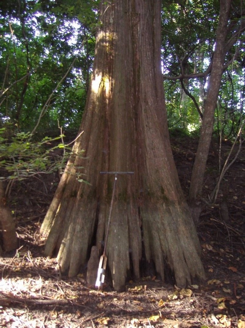
Natural vegetation of this site is representative of perhaps the most iconic wetland system of the southeastern United States: the bald cypress – water tupelo swamp association. Key to the development and occurrence of this ecological site is the presence of surface water well into or throughout much of the growing season (Conner and Buford, 1998; NatureServe, 2020).
The range of variability of the bald cypress – water tupelo association, as characterized for this ecological site, includes multiple cover types that are recognized and described by the Society of American Foresters. These types include the characteristic bald cypress – tupelo, Type 102; bald cypress, Type 101; and water tupelo – swamp tupelo, Type 103 (Eyre, 1980). The primary difference among these types are dominance patterns of the key species. Dominance by either bald cypress or water tupelo may vary by location with some areas being comprised almost entirely of bald cypress whereas other areas may support a preponderance of water tupelo. Where the system occurs on smaller tributary floodplains, water tupelo may be replaced or accompanied by the closely related swamp tupelo (Nyssa biflora). Reportedly, swamp tupelo may increase in presence and abundance along the margins of alluvial swamps where maximum water depth is less than 2 feet (Eyre, 1980) and in shallow depressions that completely dry during droughty periods (MMNS, 2015). Of the three species, bald cypress and water tupelo appear to be most tolerant of inundation and may advance into the deepest portion of a swamp when water levels recede during long dry periods, thus allowing for reproduction and regeneration to occur (Eyre, 1980).
Although bald cypress and water tupelo are regarded as the characteristic or representative species for this site, a broad range of water tolerant bottomland hardwoods occur, especially since water levels and the hydroperiod directly influence species composition. Associates in the deeper swamps that remain inundated for large portions of the year may include black willow (Salix nigra), Drummond’s maple (Acer rubrum var. drummondii), pumpkin ash (Fraxinus profunda), swamp cottonwood (Populus heterophylla), and water locust (Gleditsia aquatica) with a shrub layer consisting of common buttonbush (Cephalanthus occidentalis), eastern swampprivet (Forestiera acuminata), planertree (Planera aquatica), and Virginia sweetspire (Itea virginica). The deepest portions of a swamp, without extending into the miscellaneous map unit, "Water", often consist of scattered trees over open water that may be covered or partially covered by floating and submersed aquatic plants such as yellow pond-lily (Nuphar lutea ssp. advena), American lotus (Nelumbo lutea), American spongeplant (Limnobium spongia), and coontail (Ceratophyllum demersum). Depending on the hydroperiod or disruption to the local hydrology, species occupying drier positions or locations can become dominant components, which may consist of overcup oak, laurel oak (also known as diamondleaf oak), Nuttall oak, willow oak, water hickory, green ash, sweetgum, and American elm (Eyre, 1980; MMNS, 2015; NatureServe, 2020).
Succession of the bald cypress – water tupelo association is not known or well documented, and some regard it as “arrested” (Hodges, 1997) or a permanent cover type if excessive sedimentation does not alter drainage characteristics (Eyre, 1980). Hodges (1997) emphasized that the cypress – tupelo cover type is the oldest association of the alluvial floodplain and stands may survive for 200 to 300 years before canopy breakup occurs. If depositional rates are extremely slow, and barring catastrophic disturbances, some stands may last for even longer periods. Mitsch and Gosselink (1993) referred to the documentation of some cypress stands existing for 400 to 600 years. Nonetheless, this association does occur in a highly dynamic, constantly changing environment. Over time, even the old, low-lying floodplain depressions aggrade, leading to better soil drainage and eventual transition to other hardwood cover types such as the overcup oak – water hickory forest association. This is especially true for the many linear swales that occur on meander scrolls. Those narrow depressions are vulnerable to deposition as the adjoining ridges erode, particularly in areas undergoing modification.
While these sites are sometimes viewed as timeless, mature cypress – tupelo stands can experience dramatic shifts in vegetation following a disturbance. One potential stand initiating event consists of particularly destructive windstorms. Fire in this system is rare, however destructive fires into and through backwater swamps have occurred, especially during extreme droughts or following artificial drainage (Mitsch and Gosselink, 1993; Ewel, 1995). The most common disturbance to this system is manipulation or alteration of the hydrologic regime such as intentional drainage or the converse, local inundation throughout the year or beyond the natural hydroperiod. In situations where the overstory has been removed or where a new swamp is just developing, a series of successional transitions (i.e., seral stages) will occur, the rates of which ultimately depend on deposition and a naturally connected hydroperiod. The initial seres or early stages of development may include formation of an aquatic bed with submergent rooted and floating vascular plants and an emergent wetland consisting of a diverse herbaceous assemblage of grasses, graminoids, and forbs. One of the dominant pioneer tree species on this site is black willow (Salix nigra), which may dominate an area for over 30 years before breakup or transition to the next vegetation type (Hodges, 1997; Conner and Buford, 1998). If sedimentation rates remain low and the site does not aggrade rapidly, the next seral stage may be characterized by an association of common buttonbush, eastern swampprivet, and planertree. This association may then be replaced by the cypress – tupelo type, which again, may endure for hundreds of years (Hodges, 1997).
Summarizing the work of others, Mitsch and Gosselink (1993) emphasized the role of periodic flooding and inundation on the functionality of backwater swamps. They noted that the productivity of swamps is inextricably linked to the local hydrologic conditions. Locations that exhibited the greatest productivity were associated with a pulsing hydroperiod – one directly associated with seasonal overbank flooding followed by a period of drier conditions. Locations that had the poorest productivity were drained areas or swamps that were continuously inundated. This is particularly concerning for alluvial swamps that have become disconnected from the associated stream or river through channelization and levee construction. When periodic flooding of an alluvial river swamp is prevented, nutrient rich sediment that is so important to the system may be reduced or halted altogether. In cases where inundation is retained due to artificial means, these continuously flooded low spots may stagnate - ultimately decreasing productivity and possibly preventing reproduction and regeneration.
Today, this ecological site no longer functions on the same scale and pattern as did the historic system. For well over a century, this ecological site has been disconnected from its principal source and hydrologic influence, the Mississippi River. The extensive levee system that has been constructed along the east bank of the Mississippi River now serves as the site’s western boundary instead of the actual river channel. One reason for this distinction between the “batture lands” (i.e., the alluvial land between the river channel and the constructed levee system) and the protected portion of the Yazoo Basin is due to the altered dynamics of the river system and the sediment conduit that the batture has become. Yet, the protected lands within the Yazoo Basin have incurred both broad-scale and localized alterations. These include a large network of locally constructed levees, stream channelizations, and miles of drainage ditches dug to convert former wetlands to multiple uses. Shankman (1993) emphasized that the development of cypress – tupelo swamps were the collective effects of channel migration across the floodplain environment over long periods of time. The disconnection of this natural process effectively reduces the formation of this ecological system (Pierce, 2005).
Within the Yazoo Basin, “recharge” of local swamps is often the result of backwater flooding from the Mississippi River proper and overbank flooding of local tributaries that drain the Basin and the adjoining Loess Hills. It is important to note that although many changes and alterations to this site have occurred, local cypress – tupelo swamps and related wetlands continue to persist. It is acknowledged that the historic conditions of this ecological site are irretrievably lost. However, if local areas continue to meet the ecological characteristics of the site’s soils (i.e., saturated conditions for much of the growing season), hydrologic regime (i.e., undrained and unmanipulated), and vegetation composition, then reference conditions within the constraints of the Yazoo Basin can be met and should be recognized. They represent the best natural or semi-natural conditions of today’s altered landscape.
Following this narrative, a “provisional” state and transition model is provided that includes the “perceived” reference state and several alternative (or altered) vegetation states that have been observed and/or projected for this ecological site. This model is based on limited inventories, literature, expert knowledge, and interpretations. Plant communities may differ from one location to the next depending on the severity of local land use activities and rates of deposition. Depending on objectives, the reference plant community may not necessarily be the management goal.
The environmental and biological characteristics of this site are complex and dynamic. As such, the following diagram suggests pathways that the vegetation on this site might take, given that the modal concepts of climate and soils are met within an area of interest. Specific locations with unique soils and disturbance histories may have alternate pathways that are not represented in the model. This information is intended to show the possibilities within a given set of circumstances and represents the initial steps toward developing a defensible description and model. The model and associated information are subject to change as knowledge increases and new information is garnered. This is an iterative process. Most importantly, local and/or state professional guidance should always be sought before pursuing a treatment scenario.
State 1
Reference: Swamp Forest
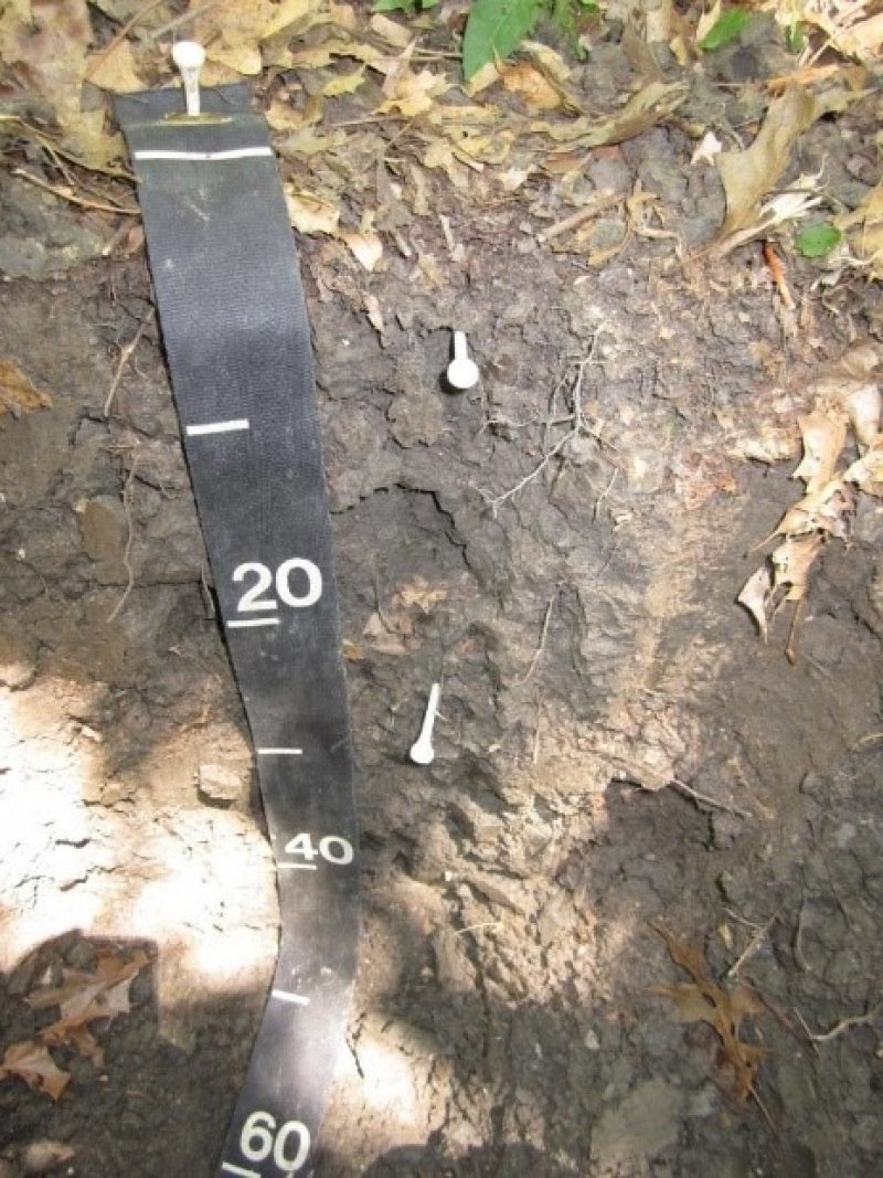
Reference conditions of this ecological site are defined by a combination of very poorly drained to poorly drained, clayey soils that may locally pond for 6 to 10 months in most years. Water depths of many locations may reach 5 feet (or more) for sustained periods during the wetter times of the year. Soils generally remain wet even after water levels recede during dry periods, and a high-water table is a critically important component of the system. The floodplain setting that best captures this combination consists of prominent depressions that remain flooded and/or ponded through winter and into (and sometimes through) the growing season.
Natural vegetation consists of species that are tolerant of anaerobic conditions created by inundation or ponding for sustained periods. Two tree species that can withstand these extremes, bald cypress and water tupelo, often co-occur as canopy dominants but may also occur singularly in some locations. Depending on water depth and ponding duration, community associates consist of wetland obligates of additional hardwood trees, shrubs, and herbaceous species that may include emergent, floating, and submerged aquatic plants. Broad shifts in species presence and abundance are largely governed by water fluctuations, depth, and disturbance (NatureServe, 2020). The community type perceived to be most representative of this provisional ecological site at the tree and shrub levels is the Bald Cypress – Water Tupelo/Common Buttonbush – Eastern Swampprivet Floodplain Forest (Community Phase 1.1). Future surveys will be critical toward confirming the dominant and representative species of this ecological site, particularly the shrub and herbaceous layers.
Characteristics and indicators. The dominance of bald cypress and/or water tupelo are diagnostic of the reference state. Where the canopy has been removed due to disturbance (through natural events or otherwise) or has never developed due to successional (seral) stage or excessive water depths signifies a different vegetation state (e.g., States 3 and 4).
Silvicultural management of stands that involve timber harvests should not disrupt or alter species dominance characteristics of the stand. Should harvesting create demonstrable shifts in species composition and community structure, then a transition to a different state has occurred (e.g., State 5).
The hydroperiod is critical to the functionality of this state. If a location has been purposefully drained or the hydroperiod intentionally extended, transition to different states have occurred.
Beavers are naturally drawn to this site. They can influence local areas by altering vegetation composition, local hydrologic conditions, and sedimentation rates by removing trees and pooling water. Perennial inundation increases senescence of mature trees, reduces productivity and regeneration, and increases the extent of open, deepwater areas.
Deposition of this site over time naturally occurs. However, the rate of deposition has likely increased for many locations due to intensive landuse and land management activities. Areas such as narrow swales and depressions that have received intensive deposition likely have shorter ponding durations and support different vegetation communities. Such areas represent a different vegetation state and over time, may transition to a different ecological site altogether.
Community 1.1
Bald Cypress - Water Tupelo/Common Buttonbush - Eastern Swampprivet Floodplain Forest
This community phase represents the successional stage, composition, and structural complexity of stands supporting perceived reference conditions. This community is representative of maturing stands (late development) occurring within undrained and unmodified (i.e., natural) floodplain depressions.
Bald cypress and water tupelo are the characteristic canopy species of this ecological site. Dominance by bald cypress or water tupelo vary by location and either species can form pure stands. Where the two species co-occur, bald cypress is often the taller – an emergent in the canopy (NatureServe, 2020). Dominance by water tupelo has been attributed to the erratic reproduction and regeneration of bald cypress in addition to frequent disturbances such as the targeted logging of cypress (Eyre, 1980; Wharton et al., 1982; Conner and Buford, 1998). Dominance patterns and species composition may also be expressed across a range of water depths. In areas of deeper, more permanent water, bald cypress may dominate (NatureServe, 2020). Swamp tupelo, a closely related species of water tupelo, is a secondary component of this community type, which occupies less frequently flooded and shallower areas (MMNS, 2015; NatureServe, 2020). Canopy and subcanopy associates of the deeper, more persistent swamps include black willow, Drummond’s maple, pumpkin ash, water locust, and swamp cottonwood. Species occupying shallower positions and/or drier locations (e.g., shallow swales) may consist of proportionally more overcup oak, water hickory, American elm, green ash, Nuttall oak, laurel oak, willow oak, sweetgum, and persimmon (Eyre, 1980; MMNS, 2015).
Canopy cover of this community varies widely, often due to local water depths. Depending on canopy closure and water depth, the shrub-small tree stratum may range from dense thickets to sparse patches that are frequently composed of black willow, common buttonbush, eastern swampprivet, planertree, Virginia sweetspire, and possumhaw (Ilex decidua). Herbaceous cover is often patchy with estimates in the 30-percent range, and this layer is frequently interspersed by deep, open water, non-vegetated muck, and woody debris. The herbaceous stratum is often represented by lizard’s tail (Saururus cernuus), aquatic milkweed (Asclepias perennis), swamp dock (Rumex verticillatus), American water-willow (Justicia americana), greater marsh St. Johnswort (Triadenum walteri), oppositeleaf spotflower (Acmella oppositifolia), small beggarticks (Bidens discoidea), oneflower false fiddleleaf (Hydrolea uniflora), yellowseed false pimpernel (Lindernia dubia), savannah-panicgrass (Phanopyrum gymnocarpon), catchfly grass (Leersia lenticularis), whitegrass (Leersia virginica), redtop panic grass (Panicum rigidulum), cypressknee sedge (Carex decomposita), cypress swamp sedge (Carex joorii), greater bladder sedge (Carex intumescens), along with additional forbs and graminoids (Morris and MacDonald, 2012; MMNS, 2015; NatureServe, 2020). Floating and submerged aquatic plant layers may include common duckweed (Lemna minor), Carolina mosquitofern (Azolla caroliniana), yellow pond-lily, American lotus, American spongeplant, and coontail (MMNS, 2015).
Resilience management. To maintain and/or retain the reference community, the hydrologic regime should not be altered by artificial drainage or by purposely extending the hydroperiod beyond what would naturally occur for the location of interest. Ground and surface water withdrawals within this site can alter the hydroperiod, which may assist in the establishment of competing vegetation including exotic species such as Chinese tallow (Triadica sebifera).
Some prominent depressions (e.g., abandoned channels) appear to be used as “landscape sumps” whereby a network of field drains, drainage ditches, and canals of adjacent areas convey runoff to them. The swamps then become sediment traps leading to shallower water depths, reduced ponding durations, and an eventual shift to a drier plant community. Additionally, some drainage systems may convey contaminants, which may negatively impact both plant and animal communities.
Harvesting the dominant canopy species (e.g., bald cypress) should not cause demonstrable shifts in composition of the community (i.e., high grading) or remove the canopy to such an extent that a shift to a shrub swamp (State 3) or an open water/emergent wetland (State 4) occurs.
Dominant plant species
-
bald cypress (Taxodium distichum), tree
-
water tupelo (Nyssa aquatica), tree
-
black willow (Salix nigra), tree
-
Drummond's maple (Acer rubrum var. drummondii), tree
-
pumpkin ash (Fraxinus profunda), tree
-
water locust (Gleditsia aquatica), tree
-
overcup oak (Quercus lyrata), tree
-
water hickory (Carya aquatica), tree
-
American elm (Ulmus americana), tree
-
green ash (Fraxinus pennsylvanica), tree
-
swamp tupelo (Nyssa biflora), tree
-
Nuttall oak (Quercus texana), tree
-
common persimmon (Diospyros virginiana), tree
-
common buttonbush (Cephalanthus occidentalis), shrub
-
eastern swampprivet (Forestiera acuminata), shrub
-
planertree (Planera aquatica), shrub
-
Virginia sweetspire (Itea virginica), shrub
-
American snowbell (Styrax americanus), shrub
-
possumhaw (Ilex decidua), shrub
-
redtop panicgrass (Panicum rigidulum), grass
-
savannah-panicgrass (Phanopyrum gymnocarpon), grass
-
catchfly grass (Leersia lenticularis), grass
-
rice cutgrass (Leersia oryzoides), grass
-
sedge (Carex), grass
-
rush (Juncus), grass
-
bulrush (Scirpus), grass
-
spikerush (Eleocharis), grass
-
lizard's tail (Saururus cernuus), other herbaceous
-
knotweed (Polygonum), other herbaceous
-
oppositeleaf spotflower (Acmella oppositifolia), other herbaceous
-
greater marsh St. Johnswort (Triadenum walteri), other herbaceous
-
swamp dock (Rumex verticillatus), other herbaceous
-
yellowseed false pimpernel (Lindernia dubia), other herbaceous
-
oneflower false fiddleleaf (Hydrolea uniflora), other herbaceous
-
aquatic milkweed (Asclepias perennis), other herbaceous
-
beggarticks (Bidens), other herbaceous
-
looseflower water-willow (Justicia lanceolata), other herbaceous
State 4
Greentree Reservoir
The Greentree Reservoir (GTR) state is provisionally included in this description due to the level of hydrologic manipulation and management that is generally pursued. Additionally, these structures have widespread distribution and occurrence throughout the Southern Mississippi River Alluvium and have been developed and established on this ecological site.
The principal function and purpose of most GTRs within MLRA 131A is to provide reliable flooded habitat for migrating and wintering waterfowl in one of North America’s irreplaceable migratory corridors, the fabled Mississippi Flyway. The extensive losses of forested habitat coupled with the draining of wetlands and construction of flood control projects throughout the MLRA have made these reservoirs particularly attractive to wildlife, recreationists, and natural resource managers (Fredrickson and Batema, 1992). They occur on both public and private lands (Wigley and Filer, 1989). In general, GTRs consist of floodplain forests that have been leveed, water control structures established, and a water supply constructed to flood targeted locations during tree dormancy, which generally occurs from late fall to late winter. These management units are typically positioned in environments that can be effectively flooded or impounded to a shallow depth, consist of predominantly clayey soils, and support mature bottomland hardwoods with a concentration of red oaks such as Nuttall, willow, water, and cherrybark with pin oak increasing in importance in the northern portions of the MLRA. Red oaks are heralded for providing an energy-rich food source for some waterfowl species. Important soft mast food sources include elm, ash, tupelo (Nyssa spp.), and red maple (Fredrickson and Batema, 1992; Fredrickson, 2005).
The composition and maturity of many forest stands within GTRs likely support characteristics that resemble reference conditions. However, hydrologic regimes and hydroperiods of many GTRs are managed intensively every year with targeted flooding beginning and ending (i.e., drained) on predetermined dates, often coinciding with waterfowl hunting seasons. In many instances, water drawdown is delayed due to logistical limitations and extends into the growing season (Wigley and Filer, 1989; Fredrickson and Batema, 1992). This annual rigor in maintaining water levels differs greatly from natural, periodic flooding regimes and has led to unanticipated single-species and community-level stressors, particularly in areas where this level of yearly management has occurred for more than a decade (Fredrickson and Batema, 1992). Some of the reported impacts include basal swelling of trees, reduced tree vigor, tree mortality, changes in plant composition to predominantly flood tolerant species, poor acorn production, poor tree regeneration, increased windthrow, crown dieback, tree cankers, a higher incidence of insect infestations, and even a decrease in waterfowl usage (Wigley and Filer, 1989; Fredrickson and Batema, 1992; Fredrickson, 2005; Hertlein and Gates, 2005; Heitmeyer et al., 2024). Notably, management of some GTRs have been modified over the years to mimic more natural, periodic flooding cycles with shortened hydroperiods to reverse these types of impacts. Still, the uncertainties of community-level responses and conditions within these impoundments have prompted inclusion of this state.
Note that this state mainly pertains to established GTRs. If there is intent to develop one of these management units, then all Federal and State statutes and regulations pertaining to wetlands and the Nation’s waters and waterways must be followed. All associated regulatory reviews and permits should be completed and obtained before construction activities are pursued.
Community 4.1
Seasonally Impounded Backswamp Forest
This community phase is representative of management extremes where the influence of annual impoundment and extended hydroperiods can lead to demonstrable changes in the plant community. Mounting evidence suggests that extending the hydroperiod on this site beyond natural weather cycles and well into the growing season could induce changes in plant community composition over the long term. Newling (1981) reported a shift towards a more water tolerant community in the understory and herbaceous layers of a GTR forest stand compared to an adjacent reference community that occurred in a natural setting. Observations by others of a GTR on this ecological site include a reduction in bole volume growth and acorn production of Nuttall oak, decline in tree vigor, and higher incidence of Nuttall oak mortality (Francis, 1983; Schlaegel, 1984), which is a favored mast-producing species. Based on the preceding coupled with observations elsewhere (e.g., Ervin et al., 2006; Heitmeyer et al., 2024), characteristics of GTRs that have been annually impounded and had hydroperiods that extended into the growing season for many years (multiple decades) may be comprised of:
• Predominantly water tolerant species with a higher abundance of overcup oak, water hickory, buttonbush, swampprivet, and planertree
• Lower plant diversity
• Higher incidence of tree mortality (e.g., snags and coarse woody debris)
• Reduced regeneration and presence of important mast producing trees (e.g., red oaks)
• Reduced tree growth rates
This ecological site occurs in the lowest and wettest positions within backswamp environments (e.g., prominent depressions and sloughs) and is the last feature to drain naturally or artificially. During particularly wet years or periods, this site could remain inundated for excessive periods due to drainage challenges of some GTRs (see Newling, 1981; Francis, 1983). Particularly problematic areas could experience stagnation, which impedes natural regeneration of even the most water tolerant tree species. Although red oaks are a minor associate of the community, they do occur in areas that have shallow ponding depths (Eyre, 1980) and could incur severe impacts when inundated for extended periods on a yearly basis (see Francis, 1983; Schlaegel, 1984).
State 5
Shrub Swamp
The Shrub Swamp state is representative of a natural vegetation type or community that may be best characterized as a seral community or a “successional intermediate” between an open Emergent Wetland Complex (State 4) and Swamp Forest (State 1). The scarcity of trees and the plurality of the ground cover by the scrub-shrub lifeform differentiates the state (Cowardin et al., 1979; MMNS, 2015). Development of the community proceeds as shrubs tolerant of prolonged inundation colonize open wetlands that were either recently formed (i.e., a few years to a few decades) or became suitable for establishment as water depths decreased due to sedimentation. Hodges (1997) emphasized that the pioneer tree species on this site is usually black willow, which may be followed by a shrub association of eastern swampprivet, planertree, and/or common buttonbush once breakup of the willow stand ensues. The shrub association may later be replaced by or assimilated into the bald cypress – water tupelo type depending on water depth, length of the hydroperiod, and sedimentation rates. In deep water areas that remain ponded throughout the growing season, bald cypress and/or water tupelo may not be able to germinate successfully, and the shrub community may persist for many years. An additional factor that may contribute to the persistence and longevity of the shrub swamp in some locations is beaver. They can impact local areas by altering vegetation composition, local hydrologic conditions, and sedimentation rates by removing recently established trees and pooling water.
An additional pathway leading to the development of this state involves a post large-scale disturbance that removes (e.g., clearcut) or destroys (e.g., catastrophic wind event) the former cypress – tupelo overstory. If the former stand supported a shrub component, development of the shrub state may accelerate following overstory removal. The shrub community may then be replaced by or assimilated into the bald cypress – water tupelo forest association should the physical factors (e.g., hydroperiod, sedimentation rates, water depth) of the impacted stand remain suitable for recovery.
Community 5.1
Common Buttonbush – Eastern Swampprivet – Planertree
This community phase is characterized by a shrub/small tree component often dominated by common buttonbush, eastern swampprivet, and/or planertree. Dominance by one or more of the preceding species may vary by location, any one of which occurring in pure stands (Penfound, 1952). Additional components of the community may include black willow, Drummond’s maple, pumpkin ash, water locust, and Virginia sweetspire. The herbaceous component is highly variable due to fluctuating water levels (MMNS, 2015) and is often relegated to growing on old stumps, tree buttresses, fallen logs, or along swamp margins (NatureServe, 2020). Areas supporting examples of this community often include zones surrounding deeper water along the edges of creeks, rivers, sloughs, and oxbow lakes (MMNS, 2015).
Dominant plant species
-
bald cypress (Taxodium distichum), tree
-
water tupelo (Nyssa aquatica), tree
-
black willow (Salix nigra), tree
-
Drummond's maple (Acer rubrum var. drummondii), tree
-
pumpkin ash (Fraxinus profunda), tree
-
water locust (Gleditsia aquatica), tree
-
common buttonbush (Cephalanthus occidentalis), shrub
-
eastern swampprivet (Forestiera acuminata), shrub
-
planertree (Planera aquatica), shrub
-
Virginia sweetspire (Itea virginica), shrub
State 6
Emergent Wetland Complex
The Emergent Wetland state represents the earliest stage of vegetation development or succession of this ecological site. The diagnostic components of the state are the presence of emergent herbaceous vegetation (or marsh); areas supporting black willow colonization; and deeper zones of open water that are often interspersed with rooted floating and submergent vegetation. Tree and shrub cover are proportionately less than the cover percentages of the emergent marsh component. This characteristic distinguishes the state from States 1, 2, and 3. In some situations, “standing dead trees” or snags may be present (e.g., beaver-influenced complexes and stands following catastrophic wind damage). The size or aerial extent of this state varies by location but often consists of small patches (one to several acres) interspersed among other vegetation types. However, some emergent wetlands may be quite large, especially in areas where water levels are manipulated by control structures (MMNS, 2015).
Historically, this state developed soon after the creation of new floodplain depressions and following catastrophic disturbances. The “natural” development of depressions, today, are unlikely or uncommon due to flood control measures (e.g., levees and stream channelization). Factors most frequently contributing to the development of this state result from deliberate water management actions (e.g., the control of water discharge and for wildlife habitat); logging or clearcutting swamp forests; large openings within swamp forests; elevated water levels due to beaver activity; and particularly destructive natural disturbances (e.g., windstorms). The longevity of this state is fleeting and unless it is intentionally managed, lasting only until it transitions to a Shrub Swamp (State 3) or Swamp Forest (State 1).
Community 6.1
Emergent Marsh/Black Willow/Open Water Complex
This community phase captures the range of species and conditions that might be expected to occur in an early successional wetland complex (pioneer stage). Black willow ranks among the first colonizers of this state in addition to several herbaceous taxa. A prominent ecological community of the emergent marsh is the rush – bulrush – flatsedge – ditch stonecrop – lizard’s tail (Juncus spp. – Scirpus spp. – Cyperus spp. – Penthorum sedoides – Saururus cernuus) association (MMNS, 2015). Components contributing to the structure of this community may include dense growths of giant cutgrass (Zizaniopsis miliacea) and cattail (Typha spp.). Additional associates of the emergent marsh consist of pickerelweed (Pontederia cordata), rosemallow (Hibiscus spp.), primrose-willow (Ludwigia spp.), valley redstem (Ammannia coccinea), cardinalflower (Lobelia cardinalis), aquatic milkweed (Asclepias perennis), jewelweed (Impatiens capensis), climbing hempvine (Mikania scandens), camphor pluchea (Pluchea camphorata), swamp smartweed (Persicaria hydropiperoides), oneflower false fiddleleaf (Hydrolea uniflora), redtop panicgrass (Panicum rigidulum), savanna-panicgrass, along with numerous additional forbs and graminoids. As the marsh grades to deeper zones, floating and submerged aquatic plants of the open water complex may be represented by pondweed (Potamogeton spp.), watershield (Brasenia schreberi), American lotus, duckweed (Lemna spp.), watermeal (Wolffia spp.) and bladderwort (Utricularia spp.).
Factors that negatively impact this state include hydrologic alterations leading to stagnation, anoxia, and high temperatures; accumulation of pollutants; sedimentation; and an increase of exotic species. Invasive plants that are impacting marsh habitats and reducing species diversity include alligatorweed (Alternanthera philoxeroides), common water hyacinth (Eichhornia crassipes), and giant salvinia (Salvinia molesta) (MMNS, 2015).
Dominant plant species
-
black willow (Salix nigra), tree
-
rosemallow (Hibiscus), shrub
-
climbing hempvine (Mikania scandens), shrub
-
common buttonbush (Cephalanthus occidentalis), shrub
-
rush (Juncus), grass
-
bulrush (Scirpus), grass
-
flatsedge (Cyperus), grass
-
giant cutgrass (Zizaniopsis miliacea), grass
-
cattail (Typha), grass
-
redtop panicgrass (Panicum rigidulum), grass
-
savannah-panicgrass (Phanopyrum gymnocarpon), grass
-
cutgrass (Leersia), grass
-
ditch stonecrop (Penthorum sedoides), other herbaceous
-
lizard's tail (Saururus cernuus), other herbaceous
-
pickerelweed (Pontederia cordata), other herbaceous
-
primrose-willow (Ludwigia), other herbaceous
-
valley redstem (Ammannia coccinea), other herbaceous
-
cardinalflower (Lobelia cardinalis), other herbaceous
-
aquatic milkweed (Asclepias perennis), other herbaceous
-
swamp smartweed (Polygonum hydropiperoides), other herbaceous
-
oneflower false fiddleleaf (Hydrolea uniflora), other herbaceous
-
camphor pluchea (Pluchea camphorata), other herbaceous
State 7
Commercial Forestland
This state consists of two very different community phases and management approaches. Community Phase 5.1 represents forest management and production on this site. A distinguishing feature of this phase is the level of management intensity designed to maximize merchantable goals. Various silvicultural methods are available for selection, and these are generally grouped into even-aged (e.g., clearcutting, seed-tree, and shelterwood) and uneven-aged (e.g., single tree, diameter-limit, basal area, and group selection) approaches (Meadows and Stanturf, 1997). Depending on the method selected, different structural and compositional characteristics of the stand may result. Removal and control of community associates are typically a critical element of production goals. These actions may result in different community or “management phases” (and possibly alternate states) depending on the methods used and local floodplain dynamics. Finding the appropriate approach for a given stand and environment necessitates close consultation with trained, experienced, and knowledgeable forestry professionals. If there is a desire to proceed with this state, it is strongly urged and advised that professional guidance be obtained and a well-designed silvicultural plan developed in advance of any work conducted.
Community Phase 5.2 represents conditions of many stands that have incurred indiscriminate timber harvests (e.g., heavy cutting or diameter-limit harvests of select species) and opportunistic regrowth following such harvests (i.e., no management at any period). This action, conducted repeatedly, can cause tremendous shifts in species composition and can decrease the vigor and health of the residual stand. (Because of the intensive management required to rehabilitate affected stands, this community phase warrants elevation to a standalone state. This should be considered in future iterations of this site’s development.)
A major limitation of this site is frequent flooding and ponding over long to very long durations. The principal management concerns are equipment use and seedling mortality (USDA-NRCS, 2006b). Achieving and maintaining successful natural or artificial regeneration may be particularly challenging in areas supporting prominent depressions that pond for exceedingly long durations (Meadows and Stanturf, 1997). Management actions and activities may need to be adjusted accordingly depending on the conditions of local environments. Care should be taken to avoid permanent alterations to this wetland system. State and Federal regulatory oversight may apply to some locations where a permanent alteration to water flow is desired or attempted. Of extreme importance, best management practices (BMPs) should be a part of any forest management plan and closely followed, especially in this iconic wetland system. Please consult the Mississippi Forestry Commission’s Best Management Practices for Forestry in Mississippi.
A key characteristic of this state is that managed stands occur within natural depressions that have not been intentionally drained or physically altered (e.g., filled and/or land leveled). An additional caveat is the state’s representation of forest conditions that have retained full site production potential. Currently, transitional pathways to this state originate from another forested state (States 1 and 2), only. Former land uses (alternate states) that result in altered conditions of the soil environment (e.g., land leveling, ditching and drainage) may deleteriously affect predicting and planning for species site selection, tree productivity, and possibly survival of the targeted species. State 8 (Forest Recovery) is representative of forest establishment and growth on locations where soil compaction and reduction of nutrients have occurred due to former land practices. Once a previously affected location has recovered its site potential, transition to this state may be possible. That potential transition is still under review and is currently not shown or addressed in the state and transition model.
Community 7.1
Bald Cypress – Water Tupelo
Bald cypress and water tupelo are the chief species of this site and hence, the principal forest products. Of the two, bald cypress is by far the most desirable and sought after species of this ecological site. In this hydric environment, species richness is generally low, which gives both species a competitive advantage due to their tolerance of very long flooding and ponding durations (Putnam et al., 1960; Hodges, 1995). This environment, however, also presents some of the biggest challenges for germination and seedling development, especially in locations that tend to pond much of the year. Water levels extending through the growing season will prevent germination, and seedlings can be killed if submerged for more than 5 weeks (Johnson and Shropshire, 1983). Regeneration in such areas will likely require an extensive dry cycle before widespread establishment and development occurs (Putnam, 1951; Johnson, 1981).
Hodges (1995) postulated that this dependence on water levels coupled with the shade intolerant nature of the species may explain the even-aged structure of most natural cypress – tupelo stands. Based on these characteristics, an even-aged management strategy is generally advocated (Johnson and Shropshire, 1983), although Meadows and Stanturf (1997) point out that any silvicultural method usually results in the cypress – tupelo association due to the flooding intolerance of would-be competitors.
Prescribing a silvicultural system for a given stand may ultimately depend on the presence and establishment of advance regeneration (i.e., the presence of seedlings and saplings of the desired species) beneath the forest canopy. Since cypress – tupelo stands can be extremely dense, this crucial element for ensuring a future crop may be sparse or even absent. If advance regeneration is sufficient, then a clearcut of the stand may be prescribed along with brush management to reduce subsequent competition of the regenerating stand (Johnson and Shropshire, 1983; Hodges, 1995). In the absence of advance regeneration, a light thinning of the stand (with understory control, if necessary) to increase sufficient overhead sunlight for seedling development may be prescribed, first (Meadows and Stanturf, 1997). Another option that utilizes natural regeneration for future stand production is a shelterwood or seed-tree approach (Hodges, 1995). Once seedlings and saplings are taller than normal ponding depths, a final harvest operation to remove both the desired products and the undesirable stock, including brush or competition control, is scheduled (Hodges, 1995; Meadows and Stanturf, 1997). An alternative to natural regeneration, which may be necessary for locations that pond the longest, is to plant seedlings (artificial regeneration) during a low water cycle following a complete harvest of all stems (Williston et al., 1980). Ultimately, the prescription (including intermediate operations such as partial cuttings), timing of activities, and extraction methods of a given stand should be based on stand characteristics, hydrologic influences of the local environment, and goals of the landowner or manager.
The preceding is entirely based on local environments that are naturally conducive for producing and regenerating the bald cypress – water tupelo type. Where this differs are locations that have received higher sedimentation rates and reduced ponding durations (e.g., shallow sloughs and swales). Such areas likely support a more diverse association of productive hardwoods (e.g., red or water oaks such as Nuttall and willow oak) and may require a different management strategy and approach. Consultation with and plan development by a silviculturist or forester should result in the appropriate management strategy for a given environment.
Community 7.2
Water Tupelo – Mixed Hardwoods
This community phase is representative of former bald cypress – water tupelo forests that have undergone repeated diameter-limit harvests or heavy cutting that mainly targeted a single species, bald cypress. This action coupled with a typically low market for water tupelo can lead to single species stands of the latter (Betts, 1942; Putnam, 1951). Local areas that have shallower ponding depths or that do not flood or pond during the growing season may become dominant in a mixture of shade tolerant hardwoods under repeated diameter-limit harvests (Conner and Day, 1976; Conner et al., 2006). Additional hardwoods that may increase in abundance under this harvest method include green ash, pumpkin ash, Drummond’s maple, water locust, sugarberry, American elm, swamp cottonwood, overcup oak, and water hickory (Conner et al., 2006). Removal of the overstory may also increase proliferation and infilling of water-tolerant shrubs such as common buttonbush, planertree, and eastern swampprivet (Putnam, 1951).
Pathway 5.1A
Community 7.1 to 7.2
This pathway includes heavy cutting of the stand that removes the desired species (typically bald cypress) of sufficient diameters followed by no management of the residual stand or repeated single-tree harvests (e.g., diameter-limit cuts) that removes the desired species followed by no management of the residual stand. The resulting stand is typically comprised of water tupelo and possibly a few residual shade tolerant species with low commercial value.
Pathway 5.2A
Community 7.2 to 7.1
Intensive management may be required to push a high-graded community into a more commercially desirable and viable system of predominantly bald cypress. Actions will likely require a complete clearcut of the stand followed by repeated brush and competitor control (chemical and mechanical). If there is a lack of seed source, artificial regeneration will likely be required to establish or reestablish the species. Continual competitor control may be required.
State 8
Cropland
This state is representative of a common land use activity in areas that have sustained extensive ditching and draining, agriculture production. Principal crops grown on these soils are rice (Oryza sativa) and soybeans (Glycine max) (Pettiet, 1974). Specialty crops (e.g., fruits, vegetables, and tree nuts) may be grown locally depending on local hydrology and the soil-site environment.
Suitability of this ecological site to row crops is generally described as poorly suited to not suited, mainly due to flooding and ponding risks and extensive saturation periods. These soils have high available water capacity, moderate to very high organic matter content, and fair natural fertility with soil reactions that range from strongly acid to moderately alkaline (USDA-SCS, 1959; USDA-NRCS, 2006b). Applications of fertilizer and lime may not be a necessity everywhere or in every circumstance as these soils range from medium to high in phosphorus and potassium concentrations (Vanderford, 1962), and pH levels are generally within a favorable range. Still, soil tests should be conducted to determine fertilizer, lime, and nitrogen needs on a specific field and for a given crop (USDA-SCS, 1990; Oldham and Jones, 2022). Management concerns are largely centered on seasonal high water tables at or above ground surface, very slow permeabilities and runoff, delayed plantings, soil compaction under equipment traffic, development of a plow pan, and poor tilth due to the clayey texture. Areas that are prone to flooding or extended periods of wetness may not be suitable for crops that require planting in April and May. Management measures to ameliorate some of these issues may include conservation tillage or management system; subsoiling to breakup plow pans for dry-land crops (e.g., soybeans); restricting tillage to appropriate soil moisture content; and establishing a drainage system or network in problematic areas (USDA-SCS, 1990; USDA-NRCS, 2004; USDA-NRCS, 2006b). Of caution, subsurface drainage systems (e.g., pipes or tiles) may not be effective in every situation due to very slow permeability or localized flooding (USDA-SCS, 1990). Major components that producers generally develop and plan are proper selection of crop cultivar, pest control, cropping system, tillage methods, nutrient management, and water management (Snipes et al., 2005). Key practices of some cropping systems often include two or more crops grown in a multiyear rotation, which has been documented to disrupt pest cycles. Leaving crop residue on the surface can help to maintain tilth, fertility, and organic matter content – all critical elements of soil quality and health. For monoculture cropping systems, the implementation of well-designed pest and nutrient management systems are imperative (Pringle et al., 2017). (For assistance, interested parties are advised to visit their local NRCS Field Office.)
Three separate management phases comprise this state: Conservation Management (6.1), Transitional Conservation Management (6.2), and Conventional Management (6.3). The three phases consist of varying tillage methods and approaches to soil health management systems.
Community 8.1
Conservation Management
This cropland phase utilizes long term, continuous conservation management systems that include reduced till and cover crops; no-till with cover crops; crop residue retention; and perennial cropping systems. The guiding principles of this system are minimizing soil disturbance and maximizing soil cover, biodiversity, and the presence of living roots. Implementing diverse crop rotations while maintaining these principles can lend to the development of an integrated pest management plan and contribute to overall system resilience.
Of caution, the above-ground crop growth or yields may not be the best tracking mechanism for assessing the efficacy or presence of this management phase. Indicators of these systems are generally determined via soil-site assessments with outcomes that may include enhanced soil aggregate stability, increased soil biological activity, higher organic matter content, and improved water holding capacity and infiltration rates while also alleviating soil compaction and reducing runoff and erosion (Chessman et al., 2019). Additional advantages to this system that have been noted by some producers are reductions in fuel and labor costs and less wear and tear on machinery and equipment.
There are challenges to this management system, especially in situations where tillage may be considered and/or needed to repair weather damage or other detrimental impacts. Implementation of conventional tillage even after long term conservation practices (e.g., no-till) can reset the affected area back to a conventional cropping system. However, those changes can be reversed and a return to a conservation management system is achievable.
Critical conservation practices associated with this phase include cover crops, no-till, and reduced till as the foundational practices. Additionally, this phase may include supporting and site-specific practices to address conservation needs for a given location.
Community 8.2
Transitional Conservation Management
This cropland phase utilizes a hybrid approach that combines conventional methods with conservation practices at specific periods and under specific situations. Practices under this phase may include a combination of conventional till, reduced till, strip till, and the inclusion of cover crops. For instance, perennial crop species could be in a continuous transitional phase where conventional tillage is implemented at the time of planting followed by reduced tillage during the rotation. Planted forage crops could also be included in this phase, especially when part of a crop rotation that utilizes reduced tillage for one crop followed by conventional tillage for a succeeding crop.
The development, implementation, and refinement of nutrient and pest management plans throughout component operations are imperative. Additionally, this phase may include supporting and/or site-specific practices to address conservation needs for a given location.
Community 8.3
Conventional Management
This management phase is representative of conventional cropland where tillage is implemented as an annual component of the production system. As crucial elements of the system, conservation practices such as nutrient and pest management are needed to address fertility requirements and pest concerns within the crop cycle. It is important to note that this phase may develop when tillage is implemented to address damage or for other purposes while under a conservation management system (Community Phase 6.1). There could also be associated, supporting, and site-specific practices that are needed to address specific conservation needs. Specific needs may include grade stabilization structures to control gully erosion, grassed waterways to trap sediment from sheet and rill erosion, or implementing reduced till.
Pathway 6.1A
Community 8.1 to 8.2
Soil disturbance (tillage); reduction of soil health.
Pathway 6.1B
Community 8.1 to 8.3
Conventional tillage, seeding, and fertility management for crops.
Pathway 6.2A
Community 8.2 to 8.1
No-till, cover crops, reduced till-soil health improvements.
Pathway 6.2B
Community 8.2 to 8.3
Conventional tillage, seeding, and fertility management for crops.
Pathway 6.3A
Community 8.3 to 8.2
Reduced till, no-till, and cover crops with soil health improvements as a goal.
State 9
Land Formed Cropland
This depressional ecological site oftentimes adjoins level to gently undulating landscapes. It is often bordered by soils of varying textures and drainage characteristics. Accordingly, inconsistencies in wetness and dryness, ease of operation, and production or yields may occur across a cropped location. An increasingly common practice consists of land forming or leveling surface irregularities into a predetermined and engineered, uniform slope. This practice removes drier and higher features, which are then used to fill the wetter and lower positions of this site (depressions or swales) across the targeted area. Advantages of land leveling may include reduced hazards of erosion and runoff rates, improved surface drainage, and enhanced distribution and conservation of irrigation water. Disadvantages of the practice is a churning of various surface and subsurface materials (former soil horizons) that no longer occur in a predictable or regular pattern. Organic matter content in the surface layer is generally low, and the surface tends to crust and pack after heavy rains (USDA-NRCS, 2006b). One potential hazard that appears to be emerging in some areas is the need for managing surface water runoff. As both irrigated and stormwater runs off leveled fields at uniform rates, surface water tends to collect cumulatively and simultaneously, which places tremendous demands on local drainage systems. Without “in field” structures (natural or artificial) to stagger runoff, the downslope (or lower) ends of some fields tend to back flood thereby contributing to more flooding overall in local watersheds (personal observations).
Immediately following land leveling, the constituent elements of soil health are likely to be absent. In some areas, producers have initiated practices such as applying organic residues (e.g., poultry litter) or growing rice crops for one to two years to rapidly boost fertility and introduce organic matter (via rice biomass) in the surface layer. Over time, the full complement of the management (or community) phases of State 6 may be possible on land leveled fields. They are not repeated or indicated here.
Currently, this state serves as an endpoint in the state and transition model because the ability to predict vegetation response when transitioning to a different state is no longer possible without soil-site investigations for each area of interest. The former soils of this ecological site, including surface and subsurface horizons, will have been buried or redistributed as particles among other former soils depending on the depth of the initial “grade cuts” and leveling efforts.
Community 9.1
Land Leveled Cropland
Some of the crop species and management practices indicated and discussed in State 6 (including all three management phases) may be suitable for establishing on land leveled areas that once supported the soils of this site. However, the type of crops suited for newly leveled areas may ultimately depend on the prevailing soil particle-size distribution and internal drainage characteristics. Former studies on precision leveled fields have noted variabilities and inconsistencies in soil particle-size distributions, bulk density, soil biological properties, and nutrients (Brye et al., 2003; Walker et al., 2003; Brye et al., 2006). Management concerns for this phase may consist of restricted permeability, low organic matter content, and crusting and packing (USDA-NRCS, 2006b). These impacts may be improved by implementing conservation tillage, cover crops, retaining crop residue, and nutrient and pest management strategies.
State 10
Forest Recovery
This state is representative of forest recovery in areas that were once under former intensive land use such as long-term row crop cultivation. A key condition of this state is that locations have retained much of their natural depressional features and characteristics; they have not been buried (filled) or leveled. Former ditching and draining efforts most likely have occurred and may still be active. Under this scenario, an opportunity to establish or reestablish the local hydrologic characteristics of the targeted area may be a management option.
Characteristics that distinguish this state from other forest states on this site include a suite of soil-site properties that reportedly affect tree growth such as higher soil bulk density due to compaction, presence of a plow pan, lower organic matter content, and reduced fertility (Baker and Broadfoot, 1979; Groninger et al., 1999). Two community phases are provisionally recognized for this state. Community Phase 8.1 represents natural colonization of tree and shrub species without management. Community Phase 8.2 is representative of intentional forest establishment by artificial regeneration or planting.
For Community Phase 8.2, determining the objectives and goals of the future stand is imperative to increase the probability of successful establishment and production of the afforested area. The decision to establish or reestablish a more natural hydrologic regime or to leave former drainage systems in place will ultimately determine the species to establish, preparation requirements, planting density, and post-planting operations (e.g., competitor control, future improvement cuttings and thinnings, regeneration methods, and overall stand health). Since each area targeted for afforestation may have unique or different land use histories, having a clear understanding of the soil-site conditions is essential. Some areas may necessitate a series of soil improvement actions prior to planting. These actions may include subsoiling or deep plowing to breakup plow pans and fertilizing the targeted area. An additional option is to allow the area to undergo fallowing for a predetermined period (Community Phase 8.1) to potentially increase soil organic matter content, enhance soil aggregate stability, increase soil biological activity, and improve water holding capacity and infiltration rates. Controlling competing vegetation (chemical and/or mechanical treatment) will be critical. Post-planting operations and maintenance of the stand can enhance survival, future development, and achieve goals and objectives (see Gardiner et al., 2002).
Finding the appropriate approach for a given environment necessitates close consultation with trained, experienced, and knowledgeable forestry professionals. If there is a desire to proceed with this state, it is strongly urged and advised that professional guidance be obtained and a well-designed afforestation and silvicultural plan developed in advance of any work conducted. For an exceptional review and summarization of the afforestation literature, techniques, and practices within the Southern Mississippi River Alluvium, interested parties are directed to Gardiner et al. (2002).
Community 10.1
Ruderal/Opportunistic Regrowth
This community phase is representative of former working lands (e.g., cropland and possibly high concentration areas of former pastureland) that have fallowed and subsequently undergone natural vegetation colonization. Depending on location, a profusion of growth may initiate within five to ten years of becoming idle - one that typically includes grasses, forbs, woody seedlings and shrubs, and an increasing presence and covering of vines. Initial colonization may be dominant in annuals followed by a shift to perennial vegetation. Shrubs and tree seedlings may appear very early following abandonment, however the rate of colonization and period to stand establishment likely depends on the proximity of established mature stands (Battaglia et al., 1995; Battaglia et al., 2002). If established stands consisting of light-seeded species adjoin fallow fields, colonizing tree species will likely be comprised of those taxa (e.g., elm, green ash, and maple) (Allen, 1990; Stanturf et al., 2001). Some areas may be far removed from established forest stands. Under this scenario, establishment of woody species (especially overstory tree species) may be very slow, and years may be required before stand establishment is reached (Battaglia et al., 1995; Allen, 1997). In fact, natural colonization by some species may be delayed indefinitely with some stands or areas being understocked (Allen, 1997; Battaglia et al., 2002; Groninger, 2005). Heavy-seeded species like oaks may not have an opportunity to colonize available areas due to distance and lack of a dependable dispersing agent (e.g., wildlife and water). Non-native invasive species may become part of the developing stand given the proliferation of exotic plant species over the past century.
It is extremely difficult, if not impossible, to predict the future composition and structure of an abandoned field on this site. Many different environmental factors will influence initial colonization and development trajectories (e.g., flooding and ponding durations, length of soil saturation, connectivity to the nearest vegetated area, etc.). The following projections are simply based on native plant species reported to occur on the soils of this site. For wetter locations that have longer durations of ponding and soil saturation, the developing stand may be comprised of black willow, Drummond’s maple, water locust, pumpkin ash, green ash, water tupelo, and bald cypress with colonizing shrubs consisting of common buttonbush, eastern swampprivet, and planertree. Drier areas may consist of proportionally more American elm, sugarberry, and persimmon. Depending on the proximity of stands with hard mast trees, oaks that may occur include overcup, willow, and Nuttall in addition to water hickory. Problematic non-native species that may occur include Japanese honeysuckle (Lonicera japonica), Chinese privet (Ligustrum sinense), and Chinese tallow (Triadica sebifera). Vines in the young, developing stand may include greenbrier (Smilax spp.), eastern poison ivy, trumpet creeper, grape, Virginia creeper, peppervine, and American buckwheat vine. As the stand matures decades into the future and the overstory stratifies (i.e., the understory reinitiation stage), shade tolerant species may dominate the stand.
Community 10.2
Afforestation
This community phase is representative of areas planted in tree species that are suited for this ecological site. Preparation of this phase may be initiated immediately following a former land use activity (e.g., State 6) or it may be started following a fallow period (Community Phase 8.1). If afforestation is initiated immediately following years of conventional tillage without soil-site preparation and improvement efforts, potential productivity of the targeted area could be less than optimal (Baker and Broadfoot, 1979; Groninger et al., 1999; Gardiner et al., 2002).
Groninger et al. (1999) utilized the Baker and Broadfoot (1979) model for site evaluation to predict potential productivity of green ash, Nuttall oak, American sycamore, sweetgum, swamp chestnut oak, water oak, and eastern cottonwood on what they termed “marginal soybean lands.” These are croplands occurring on frequently flooded areas that typically produce low soybean yields under conventional tillage. Soils associated with these areas are generally poorly drained, clayey, and typically classified as hydric. Groninger et al. (1999) did not specifically address the depressional soils of this site (i.e., the Dowling soil series), but they did evaluate the closely associated soils of the Alligator and Sharkey soil series (see Provisional Ecological Site ID: F131AY302MS). Based on information presented in Groninger et al. (1999), site index predictions on Alligator and Sharkey soils that had undergone extensive conventional tillage ranged 6 to 20 percent lower than what are reported in Broadfoot (1976). These predictions assumes that no soil-site improvement actions were undertaken. Although Groninger et al. did not evaluate the soils of this site, it is plausible that similar results would occur on this ecological site under long-term conventional tillage. (Note that site index is the height in feet of select tree species at 50 years of growth except for eastern cottonwood which is height in 30 years of growth.)
After much research, various afforestation innovations have increased the likelihood of success in addition to soil-site amelioration such as planting large, high-quality seedlings with well-developed root systems in an appropriate cover crop (Dey et al., 2010); interplanting seedlings within a fast-growing pioneer species nurse crop (Gardiner et al., 2001); and planting companionable species combinations for mixed species stands (Lockhart et al., 2008). The cover crop and nurse crop approaches reportedly help to control rapid overtopping and crowding by competing vegetation and wildlife herbivory (Dey et al., 2010). Finding the appropriate strategy for a given location requires matching the species to the local hydrologic and soil-site environment; determining short- and long-term objectives and goals; and implementing the appropriate management actions at the required intervals.
Broadfoot (1964) listed several species that frequently to occasionally occur and are favored in management on this site, and each of these may be appropriate for planting. However, adjustments may need to be made regarding the species to plant along with seedling densities and placement depending on the local hydrologic regime, especially concerning flooding and ponding frequencies, durations, and depths. From Broadfoot’s list, the species suitable for planting in the wettest locations may be restricted to bald cypress, water tupelo, and possibly overcup oak. Areas that drain more quickly may warrant inclusion of Nuttall oak, willow oak, and possibly sweetgum with preference given to Nuttall oak based on its consistent occurrence in drier areas of this and adjoining backswamp sites. The desirability and importance for establishing oaks have prompted many to attempt plantings in areas that were not conducive to oak production. Some of these former attempts likely targeted high pH soils (i.e., nonacid or alkaline) or species selections that were site incompatible (Mike Oliver, personal communication). Broadfoot (1976) warned against planting oaks on locations where soil reactions are pH 7.5 or higher and against planting hardwoods at all in areas that remain “waterlogged” for one or more growing seasons. If oaks are planted on this site, plant competition will likely dictate the need for scheduled competitor control efforts that should not be delayed or postponed.
Pathway 8.1A
Community 10.1 to 10.2
Remove undesirable competitors; final soil preparation (subsoiling or deep plowing; fertilize targeted area); establish site-appropriate species.
State 11
Conservation (Herbaceous)
This state is representative of the range of conservation actions that may be implemented and established following former row crop agriculture. Apart from planting trees and managing for forest, one may elect to establish native herbaceous species and manage for predominantly an emergent wetland of grasses, sedges, and rushes (i.e., graminoids); a complex mixture of native graminoids and forbs; or a pollinator planting whereby native forbs dominate the mix. In each of these options, it is strongly advised (possibly a programmatic requirement) that the species comprising the planting or seed mix consist of spring, summer, and fall flowering species. Additionally, it is imperative that the mix consist entirely of obligate and facultative wetland species. Depending on goals and objectives, various conservation programs and practices may be available. For additional information and assistance, please contact or visit the local NRCS Field Office.
Community 11.1
Pollinator Mix/Native Graminoids
This community phase represents the establishment of native forbs or wildflowers for pollinator habitat or native grasses. The seed mix for planting may be quite varied depending on objectives and goals. Ideally, the mix includes a wide range of species that flower at various times of the growing season (spring, summer, and fall) and are suited to this poorly to very poorly drained site. Depending on local hydrodynamics, mixes may warrant adjustments in planting approach and schedules. Species adapted to longer periods of soil saturation should be planted in the wettest locations, which may warrant separation from mixes that are better suited to areas that drain more quickly. In some situations, an overlap of the more generalist species may be appropriate for planting across the targeted area.
Depending on availability and the advice of the conservation practitioner, plant species selected for the wettest areas may include but are not limited to an assortment of graminoids such as sedges (Carex spp.), spikerush (Eleocharis spp.), rushes (Juncus spp.), bulrush (Scirpus spp.), grasses (Panicum spp., Leersia spp., Glyceria spp.); forbs such as American bur-reed (Sparganium americanum), arrowhead (Sagittaria spp.), Virginia iris (Iris virginica), seedbox (Ludwigia alternifolia), aquatic milkweed (Asclepias perennis) or swamp milkweed (A. incarnata); and shrubs such as common buttonbush and rosemallow (Hibiscus spp.). Plant mixes suited for areas that drain more quickly may include a broad assortment of forbs such as joe pye weed (Eutrochium spp.), common boneset (Eupatorium perfoliatum), ironweed (Vernonia spp.), sunflower (Helianthus spp.), beggarticks (Bidens spp.), milkweeds (Asclepias spp.), beardtongue (Penstemon spp.), lobelia (Lobelia spp.), meadowbeauty (Rhexia spp.), legumes (Chamaecrista fasciculata) among many others. If goals and objectives are to establish native grasses within a forb mix or in a grass-dominant stand, species suitable for planting may include switchgrass (Panicum virgatum), redtop panicgrass (Panicum rigidulum), eastern gamagrass (Tripsacum dactyloides), big bluestem (Andropogon gerardii), and wildrye (Elymus spp.).
Key to the establishment of this phase is initial preparation, seeding rate, planting period, follow-up treatment, and maintenance of the planting. Depending on local conditions, the wetness of this site could restrict planting and maintenance activities to a very narrow window. The selection of species to establish on any given area may ultimately depend on size and conditions of the location where the planting will occur, landowner/manager goals and objectives, and the advice and knowledge of the conservation practitioner.
Transition T1A
State 1 to 4
Actions include construction of levees, water control structures established, water supply mechanisms developed, and an effective drainage and discharge system prepared.
Transition T1B
State 1 to 5
This pathway represents a large-scale, stand replacing disturbance, which may be caused by a catastrophic windstorm (e.g., straight-line winds, tornado), ice storm, severe fire, or a silvicultural clearcut. For this stressor to occur, most or all of the overstory must be removed or destroyed allowing the shrub understory to expand.
Transition T1C
State 1 to 6
This pathway represents a large-scale, stand replacing disturbance, which may be caused by a catastrophic windstorm (e.g., straight-line winds, tornado), ice storm, severe fire, or a silvicultural clearcut. For this stressor to occur, most or all of the overstory and understory must be removed or destroyed allowing the herbaceous community to expand.
Transition T1D
State 1 to 7
Stand composition is heavily altered and managed to favor select species for production (Community Phase 5.1). This transitional pathway also includes heavy timber cutting and/or repeated partial harvests (high-grading) leading to Community Phase 5.2.
Transition T1E
State 1 to 8
Actions include establishing/maintaining a drainage system; mechanical removal of vegetation and stumps; herbicide treatment of residual plants; preparation for cultivation.
Transition T2A
State 4 to 1
Return to or mimic natural flood periodicities and hydroperiods; conduct timber stand improvement thinnings and vegetation controls; restore and regenerate species that were formerly impacted; may require removal of levees and water control structures and restoring the natural hydrology if drainage ditches were constructed.
Transition T2B
State 4 to 5
This pathway represents a large-scale, stand replacing disturbance, which may be caused by a catastrophic windstorm (e.g., straight-line winds, tornado), ice storm, severe fire, or a silvicultural clearcut. For this stressor to occur, most or all of the overstory must be removed or destroyed allowing the shrub understory to expand.
Transition T2C
State 4 to 6
This pathway represents a large-scale, stand replacing disturbance, which may be caused by a catastrophic windstorm (e.g., straight-line winds, tornado), ice storm, severe fire, or a silvicultural clearcut. For this stressor to occur, most or all of the overstory and understory must be removed or destroyed allowing the herbaceous community to expand.
Transition T2D
State 4 to 7
Conduct timber stand improvement thinnings and vegetation controls; restore and regenerate desired commercial species that were formerly impacted; may require removal of levees and obstructions that contribute to prolonged flooding and ponding.
Transition T2E
State 4 to 8
Actions include establishing/maintaining a drainage system; mechanical removal of vegetation and stumps; herbicide treatment of residual plants; preparation for cultivation.
Transition T3A
State 5 to 1
This pathway is indicative of natural succession that includes natural or artificial regeneration of trees and a concomitant reduction in shrub density and cover, which may be a natural event or mechanically induced.
Transition T3B
State 5 to 6
This pathway represents a large-scale disturbance (e.g., wildfire or mechanical) that removes or severely reduces shrub density and cover allowing for herbaceous proliferation and dominance.
Transition T3C
State 5 to 7
Vegetation composition and density is heavily altered and managed to favor establishment (planting) of select species for production (Community Phase 5.1).
Transition T3D
State 5 to 8
Actions include establishing/maintaining a drainage system; mechanical removal of vegetation and stumps; herbicide treatment of residual plants; preparation for cultivation.
Transition T4A
State 6 to 1
This pathway is indicative of natural succession that includes natural or artificial regeneration of trees.
Transition T4B
State 6 to 5
This pathway is representative of a natural proliferation of wetland shrubs that outcompetes tree colonization and regeneration.
Transition T4C
State 6 to 7
Vegetation composition and density is heavily altered and managed to favor establishment of select species for production (Community Phase 5.1).
Transition T4D
State 6 to 8
Actions include establishing/maintaining a drainage system; mechanical removal of vegetation and stumps; herbicide treatment of residual plants; preparation for cultivation.
Transition T5A
State 7 to 1
This transition represents a return to perceived reference conditions and involves the reestablishment of missing species; the control or removal of exotic species (herbicide and mechanical); stand improvement practices that favors a return of cypress – tupelo and additional shade intolerant components.
Transition T5B
State 7 to 4
Actions include construction of levees, water control structures established, water supply mechanisms developed, and an effective drainage and discharge system prepared.
Transition T5C
State 7 to 5
This pathway represents a large-scale, stand replacing disturbance, which may be caused by a catastrophic windstorm (e.g., straight-line winds, tornado), ice storm, severe fire, or a silvicultural clearcut. For this stressor to occur, most or all of the overstory must be removed or destroyed allowing the shrub understory to expand.
Transition T5D
State 7 to 6
This pathway represents a large-scale, stand replacing disturbance, which may be caused by a catastrophic windstorm (e.g., straight-line winds, tornado), ice storm, severe fire, or a silvicultural clearcut. For this stressor to occur, most or all of the overstory and understory must be removed or destroyed allowing the herbaceous community to expand.
Transition T5E
State 7 to 8
Actions include establishing/maintaining a drainage system; mechanical removal of vegetation and stumps; herbicide treatment of residual plants; preparation for cultivation.
Transition T6A
State 8 to 9
Precision land leveling
Transition T6B
State 8 to 10
Natural succession (Community 8.1) or prep area (plow pan breakup, fertilizing, etc.); planting species appropriate for site (Community 8.2).
Transition T6C
State 8 to 11
Establish select native species suitable for site; prep area for planting (herbicide and/or mechanical).
Transition T8A
State 10 to 8
Cropland establishment: vegetation removal (mechanical/chemical) and preparation for cultivation.
Transition T9A
State 11 to 8
Cropland establishment: vegetation removal (mechanical/chemical) and preparation for cultivation.
Transition T9B
State 11 to 10
Natural succession (Community 8.1) or prepare area (e.g., plow pan breakup, fertilizing, etc.) for planting tree species appropriate for site (Afforestation - Community 8.2).