Natural Resources
Conservation Service
Ecological site R055AY049ND
Subirrigated Sands
Last updated: 5/09/2025
Accessed: 10/18/2025
General information
Provisional. A provisional ecological site description has undergone quality control and quality assurance review. It contains a working state and transition model and enough information to identify the ecological site.
MLRA notes
Major Land Resource Area (MLRA): 055A–Northern Black Glaciated Plains
The Northern Black Glaciated Plains MLRA is an expansive and agriculturally important region consisting of 8,200,000 acres and including all or a portion of 16 counties in north-central and northeast North Dakota.
Nearly all of MLRA 55A is covered by till: material that was moved and redeposited by the glaciers. Pre-glaciated bedrock (shale) is exposed in some of the deeper valleys and at the edges of some hills; but what covers the bedrock is glacier sediment, known as drift. These areas have the Late Wisconsin age till plain integrated drainage system in contrast to the closed drainage of the majority of the till plain and moraines. The Drift Prairie Region consists of nearly level to gently rolling glacial till plains dissected by glacial outwash channels. Five rivers flow through parts of the MLRA. The Souris (Mouse) River meanders across the Canadian border through Renville and Ward counties; it then loops east through McHenry County and north through Bottineau County returning to Canada. The Des Lacs River flows southward from Canada through Burke, southwest Renville, and Ward counties where it joins the Souris River. Along the eastern edge of the MLRA the Pembina River, Park River, and Forest River flow eastward to join the Red River. Some soils along these rivers have weathered shale beds in the substratum.
This region is nearly all made up of farms and ranches; about 80 percent is cropland that is dry-farmed. Cash-grain, bean and oil production crops are the principal enterprise on many farms, but other feed grains and hay also are grown. The more sloping and thinner or sandy soils are in native range. About 3 percent of this area is forested. The most extensive areas of forest are in the Turtle Mountains, Pembina Gorge and Hills and, on the moraines in proximity to Devils Lake. Artic air frequently surges over the area..
Classification relationships
Level IV Ecoregions of the Conterminous United States: 46a Pembina Escarpment, 46b Turtle Mountains, 46c Glacial Lake Basins, 46d Glacial Lake Deltas, 46f End Moraine Complex, 46g Northern Black Prairie, 46i Drift Plains, 46j Glacial outwash.
Ecological site concept
The Subirrigated Sands ecological site is located on swales or on concave or linear side slopes of eolian sand plains, lake plains, outwash plains, as well as on till plains and lake plains mantled with eolian sands. Some areas of this site occur as small, low-relief inclusions on steeper uplands. The soils are very deep. Surface and subsoil textures are typically loamy fine sand or sand (do not form a ribbon); however, fine sandy loam or sandy loam surface textures are allowable if <10 inches thick. Some soils have loamy or silty substratum layers deeper than 20 inches. Soil on this site is moderately well drained; redoximorphic features are deeper than 30 inches, but within a depth of 40 inches. Slopes range from 0 to 6 percent. On the landscape, this site is below the Choppy Sands and Sands ecological sites and above the Limy Subirrigated, Subirrigated, and Wet Meadow sites. The reference community includes Big Bluestem-Needlegrasses (Andropogon gerardii-Hesperostipa spp.) and the disturbances include grazing, lack of fire, drought, introduction of exotic cool season grasses.
Associated sites
| R055AY055ND |
Wet Meadow This site is in depressions and on poorly drained flats. It is poorly drained - a seasonal high water table is typically within a depth of 1.5 feet during the months of April through June; in depressions, it is frequently ponded (typically <1.5) in April and May. It typically has redoximorphic features within a depth of 18 inches. Some soils are highly calcareous. It is non-saline to slightly saline (E.C. <8) in the surface and subsoil layers. All textures are included in this site. |
|---|---|
| R055AY040ND |
Limy Subirrigated This site occurs higher on the landscape. It is sand or loamy sand (fine to coarse sands) within a depth of 10 inches; the subsoil soil does not form a ribbon. Redoximorphic features, where present, are deeper than 40 inches. |
| R055AY043ND |
Sands This site occurs higher on the landscape. It is deeper than 4 feet to redoximorphic features. Characteristic vegetation includes a mix of tall, warm-season bunchgrass and mid-statured, cool-season, sod-forming grasses. Porcupine grass and Prairie Sandreed are in the reference state. |
| R055AY048ND |
Subirrigated This site occurs in swales and blow-outs. It has redoximorphic features at a depth of 18 to 30 inches. All textures are included in this site. |
| R055AY051ND |
Choppy Sands This site occurs on dunes with slopes >15 percent. The surface and subsoil layers do not form a ribbon. |
Similar sites
| R055AY043ND |
Sands This site occurs higher on the landscape. It is sand or loamy sand (fine to coarse sands) within a depth of 10 inches; the subsoil soil does not form a ribbon. Redoximorphic features, where present, are deeper than 40 inches. |
|---|---|
| R055AY048ND |
Subirrigated This site occurs in swales and blow-outs. It has redoximorphic features at a depth of 18 to 30 inches. All textures are included in this site. |
Table 1. Dominant plant species
| Tree |
Not specified |
|---|---|
| Shrub |
Not specified |
| Herbaceous |
(1) Andropogon gerardii |
Physiographic features
This site typically occurs on uplands – eolian sand plains, lake plains, and outwash plains. Some occur on till plains and lake plains mantled with eolian sands. Some areas of this site occur as small, low-relief inclusions in steeper uplands. It is in swales or on concave or linear side slopes. Parent materials are eolian sands, sandy glaciolacustrine sediments, or sandy glaciofluvial sediments; in some areas each of these parent materials have an underlying parent material, either of till or of glaciolacustrine sediments containing more silt and clay. Slopes range from 0 to 6 percent.
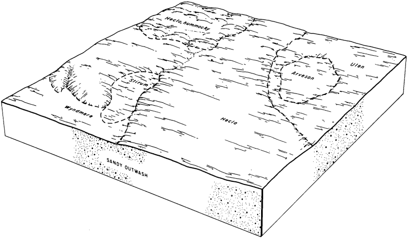
Figure 1.
Table 2. Representative physiographic features
| Landforms |
(1)
Sand sheet
(2) Lake plain (3) Outwash plain |
|---|---|
| Runoff class | Very low to low |
| Flooding frequency | None |
| Ponding frequency | None |
| Elevation | 950 – 2,525 ft |
| Slope | 6% |
| Water table depth | 36 – 72 in |
| Aspect | Aspect is not a significant factor |
Climatic features
MLRA 55A is considered to have a continental climate with cold winters and hot summers, low humidity, light rainfall, and much sunshine. Extremes in temperature are common and characteristic of MLRA 55A. The continental climate is the result of the location of this MLRA in the geographic center of North America. There are few natural barriers on the northern Great Plains, so air masses move unobstructed across the plains and account for rapid changes in temperature.
The average annual precipitation is 17 to 19 inches (432 to 483 millimeters). The normal average annual temperature is 36⁰ to 41⁰ F (2⁰ to 5⁰ C). January is the coldest month with an average low temperature of about ⁻ 3⁰ F (⁻19⁰ C). July is the warmest month with an average high temperature of about 80⁰ F (27⁰ C).
About 75 percent of the rainfall occurs as high-intensity, convective thunderstorms during the growing season. Winter precipitation is typically snow. The annual snowfall is 25 to 50 inches (635 to 1,270 millimeters). The frost-free period averages 101 days and ranges from 108 days to 92 days. The freeze-free period averages 124 days and ranges from 128 to 119 days.
Growth of native cool-season plants begins in mid-April and continues to mid-July. Native warm-season plants begin growth in late May and continue to the end of August. Green-up of cool-season plants can occur in September and October when adequate soil moisture is present.
Long-term climate data is lacking for Turtle Mountain; however, annual precipitation for the International Peace Garden averaged 27.7 inches (704 millimeters) from 1967-1970 while that for Boissevain, Manitoba averaged 17.1 inches (434 millimeters). Turtle Mountain likely has greater precipitation, cooler temperatures and less evapotranspiration than the adjacent plains.
Table 3. Representative climatic features
| Frost-free period (characteristic range) | 92-109 days |
|---|---|
| Freeze-free period (characteristic range) | 119-128 days |
| Precipitation total (characteristic range) | 17-19 in |
| Frost-free period (actual range) | 88-112 days |
| Freeze-free period (actual range) | 116-132 days |
| Precipitation total (actual range) | 17-20 in |
| Frost-free period (average) | 101 days |
| Freeze-free period (average) | 124 days |
| Precipitation total (average) | 18 in |
Figure 2. Monthly precipitation range
Figure 3. Monthly minimum temperature range
Figure 4. Monthly maximum temperature range
Figure 5. Monthly average minimum and maximum temperature
Figure 6. Annual precipitation pattern
Figure 7. Annual average temperature pattern
Climate stations used
-
(1) DRAKE 9 NE [USC00322304], Drake, ND
-
(2) EDMORE 1NW [USC00322525], Edmore, ND
-
(3) MINOT EXP STN [USC00325993], Minot, ND
-
(4) TOWNER 2 NE [USC00328792], Towner, ND
-
(5) WILLOW CITY [USC00329445], Willow City, ND
-
(6) DEVILS LAKE KDLR [USW00014912], Devils Lake, ND
-
(7) UPHAM 3 N [USC00328913], Upham, ND
-
(8) MINOT INTL AP [USW00024013], Minot, ND
-
(9) BOTTINEAU [USC00320941], Bottineau, ND
-
(10) GRANVILLE [USC00323686], Granville, ND
-
(11) LANGDON EXP FARM [USC00324958], Langdon, ND
-
(12) LEEDS [USC00325078], Leeds, ND
-
(13) VELVA 3NE [USC00328990], Velva, ND
-
(14) WESTHOPE [USC00329333], Westhope, ND
-
(15) HANSBORO 4 NNE [USC00323963], Hansboro, ND
-
(16) MOHALL [USC00326025], Mohall, ND
-
(17) ROLLA 1NE [USC00327664], Rolla, ND
-
(18) RUGBY [USC00327704], Rugby, ND
-
(19) CROSBY [USC00321871], Crosby, ND
-
(20) BOWBELLS [USC00320961], Bowbells, ND
Influencing water features
Under normal climatic conditions, this site receives additional water from a seasonal high water table. The duration of the water table can be prolonged in some soils due a loamy substratum layer which perches some water in the lower root zone and also contributes to lateral flow from surrounding uplands. During the growing season, water table depths typically are 3 to 5 feet during April through June. It commonly lowers to 4 to 6 feet during mid-summer through autumn. Surface infiltration is rapid or very rapid. Saturated hydraulic conductivity through the profile typically is high. In soils with a loamy substratum, the saturated hydraulic conductivity is moderately high in that layer. Water loss is primarily through evapotranspiration. During mid-summer, percolation below the root zone may also occur.
Due to the low relief landscape that typically surrounds this site, additional water received as runoff from adjacent uplands is not a major factor in the soil/hydrology/plant relationship.
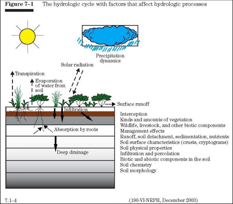
Figure 8. Fig 7-1 Hydrologic cycle from the National Range and Pasture Handbook.
Soil features
Soils associated with Subirrigated Sands ES are in the Mollisol and Entisol orders. The Mollisols are classified further as Oxyaquic Hapludolls. The Entisols are classified further as Aquic Udipsamments. These soils were developed under prairie vegetation. They formed in glaciolacustrine sediments, glaciofluvial deposits, eolian sands, or eolian deposits over till or glacial lacustrine sediments.
The common features of soils in this site are coarse textures to a depth of greater than 20 inches and a seasonal water table which is moderately high contributing additional water for transpiration. The soils are moderately well drained – redoximorphic features are visible at a depth of 3 to 3.5 feet. These soils are very deep, some have a loamy substratum within a depth of 20 to 60 inches. Most soils in this site have less than 5 percent gravel, but some have as much as 15 percent in the upper 3 feet and as much as 35 percent in the lower substratum.
Soil salinity and sodicity are typically none in the sandy materials; where a loamy substratum occurs, the salinity is very slight (E.C. 2 - <4) and sodicity is low. Soil reaction typically is slightly acid to slightly alkaline (pH 6.1 to 7.8) in the sandy materials; however, a few soils have lower subsoils which are moderately alkaline (pH 7.9 to 8.4) due to calcium carbonate accumulation. Where a loamy substratum occurs, it is slightly to moderately alkaline (pH 7.4 to 8.4). The calcium carbonate content is none to low in the upper part of the soil, but in some soils increases to as much as 30 percent at a depth greater than 2 feet.
This site should show slight to no evidence of rills, wind-scoured areas, or pedestaled plants. No water flow paths are seen on this site. The soil surface is stable and intact. Sub-surface soil layers are non-restrictive to water movement and root penetration. These soils are susceptible to wind erosion. Loss of the soil surface layer can result in a shift in species composition and/or production.
Major soil series correlated to the Subirrigated Sands site are: Aylmer, Falsen , Hecla, Towner (moderately well drained phase), and Walum.
Access Web Soil Survey (https://websoilsurvey.sc.egov.usda.gov/App/WebSoilSurvey.aspx) for specific local soils information.
Table 4. Representative soil features
| Parent material |
(1)
Glaciolacustrine deposits
(2) Glaciofluvial deposits (3) Eolian sands |
|---|---|
| Surface texture |
(1) Loamy fine sand (2) Fine sand (3) Coarse sand |
| Family particle size |
(1) Sandy |
| Drainage class | Moderately well drained |
| Permeability class | Rapid |
| Soil depth | 80 in |
| Surface fragment cover <=3" | 12% |
| Surface fragment cover >3" | 1% |
| Available water capacity (0-40in) |
2.5 – 9 in |
| Calcium carbonate equivalent (0-40in) |
30% |
| Electrical conductivity (0-40in) |
2 mmhos/cm |
| Sodium adsorption ratio (0-40in) |
Not specified |
| Soil reaction (1:1 water) (0-40in) |
6.1 – 8.4 |
| Subsurface fragment volume <=3" (Depth not specified) |
12% |
| Subsurface fragment volume >3" (Depth not specified) |
2% |
Ecological dynamics
The site developed under Northern Great Plains climatic conditions. The historical disturbance regime for the region included frequent fires, both natural and anthropogenic. Most fires, however, were anthropogenic fires set by Native Americans. Native Americans set fires in all months except perhaps January. These fires occurred in two peak periods, one from March-May with the peak in April and another from July-November with the peak occurring in October. Most of these fires were scattered and of small extent and duration. The grazing history would have involved grazing and browsing by American bison, elk, and whitetail deer. Herbivory by small mammals, insects, nematodes and other invertebrates are also important factors influencing the production and composition of the communities. Grazing and fire interaction, particularly when coupled with drought events, set up the dynamics discussed and displayed in the following state and transition diagram and descriptions.
This ecological site has a history of grazing by domestic livestock, particularly cattle. The introduction of domestic livestock and associated activities (e.g. fencing, water developments) have radically changed the disturbance regime of this site. Changes will occur in the plant communities due to weather fluctuations and/or management actions and, under adverse impacts, a slow decline in vigor and composition will result. However, under favorable conditions the site has the potential to resemble the reference state.
The plant community upon which interpretations are primarily based is the Reference Plant Community (Plant Community Phase 1.1 Big Bluestem-Needlegrasses). The Reference Plant Community has been determined by study of historical documents, relict areas, along with ecological aspects of plant species and plant communities. Trends in plant community dynamics ranging from heavily grazed to lightly grazed areas and seasonal use pastures have also been considered. Plant community states, phases, transitional pathways, and thresholds have been determined through similar methods.
Colonization of the site by exotic species will cause the Reference Plant Community to transition to State 2: Native/Invaded State. This transition is probably inevitable, and often results from colonization by exotic cool-season grasses such as Kentucky bluegrass, smooth brome, crested wheatgrass, and/or quackgrass.
These exotic cool-season grasses have been particularly and consistently invasive under extended periods of no-use and no fire. To slow or limit the invasion of these exotic grasses it is imperative that managerial options (e.g. prescribed grazing, prescribed burning) be carefully constructed and evaluated with respect to that objective. If management does not include measures to control or reduce these exotic cool-season grasses the transition to State 3: Invaded State (T2A) should be expected. Studies indicate that a threshold may exist in this transition when Kentucky bluegrass exceeds 30% of the plant community and native grasses represent less than 40% of the plant community composition. Similar thresholds may exist for smooth brome and quackgrass. This transition may occur under a wide range of managerial conditions ranging from non-use and no fire to heavy season-long grazing (primarily Kentucky bluegrass).
State and Transition Models (STM) are ecological process driven models. The ecological dynamics characterized by the STM reflect the functional changes in ecological drivers and feedback mechanisms (pathways) and the resulting changes in plant community composition (phases or states). The application of various management actions, coupled with weather variables, impact the ecological processes/drivers/feedback mechanisms that drive the plant community composition changes. The pathway narratives describing the ecological dynamics of the site reference various management inputs (e.g. prescribed grazing, prescribed fire); it is the manager’s responsibility to understand how these various management actions impact the ecological processes/drivers/feedback mechanisms.
The following State and Transition diagram illustrates the common states, community phases, community pathways, transitions and restoration pathways that can occur on the site. These are the most common plant community phases and states based on current knowledge and experience; changes may be made as more data are collected.
Following the state and transition diagram are narratives for each of the described states and community phases. These may not represent every possibility, but they are the most prevalent and repeatable states/community phases. The plant composition tables shown below have been developed from the best available knowledge at the time of this revision. As more data are collected, some of these community phases and/or states may be revised or removed; new ones may be added. The main purpose for including the descriptions here is to capture the current knowledge and experience at the time of this revision.
State and transition model


More interactive model formats are also available.
View Interactive Models
Click on state and transition labels to scroll to the respective text
| T1A | - | Introduction of exotic cool-season grasses |
|---|---|---|
| T2A | - | Extended periods of non-use, or very light grazing, no fire |
| R3A | - | Long-term prescribed grazing with prescribed burning |
| R4A | - | Successful range seeding |
| R4B | - | Failed range seeding |
| T5A | - | Cessation of annual cropping |
State 1 submodel, plant communities
| 1.1a | - | Heavy season-long grazing with or without drought |
|---|---|---|
| 1.2a | - | Return to average growing conditions and reduced grazing pressure |
State 2 submodel, plant communities
| 2.1a | - | Heavy season-long grazing with or without drought |
|---|---|---|
| 2.2a | - | Long term prescribed grazing with prescribed burning |
State 3 submodel, plant communities
State 1
Reference
This state represents the natural range of variability that dominates the dynamics of this ecological site. Plant community phases occurring within this state are diverse, stable, productive, and well adapted to the Northern Great Plains. The primary disturbance mechanisms for this site in the reference conditioned include frequent fire and grazing by large herding ungulates. Timing of fires and grazing, coupled with weather events, dictated the dynamics that occurred within the natural range of variability. Colonization of the site by exotic plants, mainly cool-season grasses such as Kentucky bluegrass, quackgrass, and/or smooth brome can cause the site to transition to the State 2: Native/Invaded Site. A transition to State 3: Invaded State can be expected unless a prescribed grazing and/or prescribe burning program is implemented.
Dominant plant species
-
big bluestem (Andropogon gerardii), grass
-
prairie sandreed (Calamovilfa longifolia), grass
-
sand dropseed (Sporobolus cryptandrus), grass
-
needle and thread (Hesperostipa comata), grass
-
porcupinegrass (Hesperostipa spartea), grass
-
sand bluestem (Andropogon hallii), grass
-
sideoats grama (Bouteloua curtipendula), grass
-
prairie Junegrass (Koeleria macrantha), grass
-
Canada wildrye (Elymus canadensis), grass
-
blue grama (Bouteloua gracilis), grass
-
sedge (Carex), grass
-
white sagebrush (Artemisia ludoviciana), other herbaceous
-
white heath aster (Symphyotrichum ericoides), other herbaceous
-
silky prairie clover (Dalea villosa), other herbaceous
-
longbract spiderwort (Tradescantia bracteata), other herbaceous
-
goldenrod (Solidago), other herbaceous
Community 1.1
Big Bluestem-Needlegrasses (Andropogon gerardii-Hesperostipa spp.)
This community phase was historically the most dominant both temporally and spatially. Mid statured cool-season bunchgrass such as porcupinegrass and needle and thread would have been co-dominants with tall warm-season grasses such as big bluestem, sand bluestem, and prairie sandreed. Other grass and grass-like species included little bluestem, sideoats grama, sand dropseed, prairie Junegrass, Canada wildrye, blue grama, and sedges. A variety of leguminous and non-leguminous perennial forbs including longbract spiderwort, white sagebrush, white heath aster, goldenrod, and silky prairie clover were present. Shrubs included prairie rose, prairie willow, and western snowberry. Annual production of this community would have ranged between about 2500-4100 pounds per acre and consisting of about 80% graminoids, 10% forbs, and 10% shrubs. This is the interpretive plant community phase and is described in the “Plant Community Composition and Group Annual Production” portion of this ecological site description. Due to the codominance of warm-season and cool-season graminoids, production would have been spread across the entire growing season. This diverse community also allowed for high drought tolerance.
Figure 9. Annual production by plant type (representative values) or group (midpoint values)
Table 5. Annual production by plant type
| Plant type | Low (lb/acre) |
Representative value (lb/acre) |
High (lb/acre) |
|---|---|---|---|
| Grass/Grasslike | 2000 | 2640 | 3280 |
| Forb | 250 | 330 | 410 |
| Shrub/Vine | 250 | 330 | 410 |
| Total | 2500 | 3300 | 4100 |
Figure 10. Plant community growth curve (percent production by month). ND5503, Central Black Glaciated Plains, cool-season/warm-season co-dominant.. Cool-season, warm-season co-dominant..
| Jan | Feb | Mar | Apr | May | Jun | Jul | Aug | Sep | Oct | Nov | Dec |
|---|---|---|---|---|---|---|---|---|---|---|---|
| J | F | M | A | M | J | J | A | S | O | N | D |
| 0 | 0 | 2 | 6 | 21 | 40 | 20 | 6 | 4 | 1 | 0 | 0 |
Community 1.2
Needlegrasses-Prairie Sandreed-Sand Dropseed (Hesperostipa spp.-Calamovilfa longifolia-Sporobolus cryptandrus)
This plant community results from heavy season-long grazing with or without drought. Compared to Community Phase 1.1, this community phase would support increased amounts of the more grazing tolerant grasses such as needle and thread, prairie sandreed, and sand dropseed with a decreased amount of big bluestem and porcupinegrass. Forbs have increased in production compared to Community Phase 1.1. Those showing notable increases generally include white sagebrush, Cuman ragweed, goldenrod, and white heath aster. Annual production is somewhat reduced compared to Community Phase 1.1.
Figure 11. Plant community growth curve (percent production by month). ND5502, Central Black Glaciated Plains, cool-season dominant, warm-season sub-dominant.. Cool-season dominant, warm-season sub-dominant..
| Jan | Feb | Mar | Apr | May | Jun | Jul | Aug | Sep | Oct | Nov | Dec |
|---|---|---|---|---|---|---|---|---|---|---|---|
| J | F | M | A | M | J | J | A | S | O | N | D |
| 0 | 0 | 3 | 7 | 23 | 42 | 15 | 5 | 4 | 1 | 0 | 0 |
Pathway 1.1a
Community 1.1 to 1.2
Community Phase Pathway 1.1 to 1.2 occurs with heavy season-long grazing with or without drought. This results in a decrease in big bluestem and porcupine grass with a corresponding increase in the more grazing tolerant grasses such as needle and thread, prairie sandreed and sand dropseed. This shift may also be facilitated by periods of below normal precipitation and heavy grazing.
Pathway 1.2a
Community 1.2 to 1.1
Community Phase Pathway 1.2 to 1.1 occurs with a return to average growing conditions and reduced grazing pressure enabling big bluestem and porcupinegrass to increase with a corresponding decrease in needle and thread, prairie sandreed, and sand dropseed.
State 2
Native/Invaded
This state is very similar to the Reference State but now supports minor amounts of exotic plants. This state is still dominated by native warm-season and cool-season grasses; but exotic species, typically the cool-season grasses Kentucky bluegrass, smooth brome, and/or quackgrass are now present in all community phases of the state. Annual production can vary considerably, in part due to the extent of invasion by cool-season grasses, but may be in the range of 3800-4550 pounds per acre with the exotic cool-season grasses contributing between 16-30%. These exotic cool-season grasses have been particularly and consistently invasive under extended periods of non-use and no fire. To slow or limit the invasion of these exotic grasses, it is imperative that managerial options (e.g. prescribed grazing, prescribed burning, other) be carefully constructed and evaluated with respect to that objective. If management does not include measures to control or reduce these exotic cool-season grasses, the transition to State 3: Invaded State should be expected.
Dominant plant species
-
big bluestem (Andropogon gerardii), grass
-
needle and thread (Hesperostipa), grass
-
prairie sandreed (Calamovilfa longifolia), grass
-
sand dropseed (Sporobolus cryptandrus), grass
-
smooth brome (Bromus inermis), grass
-
Kentucky bluegrass (Poa pratensis), grass
-
quackgrass (Elymus repens), grass
-
white sagebrush (Artemisia ludoviciana), other herbaceous
-
white heath aster (Symphyotrichum ericoides), other herbaceous
-
silky prairie clover (Dalea villosa), other herbaceous
Community 2.1
Big Bluestem-Needlegrasses (Andropodon gerardii-Hesperostipa spp.)
This community phase closely resembles Community Phase 1.1 but now supports minor amounts of exotic species, generally cool-season grasses Kentucky bluegrass, smooth brome, and/or quackgrass. This community may be maintained with grazing systems that allow for adequate recovery periods following grazing events and, potentially, the combination of grazing and prescribed burning which closely mimics the natural disturbance regime.
Figure 12. Plant community growth curve (percent production by month). ND5503, Central Black Glaciated Plains, cool-season/warm-season co-dominant.. Cool-season, warm-season co-dominant..
| Jan | Feb | Mar | Apr | May | Jun | Jul | Aug | Sep | Oct | Nov | Dec |
|---|---|---|---|---|---|---|---|---|---|---|---|
| J | F | M | A | M | J | J | A | S | O | N | D |
| 0 | 0 | 2 | 6 | 21 | 40 | 20 | 6 | 4 | 1 | 0 | 0 |
Community 2.2
Needlegrasses-Prairie Sandreed-Sand Dropseed (Hesperostipa spp.-Calamovilfa longifolia-Sporobolus cryptandrus)
This plant community results from heavy season-long grazing with or without drought. Compared to Community Phase 2.1 this community phase would support increased amounts of the more grazing tolerant grasses such as needle and thread and sand dropseed with a decreased amount of big bluestem and porcupinegrass. Forbs have increased in production compared to Community Phase 2.1. Those showing notable increases include white sagebrush, Cuman ragweed, goldenrod, and white heath aster. This community phase is often dispersed throughout a pasture in an overgrazed/undergrazed pattern, typically referred to as patch grazing. Some overgrazed areas will exhibit the impacts of heavy use, while the ungrazed areas will have a build-up of litter and increased plant decadence. This is a typical pattern found in properly stocked pastures grazed season-long. As a result, Kentucky bluegrass tends to increase more in the undergrazed areas while the more grazing tolerant short statured species, such as blue grama and sedges, increase in the heavily grazed areas. If present, Kentucky bluegrass may increase under heavy grazing. This community phase is approaching the threshold which would readily lead to State 3: Invaded State. However, if management is significantly altered, this community phase can still be reverted back to Community Phase 2.1. A combination of prescribed grazing and prescribed burning may be the most effective managerial techniques in accomplishing this.
Figure 13. Plant community growth curve (percent production by month). ND5502, Central Black Glaciated Plains, cool-season dominant, warm-season sub-dominant.. Cool-season dominant, warm-season sub-dominant..
| Jan | Feb | Mar | Apr | May | Jun | Jul | Aug | Sep | Oct | Nov | Dec |
|---|---|---|---|---|---|---|---|---|---|---|---|
| J | F | M | A | M | J | J | A | S | O | N | D |
| 0 | 0 | 3 | 7 | 23 | 42 | 15 | 5 | 4 | 1 | 0 | 0 |
Pathway 2.1a
Community 2.1 to 2.2
Community Phase Pathway 2.1 to 2.2 occurs with heavy season-long grazing with or without drought. This results in a decrease in big bluestem and porcupine grass with a corresponding increase in the more grazing tolerant grasses such as needle and thread and sand dropseed. This shift may be facilitated by periods of below normal precipitation and heavy grazing. As the exotic cool-season grasses increase, peak production can be expected to shift to earlier in the growing season.
Pathway 2.2a
Community 2.2 to 2.1
Community Phase Pathway 2.2 to 2.1 can occur with long-term prescribed grazing and prescribed burning which enables big bluestem and porcupinegrass to increase with a corresponding decrease in needle and thread, prairie sandreed, and sand dropseed.
State 3
Invaded
This state is the result of invasion and dominance by exotic plants, typically the cool-season grasses (Kentucky bluegrass, smooth brome, and/or quackgrass). These exotic cool-season species often form monotypic stands and, as a result, plant diversity is often markedly reduced and peak production is restricted to late spring/early summer. With the invasion of Kentucky bluegrass or smooth brome this state is often characterized by an increasing thatch layer that effectively blocks introduction of other plants into the site. Annual production can vary considerably, in part due to the extent of invasion by cool-season grasses but may be in the range of 3000-5000 pounds per acre with the exotic cool-season grasses contributing between 59-86%. Once the state is well established, even drastic events such as high intensity fires driven by high fuel loads of litter and thatch will not result in more than a very short-term reduction of these two species. These events may reduce the dominance of these exotic sodgrasses but, due to the large amount of rhizomes in the soil, there is no opportunity for the native species to establish and dominate before the exotic sodgrasses rebound and again dominate the site.
Dominant plant species
-
smooth brome (Bromus inermis), grass
-
Kentucky bluegrass (Poa pratensis), grass
-
quackgrass (Elymus repens), grass
Community 3.1
Kentucky Bluegrass/Smooth Bromegrass/Shrubs
This community phase is dominated by the shade tolerant cool-season sodgrasses including smooth brome and Kentucky bluegrass. Common forbs include goldenrod, American licorice, scurfpea, heath aster, and western yarrow. Western snowberry can increase and become a major component in this community phase. Remnants of native warm- and cool-season grasses are still present, but greatly reduced in vigor and production. Infiltration is reduced and runoff is increased when compared to the Reference State but soil erosion remains low. Nutrient cycling is limited by the rooting depth of these species, the lack of leguminous forbs, and the alteration of the soil biotic community. Organic matter oxidizes in the air rather than being incorporated into the soil due to lack of animal impact and reduced soil biological activity. Energy capture into the system is restricted to a short window provided by the early season species and the high amount of dead standing plant material. This community phase is somewhat resistant to change. Once reached, time and external resources will be needed to see any immediate recovery. The combination of both prescribed grazing and prescribed fire is the most effective in moving this plant community towards State 2.
Figure 14. Plant community growth curve (percent production by month). ND5501, Central Black Glaciated Plains, cool-season dominant. Cool-season dominant..
| Jan | Feb | Mar | Apr | May | Jun | Jul | Aug | Sep | Oct | Nov | Dec |
|---|---|---|---|---|---|---|---|---|---|---|---|
| J | F | M | A | M | J | J | A | S | O | N | D |
| 0 | 0 | 3 | 8 | 24 | 45 | 10 | 3 | 5 | 2 | 0 | 0 |
Community 3.2
Kentucky Bluegrass/Forbs
This community phase is dominated by Kentucky bluegrass with lesser amounts of sedge. Common forbs would include goldenrod, western yarrow, aster, western ragweed and a variety of introduced forbs. The longer this community phase exists the more resistant and resilient it becomes. Natural or management disturbances that reduce the cover of Kentucky bluegrass are very short lived due to the abundance of rhizomes of Kentucky bluegrass in the soil and the lack of propagules of other species present. Production is limited to the sod forming species. Energy capture into this system is limited to one early growing species. Runoff increases and is the highest of any plant community phase on this ecological site. Nutrient cycling is severely limited due to the shallow rooting depth of the Kentucky bluegrass and production is limited.
Figure 15. Plant community growth curve (percent production by month). ND5501, Central Black Glaciated Plains, cool-season dominant. Cool-season dominant..
| Jan | Feb | Mar | Apr | May | Jun | Jul | Aug | Sep | Oct | Nov | Dec |
|---|---|---|---|---|---|---|---|---|---|---|---|
| J | F | M | A | M | J | J | A | S | O | N | D |
| 0 | 0 | 3 | 8 | 24 | 45 | 10 | 3 | 5 | 2 | 0 | 0 |
Community 3.3
Annual/Pioneer Perennial
The Annual, Pioneer Perennial community phase is highly variable depending on the level and duration of disturbance related to the T4 transitional pathway. In this MLRA, the most probable origin of this phase is secondary succession following cropland abandonment. This plant community will initially include a variety of annual forbs and grasses. Over time, the introduced cool-season perennial grasses will begin to establish on this site.
Pathway 3.1a
Community 3.1 to 3.2
This pathway is initiated by heavy continuous season-long grazing. The heavy continuous grazing favors those plants which can tolerate repeated defoliation (Kentucky bluegrass). Smooth brome will decrease with heavy use due to its elevated growth point. Western snowberry will experience mechanical damage and will decrease in production and cover. Grazing pressure reduces litter cover resulting in elevated soil surface temperatures increasing evaporation rates and further reducing biological activity.
Pathway 3.3a
Community 3.3 to 3.2
With grazing and time, the grazing tolerant Kentucky bluegrass will continue to increase leading to community phase 3.2. In the absence of grazing, this pathway will lead to a community phase resembling 3.1 with the primary difference being the lack of western snowberry and remnant native grass species.
State 4
Go-Back State
This community phase is highly variable depending on the level and duration of disturbance related to the T5A transitional pathway. In this MLRA, the most probable origin of this phase is plant succession following cropland abandonment. This plant community will initially include a variety of annual forbs and grasses, some of which may be noxious weeds needing control. However, over time exotic cool-season grasses such as Kentucky bluegrass, smooth brome, and/or quackgrass come to dominate the site. Associates include western snowberry, wild rose, common dandelion, Canada goldenrod, common yarrow and Canada thistle.
Dominant plant species
-
western snowberry (Symphoricarpos occidentalis), shrub
-
rose (Rosa), shrub
-
Kentucky bluegrass (Poa pratensis), grass
-
smooth brome (Bromus inermis), grass
-
quackgrass (Elymus repens), grass
-
common dandelion (Taraxacum officinale), other herbaceous
-
Canada goldenrod (Solidago canadensis), other herbaceous
-
common yarrow (Achillea millefolium), other herbaceous
-
Canada thistle (Cirsium arvense), other herbaceous
State 5
Any Plant Community
This state is the result of annual cropping.
Transition T1A
State 1 to 2
Colonization of the site by exotic plants will cause State 1: Reference State to transition to State 2: Native/Invaded State. The transition may result from a variety of factors ranging from extended periods of no use and no fire to heavy season-long grazing. This transition is probably inevitable and often results from colonization by exotic cool-season grasses such as Kentucky bluegrass, smooth brome, and/or quackgrass.
Transition T2A
State 2 to 3
This transition from State 2: Native/Invaded State to State 3: Invaded State occurs during extended periods of non-use or very light grazing and no fire which is advantageous to the exotic cool-season grasses Kentucky bluegrass, smooth, and/or quackgrass. Studies indicate that a threshold may exist in this transition when Kentucky bluegrass exceeds 30% of the plant community and native grasses represent less than 40% of the plant community composition. Similar thresholds may exist for smooth brome and quackgrass. This transition may occur under a wide range of managerial conditions ranging from non-use and no fire to heavy season-long grazing (primarily Kentucky bluegrass).
Restoration pathway R3A
State 3 to 2
This Restoration from State 3: Invaded State to State 2: Native/Invaded State may be accomplished with long-term prescribed grazing with prescribed burning.
Restoration pathway R4A
State 4 to 2
This restoration pathway from State 4: Go-Back State to State 2: Native/Invaded State results from a successful range seeding with prescribed grazing and prescribed burning.
Restoration pathway R4B
State 4 to 3
The restoration pathway from State 4: Go-Back State to State 3: Invaded State results from a failed range seeding.
Transition T5A
State 5 to 4
This transition is most commonly associated with the cessation of cropping without benefit of seedings or plantings resulting in State 4: Go-Back State
Additional community tables
Table 6. Community 1.1 plant community composition
| Group | Common name | Symbol | Scientific name | Annual production (lb/acre) | Foliar cover (%) | |
|---|---|---|---|---|---|---|
|
Grass/Grasslike
|
||||||
| 1 | Tall Warm-season Grasses | 495–825 | ||||
| big bluestem | ANGE | Andropogon gerardii | 160–495 | – | ||
| sand bluestem | ANHA | Andropogon hallii | 160–495 | – | ||
| prairie sandreed | CALO | Calamovilfa longifolia | 160–495 | – | ||
| switchgrass | PAVI2 | Panicum virgatum | 64–330 | – | ||
| Indiangrass | SONU2 | Sorghastrum nutans | 32–165 | – | ||
| prairie cordgrass | SPPE | Spartina pectinata | 0–66 | – | ||
| 2 | Cool-season Bunchgrasses | 330–825 | ||||
| porcupinegrass | HESP11 | Hesperostipa spartea | 166–660 | – | ||
| slender wheatgrass | ELTR7 | Elymus trachycaulus | 33–330 | – | ||
| needle and thread | HECOC8 | Hesperostipa comata ssp. comata | 33–130 | – | ||
| Canada wildrye | ELCA4 | Elymus canadensis | 0–99 | – | ||
| 3 | Mid Warm-season Grasses | 165–330 | ||||
| little bluestem | SCSC | Schizachyrium scoparium | 165–330 | – | ||
| sideoats grama | BOCU | Bouteloua curtipendula | 66–330 | – | ||
| sand dropseed | SPCR | Sporobolus cryptandrus | 66–330 | – | ||
| 4 | Short Warm-season Grasses | 33–165 | ||||
| blue grama | BOGR2 | Bouteloua gracilis | 33–165 | – | ||
| mat muhly | MURI | Muhlenbergia richardsonis | 0–66 | – | ||
| 5 | Other Native Grasses | 33–165 | ||||
| Graminoid (grass or grass-like) | 2GRAM | Graminoid (grass or grass-like) | 33–165 | – | ||
| prairie Junegrass | KOMA | Koeleria macrantha | 33–99 | – | ||
| Scribner's rosette grass | DIOLS | Dichanthelium oligosanthes var. scribnerianum | 0–66 | – | ||
| fall rosette grass | DIWI5 | Dichanthelium wilcoxianum | 0–66 | – | ||
| 6 | Grass-likes | 66–330 | ||||
| sun sedge | CAINH2 | Carex inops ssp. heliophila | 33–264 | – | ||
| Pennsylvania sedge | CAPE6 | Carex pensylvanica | 33–264 | – | ||
| Grass-like (not a true grass) | 2GL | Grass-like (not a true grass) | 33–264 | – | ||
|
Forb
|
||||||
| 7 | Forbs | 165–330 | ||||
| white sagebrush | ARLU | Artemisia ludoviciana | 33–99 | – | ||
| flat-top goldentop | EUGR5 | Euthamia graminifolia | 33–66 | – | ||
| Maximilian sunflower | HEMA2 | Helianthus maximiliani | 33–66 | – | ||
| stiff goldenrod | OLRI | Oligoneuron rigidum | 33–66 | – | ||
| Missouri goldenrod | SOMI2 | Solidago missouriensis | 33–66 | – | ||
| white heath aster | SYER | Symphyotrichum ericoides | 33–66 | – | ||
| longbract spiderwort | TRBR | Tradescantia bracteata | 33–66 | – | ||
| purple prairie clover | DAPU5 | Dalea purpurea | 33–66 | – | ||
| silky prairie clover | DAVI | Dalea villosa | 33–66 | – | ||
| Forb, native | 2FN | Forb, native | 33–66 | – | ||
| goldenrod | SOLID | Solidago | 33–66 | – | ||
| smooth horsetail | EQLA | Equisetum laevigatum | 0–33 | – | ||
| Cuman ragweed | AMPS | Ambrosia psilostachya | 0–33 | – | ||
| smooth horsetail | EQLA | Equisetum laevigatum | 0–33 | – | ||
| narrowleaf stoneseed | LIIN2 | Lithospermum incisum | 0–33 | – | ||
| lobelia | LOBEL | Lobelia | 0–33 | – | ||
| rush skeletonplant | LYJU | Lygodesmia juncea | 0–33 | – | ||
| prairie milkweed | ASSU3 | Asclepias sullivantii | 0–33 | – | ||
|
Shrub/Vine
|
||||||
| 8 | Shrubs | 165–330 | ||||
| prairie willow | SAHU2 | Salix humilis | 33–132 | – | ||
| Shrub (>.5m) | 2SHRUB | Shrub (>.5m) | 0–99 | – | ||
| prairie rose | ROAR3 | Rosa arkansana | 33–99 | – | ||
| western snowberry | SYOC | Symphoricarpos occidentalis | 33–66 | – | ||
| white meadowsweet | SPAL2 | Spiraea alba | 33–66 | – | ||
Interpretations
Animal community
Animal Community – Wildlife Interpretations
Landscape
The MLRA 55A landscape is characterized by mostly nearly level to gently rolling till plains with some steep slopes adjacent to streams. The MLRA includes areas of kettle holes, kames, and moraines. MLRA 55A is considered to have a continental climate with cold winters and hot summers, low humidity, light rainfall, and much sunshine. Extremes in temperature are common and characteristic of MLRA 55A. This area supports mid- to tall-grass prairie vegetation with quaking aspen, bur oak, green ash, and willow species growing on the higher elevations in Turtle Mountain, on moraines in proximity south of Devils Lake, Pembina River Gorge, and various drainageways throughout the MLRA. Numerous depressional wetlands are ringed with quaking aspen. Complex, intermingled ecological sites create diverse grass/shrub land habitats interspersed with varying densities of linear, slope, depressional, and in-stream wetlands associated with headwater streams and tributaries of the Mouse and Pembina Rivers. MLRA 55A is located entirely within North Dakota and within the boundaries of the Prairie Pothole Region. The primary land use is cropland. Glacial Lake Souris and the Devils Lake Basin are known for exceptional fertility with major crops including corn, canola, soybeans, corn, and small grains. Together, these two areas make up 73% of the MLRA (Glacial Lake Souris 5500 mi2, 43%; and the Devils Lake Basin 3810 mi2, 30%).
Turtle Mountain (1000 mi2 of which 405 mi2 are found in America), in the north-central part of the MLRA on the Canadian border, is approximately 1,950 to 2,550 feet (595 to 775 meters) in elevation, rising approximately 600 to 800 feet (150 meters) above the adjacent till plain. Home to an extensive forest of quaking aspen, bur oak, green ash, and willows, it has an understory of beaked hazel, with associates of chokecherry, Saskatchewan serviceberry, downy arrowwood, and rose. Turtle Mountain comprises the largest area of quaking aspen forest in North Dakota.
The Pembina Escarpment extends from the Canadian border southeast to Walhalla where the Pembina River enters the floor of the Red River Valley in MLRA 56. Mainly found on steep slopes along the Pembina River, the Pembina Gorge is in a rugged and sheltered setting with bur oak, green ash, cottonwood, and American elm. Encompassing approximately 12,500 acres, the Pembina Gorge is one of the largest uninterrupted blocks of woodlands in North Dakota. This segment of the Pembina River is the longest segment of unaltered river valley in the North Dakota.
Two major Hydrologic Unit Areas make up this MLRA. 56% of the MLRA drains into the Mouse (also known as Souris) River while 44% drains into the Red River via the Pembina or into Devils Lake (out-letting to Sheyenne River via a pump, pipeline, canal system). The North Dakota portion of the Mouse River watershed is in this MLRA. The Mouse River basin drains nearly 23,600 square miles and has a long history of flooding.
By the mid-19th century, over 75% of the MLRA had been converted from mid- to tall-grass prairie or woodland to annual crop production. To alleviate crop production loss from wetlands and overland flow, a system of shallow surface ditches, judicial ditches, and road ditches removes surface water in spring and during high rainfall events. Tile drainage systems have been or are being installed extensively throughout MLRA 55A for sub-surface field drainage to enhance annual crop production.
Historic Communities/Conditions within MLRA 55A:
The northern tall- and mixed-grass prairie along with the quaking aspen forest were disturbance-driven ecosystems with fire, herbivory, and climate functions as the primary ecological drivers - either singly or often in combination. American bison roamed MLRA 55A wintering along the Mouse River and migrating through MLRA 55A into MLRAs 56 and 55B. Many species of grassland birds, small mammals, insects, reptiles, amphibians, elk, moose, pronghorn and large herds of American bison were historically among the inhabitants adapted to this region. Roaming herbivores, as well as several small mammal and insect species, were the primary consumers linking the grassland resources to large predators such as the wolf, American black bear, grizzly bear, and smaller carnivores such as the coyote, bobcat, red fox, and raptors. Extirpated species include free-ranging American bison and gray wolf (breeding). Extinct is the Rocky Mountain locust.
Present Communities/Conditions within MLRA 55A:
This area supports natural prairie vegetation characterized by western wheatgrass, green needlegrass, needle and thread, and blue grama. Little bluestem is an important species on the more sloping and shallower soils. Prairie cordgrass, northern reedgrass, big bluestem, and wheat sedge are important species on wet soils. Western snowberry, leadplant, and prairie rose are commonly interspersed throughout the area. Native forests occur in Turtle Mountain, Pembina Gorge, moraines south of Devils Lake, woody draws, scattered tracts along the Mouse River, and in the sand dunes in west central region of the MLRA.
Over 75% of MLRA 55A has been converted to annual crop production. European influence has impacted remaining grassland, forestland, and shrubland by domestic livestock grazing, elimination of fire, tree harvest, removal of surface and subsurface hydrology via artificial drainage, and other anthropogenic factors influencing plant community composition and abundance.
Hydrological manipulation is extensive throughout the MLRA. Extensive wetland and subsurface tile drainage have taken place. Ephemeral and intermittent streams and the Mouse River have been straightened - removing sinuosity, creating isolated oxbows, and converting riparian zones to annual crop production. These anthropogenic impacts have reduced flood water detention and retention on the landscape. The results have been increasing storm water runoff sediment and nutrient loading impacting the Mouse and Des Lacs Rivers and their tributaries along with Devils Lake and other lakes within the MLRA. The installation of instream structures has reduced aquatic species movement within the MLRA. Two large dams in Saskatchewan, Canada (Rafferty on the Mouse River and the Alameda on Moose Mountain Creek, a major tributary to the Mouse River) were built, in part, to reduce flood peaks on the Mouse River. In addition, three USFWS National Wildlife Refuges were created by building two low-head dams on the Mouse River and one on the Des Lacs River in North Dakota. Numerous low-head dams are located on the Mouse and Des Lacs Rivers in North Dakota. The Eaton Irrigation Project low-head dam, located in the vicinity of Towner, North Dakota, provides flood irrigation to approximately 6,700 acres of hayland and pastureland.
The loss of the American bison and fire, as primary ecological drivers, greatly influenced the character of the remaining native plant communities and the associated wildlife moving towards a less diverse and more homogeneous landscape. Annual cropping is the main factor contributing to habitat fragmentation, reducing habitat quality for area-sensitive species. These influences fragmented the landscape, reduced or eliminated ecological drivers (fire), and introduced exotic species including smooth brome, Kentucky bluegrass, and leafy spurge further impacting plant and animal communities.
Included in this MLRA are over 121,000 acres of National Wildlife Refuges and over 77,000 acres of waterfowl production areas owned and managed by the United States Fish and Wildlife Service. White Horse Hill National Game Preserve is a 1,674-acre national wildlife refuge sitting on the south shores of Devils Lake, about 10 miles south of the city of Devils Lake. Numerous state-owned parks, state wildlife management areas, North Dakota Forest Service and Department of Trust Lands are found in the MLRA. Wakopa Wildlife Management Area is the largest WMA covering approximately 6,739 acres.
Some characteristic wildlife species in this area are:
Birds: Common loon, common goldeye, bufflehead, ruffed grouse, broad-winged hawk, alder flycatcher, mourning warbler, mallard, blue-winged teal, red-tailed hawk, American kestrel, killdeer, eastern and western kingbird, American crow, common yellowthroat, clay-colored sparrow, vesper sparrow, red-necked grebe, Savannah sparrow, downy and hairy woodpeckers, black-capped chickadee, white-breasted nuthatch, and brown-headed cowbird.
Mammals: Northern short-tailed shrew, water shrew, beaver, muskrat, mink, long-tailed weasel, American martin, fisher, white-tailed jackrabbit, snowshoe hare, Franklin’s ground squirrel, thirteen-lined ground squirrel, northern pocket gopher, plains pocket gopher, western harvest mouse, deer mouse, meadow vole, meadow jumping mouse, western jumping mouse, coyote, red fox, racoon, American badger, striped skunk, white-tailed deer, elk, moose, and woodchuck, red squirrel, porcupine, and northern flying squirrel.
Reptiles/Amphibians: American toad, Great Plains toad, northern leopard frog, chorus frog, tiger salamander, plains garter snake, smooth green snake, wood frog, and common garter snake.
Presence of wildlife species is often determined by ecological site characteristics including grass and forb species, tree and shrub species, hydrology, aspect, and other associated ecological sites. The home ranges of a majority species are usually larger than one ecological site or are dependent on more than one ecological site for annual life requisites. Ecological sites offer different habitat elements as the annual life requisites change. Habitat improvement and creation must be conducted within the mobility limits of a known population for the species.
Insects play an important role providing ecological services for plant community development. Insects that are scavengers or aid in decomposition provide the food chain baseline sustaining the carnivorous insects feeding upon them. Many insects provide the ecological services necessary for pollination, keeping plant communities healthy and productive. Insects provide a protein food source for numerous species including grassland-nesting birds, woodpeckers, woodland edge and interior species and their young. Extensive use of insecticides for specialty crops such as soybeans, corn, and other crops has greatly reduced insects within this MLRA.
Species of Concern within MLRA 55A:
The following is a list of species considered “species of conservation priority” in the North Dakota State Wildlife Action Plan (2015) and “species listed as threatened, endangered, or petitioned” under the Endangered Species Act within MLRA 55A at the time this section was developed:
Invertebrates: Dakota skipper, monarch butterfly, and regal fritillary. Within the MLRA, the United States Fish and Wildlife Service lists 5 areas (in Rolette and McHenry Counties) as critical habitat for the Dakota skipper.
Birds: American avocet, American bittern, American kestrel, American white pelican, Baird’s sparrow, bald eagle, black tern, black-billed cuckoo, bobolink, canvasback, chestnut-collard longspur, ferruginous hawk, Franklin’s gull, grasshopper sparrow, horned grebe, LeConte’s sparrow, lesser scaup, loggerhead shrike, marbled godwit, Nelson’s sparrow, northern harrier, northern pintail, piping plover, sharp-tailed grouse, short-eared owl, Sprague’s pipit, Swainson’s hawk, upland sandpiper, western meadowlark, whooping crane, willet, Wilson’s phalarope, and yellow rail.
Mammals: American martin, Arctic shrew, big brown bat, gray fox, little brown bat, northern long-eared bat, plains pocket mouse, pygmy shrew, Richardson’s ground squirrel, river otter, and Townsend’s big-eared bat.
Amphibians/Reptiles: Canadian toad, common snapping turtle, plains hog-nosed snake, and smooth green snake.
Fish: Finescale dace, hornyhead chub, largescale stoneroller, logperch, northern pearl dace, and trout-perch.
Mussels: Black sandshell, creek heelsplitter, creeper, mapleleaf, and pink heelsplitter.
Grassland and Woodland Management for Wildlife in the MLRA 55A
Management activities within the community phase pathways impact wildlife but are essential for maintenance of healthy grassland ecosystems. Community phase, transitional, and restoration pathways are keys to long-term management within each State and between States. Timing, intensity, and frequency of these inputs can have dramatic positive or negative effects on local wildlife species. Ranchers and other land managers must always consider the long-term beneficial management effects of grassland and woodland resources in comparison to typically short-term negative effects to the habitats of individual species.
Ecological sites occur as intermingled complexes on the landscape with gradual or sometimes abrupt transitions. Rarely do ecological sites exist in large enough acreage to manage independently for wildlife. Conversion to annual cropping and fragmentation due to transportation and electrical transmission corridors and to rural housing are main causes of fragmentation. This MLRA supports ecological sites that are dominated by woody vegetation and can be located adjacent to ecological sites that support tall- to mid-statured grasses (Thin Loamy/Shallow Loamy) or are adjacent to ecological sites that support wetland vegetation (Shallow Marsh and Wet Meadow).
Management of these ecological site complexes challenges managers to properly manage the entire landscape. A management strategy for one ecological site may negatively impact an adjacent site. For example, grazing Upland Hardwood Forest ecological sites along with herbaceous dominated Loamy Overflow ecological sites may degrade one site by under-use, favoring woody vegetation or increasing exotic cool-season grasses.
Life requisites and habitat deficiencies are determined for targeted species. Deficiencies need to be addressed along community phase, transitional, and restoration pathways as presented in specific state-and-transition models. Ecological sites should be managed and restored within the site’s capabilities to provide sustainable habitat for targeted species or species guilds. Managers also need to consider vegetative associations provided by adjacent/intermingled ecological sites for species with home ranges or life requisites that may not be provided by one ecological site. Understanding specific grassland species’ sensitivity to woody encroachment and preferred vegetative structure enables managers to determine which grassland-nesting bird species will avoid grassland habitats adjacent to Upland Hardwood Forest or Loamy Savanna ecological sites or woody dominated, Plant Community Phase 5, Loamy ecological site.
Many passerine species utilize MLRA 55A as a major migratory travel corridor. Grassland species sensitive to woody associations during nesting and brooding may utilize the woodier fragmented sites such as the Wooded State 5.0 in the Loamy ecological site during migration.
Grassland-nesting birds use various grass heights for breeding, nesting, foraging, or winter habitat. While most species use varying heights, many have a preferred vegetative stature height or sensitivity to woody vegetation. Understanding the sensitivity of grassland species to woody vegetation and preferred vegetative structure enables managers to determine which grassland-nesting bird species avoid grassland habitats adjacent to Upland Hardwood Forest or Loamy Savanna ecological sites. The following chart provides sensitivity to woody vegetation and preferred vegetative stature heights.
Grassland-nesting
Bird Species Preferred Vegetative Stature Avoids woody vegetation*
Short < 6 inches Medium 6 - 12 inches Tall >12 inches
Baird's sparrow x x x
Bobolink x x x
Brewer's sparrow x x
Burrowing owl x x
Chestnut-collared longspur x x x
Common yellowthroat x
Dickcissel x x
Ferruginous hawk x x
Grasshopper sparrow x x x
Horned lark x x
Killdeer x x
Lark bunting x x
Lark sparrow x
Le Conte's sparrow x x
Long-bill curlew x x
Marbled godwit x x x
McCown's longspur x x x
Mountain plover x x
Nelson's sparrow x x
Nesting waterfowl x x
Northern harrier x x x
Savannah sparrow x x x
Short-eared owl x x x
Sprague's pipit x x x
Upland sandpiper x x x
Western meadowlark x x
Willet x x x
*Many of the listed species avoid nesting in grassland areas with large amounts of woody vegetation within a grassland or avoid nesting near woody vegetation in adjacent habitats. Although these species avoid areas with woody vegetation, most can tolerate a small amount of woody vegetation within areas dominated by grassland habitat, including short-statured shrubs (e.g., sagebrush, western snowberry) in this MLRA.
Subirrigated Sands Wildlife Habitat Interpretation:
Subirrigated Sands ecological sites are very deep, moderately well drained, coarse textured soils, found in swales and on concave or linear side slopes on low relief eolian sand plains, lake plains, and outwash plains, as well as on till plains and lake plains mantled with eolian sands. This site has a persistent water table strongly influencing vegetation production. This site does not have any salinity and sodicity limiting plant stature. Associated ecological sites include Limy Subirrigated, Subirrigated, Choppy Sands, Sands, and Wet Meadow.
Subirrigated Sands habitat features, components, and associated ecological sites provide habitat for many edge-sensitive grassland bird species preferring medium- to tall-statured vegetation. Insects rely on associated forbs and grasses for survival and serve as food sources for birds and their young, and forage for small and large herbivores.
Subirrigated sands ecological sites may be found in four plant community states (1.0 Reference State, 2.0 Native/Invaded State, 3.0 Invaded State, and 4.0 Go-Back State) within a local landscape. Multiple plant community phases exist within this ecological site. Today, these states occur primarily in response to drought, fire, grazing, non-use (lack of management), and other anthropogenic disturbances.
Because there is no known restoration pathway from State 2.0 to State 1.0, it is important to intensively manage using tools in State 1.0 and State 2.0 Community Phase Pathways to prevent further plant community degradation along the T2A Transitional Pathway to State 3.0. Native wildlife generally benefits from the heterogeneous grasslands found in States 1.0 and 2.0 that include diverse grass and forb species of varying stature and density. As plant communities degrade within State 2.0, Kentucky bluegrass increases while native forbs are reduced. When Kentucky bluegrass exceeds 30%, the site transitions to 3.0 Invaded State. This transition results in reduced stature and increased plant community homogeneity. When adjacent and/or intermingled ecological sites undergo the same transition, the result can be an expansive, homogenous landscape.
Success along Restoration Pathway R3A from State 3.0 to State 2.0 is very difficult and is dependent upon presence of a remnant native grass population and intensive management. This concept also applies to wildlife as the target species must either be present on adjacent State 1.0 or State 2.0 plant communities or other ecological sites within the mobility limits of the species. Species with limited mobility, such as Dakota skippers, must exist near the plant community to utilize restored sites. Mobile species such as grassland-nesting birds can easily locate isolated, restored plant communities.
Plant Community Phase 3.1 show dramatic increased homogeneity of exotic cool-season grasses and further reduction in native forbs. Reduced forb diversity limits insect populations, negatively affecting foraging opportunities for grassland-nesting birds. Increased exotic grass litter can limit access to bare ground by nesting insects and can limit mobility by small chicks. A homogenous grassland landscape does not provide quality escape or winter cover. As a result, many species are not able to meet life requisites, especially over-wintering species.
Management along community phase, transition, or restoration pathways should focus upon attainable changes. Short- and long-term monetary costs must be evaluated against short- and long-term ecological services in creating and maintaining habitat of sufficient quality to support a sustainable population density.
1.0 Reference State
Community Phase 1.1 Big Bluestem-Needlegrass: This plant community offers excellent vegetative cover for wildlife and every effort should be made to maintain this ecological site within this community phase. This phase retains high functionality through continued maintenance including prescribed grazing (with adequate recovery period) as well as prescribed fire. Prescribed fire maintains a grass-dominated plant community providing habitat for bird species sensitive to woody vegetation. Predominance of grass species in this community favors grazers and mixed-feeders (animals selecting grasses as well as forbs and shrubs). The structural diversity provides habitat for a wide array of migratory and resident birds.
Invertebrates: Insects play a role in maintaining the forb community and provide a forage base for grassland birds, reptiles, and rodents. Ecological services, historically provided by bison, are simulated by domestic livestock. These services include putting plant material and dung in contact with mineral soil to be used by lower trophic level consumers such as invertebrate decomposers, scavengers, shredders, predators, herbivores, dung beetles, and fungal-feeders.
Dakota skippers do not prefer this site since preferred forb species are absent. Regal fritillary do not prefer this site since violet species are absent for larval food. Monarch butterfly may use flowering forbs on this site; milkweed species are generally not available for caterpillar food. Bumblebees and other native bees utilize forbs as a nectar source. This site has minimal bare ground, providing limited nesting sites for ground nesting bee species. Prescribed grazing with adequate recovery periods, as well as prescribed fire, to maintain the 1.1 phase will have long term positive effects on ground dwelling insects.
Birds: This plant community provides quality nesting, foraging, and escape habitats favored by mid- to tallgrass-nesting birds. Prescribed fire maintains a grass-dominated plant community providing habitat for bird species sensitive to woody vegetation. This plant community does not provide suitable areas for sharp-tailed grouse lek sites, unless grazed, but does provide nesting habitat and brood-rearing, escape, and winter cover. This site provides good hunting opportunities for grassland raptors.
Mammals: The diversity of grasses and forbs provide high nutrition levels for small and large herbivores including voles, mice, rodents, jackrabbits, elk, and white-tailed deer. Tall- to mid-statured vegetation provides excellent food and thermal, protective, and escape cover for small and large herbivores.
Amphibians and Reptiles: This ecological site provides high quality food, foraging, and dispersal habitat for the northern leopard frog and Canadian toad since this site is frequently near Wet Meadow ecological sites. Herbaceous vegetation may be too dense or tall for the plains hog-nosed snake and northern prairie skink decreasing sunlight penetration needed to temperature regulation.
Fish and Mussels: This ecological site can be located adjacent to streams, rivers, or water bodies, but is more commonly near Wet Meadow ecological sites (temporary wetland). This site receives limited run-on hydrology from adjacent ecological sites and provides hydrology to Limy Subirrigated ecological sites. Management on Subirrigated Sands sites, in conjunction with neighboring run-on sites, can have a direct effect on aquatic species found in temporary wetlands while having an indirect effect on aquatic species in streams and/or tributaries receiving water from adjacent sites. Optimum hydrological function and nutrient cycling limit potential for sediment yield and nutrient loading to the adjacent aquatic ecosystems from Community Phase 1.1.
Community Phase 1.2: Needlegrasses-Prairie Sandreed-Sand Dropseed: This plant community phase develops through heavy season-long grazing with or without drought conditions via Community Phase Pathway 1.1A. Forbs, such as goldenrod, Cuman ragweed, and heath aster increase but overall diversity does not increase.
Invertebrates: Provides similar life requisites as Community Phase 1.1. Overall diversity of pollinating plants has not increased; however, an increase in late-season bloom period species provide increased pollen and nectar sources for insects late into the growing season. Bare ground increases due to increase in needlegrasses and sand dropseed providing more opportunity for grounds nesting bees.
Birds: Provides similar life requisites as Community Phase 1.1; however, ground nesting species may increase with the increase of bunch grasses such as needlegrasses and sand dropseed.
Mammals: Provides similar life requisites as Community Phase 1.1.
Amphibians and Reptiles: Provides similar life requisites as Community Phase 1.1.
Fish and Mussels: Provides similar life requisites as Community Phase 1.1.
2.0 Native/Invaded State
Community Phase 2.1 Big Bluestem-Needlegrasses: This plant community develops through Transition Pathway T1, due to changes in management and the presence of exotic, cool-season grasses. The threshold between States 1.0 and 2.0 is crossed when exotic cool-season grasses such as Kentucky bluegrass, bromegrass, and quackgrass become established. This plant community phase has a very similar appearance and function to the Plant Community 1.1, except that it has a minor amount of cool-season exotic grasses and forbs. This phase functions at a high level for native wildlife; therefore, managers should consider management within the State 2.0 Community Phase Pathways to avoid transitioning to State 3.0.
Invertebrates: Provides similar life requisites as Community Phase 1.1.
Birds: Provides similar life requisites as Community Phase 1.1.
Mammals: Provides similar life requisites as Community Phase 1.1.
Amphibians and Reptiles: Provides similar life requisites as Community Phase 1.1.
Community Phase 2.2 Needlegrasses-Prairie Sandreed-Sand Dropseed: Heavy, continuous season-long grazing or continuous seasonal grazing without adequate recovery periods along Community Phase Pathway 2.1A reduces tall, warm-season grasses. The reduction of vigor of warm-season grasses allows for the increase in Kentucky bluegrass and other exotic grasses, the decrease in some native forbs, and an increase in western snowberry. Initiating prescribed grazing and prescribed fire via Community Pathway 2.2A can move this plant community back to 2.1 Big Bluestem-Needlegrass.
This community phase is often found in a mosaic in the pasture in an overgrazed/undergrazed pattern typical of properly stocked pastures grazed season-long. Some areas will be impacted by heavy use while other areas will have a build-up of litter and a high amount of plant decadence. This mosaic of grazed and ungrazed areas provides a short to tall vegetative stature.
Invertebrates: Increased grazing pressure reduces litter amount while increasing grazing tolerant exotic species such as Kentucky bluegrass. Kentucky bluegrass can increase to as much as 30 percent of the community by weight causing a reduction in bare ground - reducing habitat for ground nesting insects. Grazing tolerant, late season forbs have increased such as Cuman ragweed, goldenrods, and white heath aster providing additional late season pollen and nectar sources. However, overall diversity of forbs may decrease. An increase in shrubs, such as western snowberry, provides an excellent late spring pollen and nectar source.
Birds: Dependent upon the abundance of Kentucky bluegrass, the shift to short- to mid-grass statured vegetation favors grassland nesting birds preferring short to medium vegetative stature. Depending on the patch size of overgrazed vs. undergrazed areas, grassland nesting birds preferring short/mid-vegetative stature may prefer this plant community phase. The presence and density of western snowberry should not negatively impact grassland-nesting bird species intolerant to woody vegetation. The loss of bluestem limits nesting opportunities for grassland nesting birds preferring tall structure.
Mammals: The shift to shorter statured grasses reduces habitat for large ungulates such as white-tailed deer. Dependent upon the amount of western snowberry, white-tailed deer browse and habitat may increase.
Amphibians and Reptiles: Provides similar life requisites as Community Phase 1.1.
Fish and Mussels: Provides similar life requisites as Community Phase 1.1.
3.0 Invaded State
Community Phase 3.1 Exotic Grasses/Shrubs/Forbs: Extended periods of non-use or very light grazing and no fire (via Transitional Pathway T2A) allows Kentucky bluegrass, bromegrass, and/quackgrass to become a major component on this site. Warm-season, native grasses may still be present but with reduced vigor and numbers. Restoration via Restoration Pathway R3A includes high levels of long-term prescribed grazing with prescribed burning. Remnant populations of native grasses are required to successfully initiate this restoration pathway. This plant community is resistant to change; time and extensive resources will be needed to accomplish significant change. Managers need to evaluate impacts to wildlife while implementing these management practices. Intensified management along the R3A Pathway will have significant short-term negative impacts on wildlife habitat; however, this is necessary to restore long-term native habitat functions.
Invertebrates: The invasion of Kentucky bluegrass, smooth bromegrass, and western snowberry and the loss of bluestems reduces or eliminates habitat for invertebrate species of concern within MLRA 55A. Season-long pollen and nectar availability remains relatively stable as western snowberry, prairie rose, and willows provide some early- to mid-season bloom period nectar and pollen. Forbs, such as goldenrod and heath aster, provide late season pollen and nectar opportunities. Overall, pollinator plant diversity is lower than State 1.0, limiting season-long nectar and pollen production. Litter and thatch levels are high limiting bare ground for ground-nesting bee species. Common forbs include white sagebrush, white heath aster, goldenrod, Cuman ragweed, and prairie clover. Common shrubs may include western snowberry, prairie rose, and prairie willow.
Birds: Dependent upon the density of western snowberry, grassland nesting birds sensitive to woody vegetation encroachment may not tolerate this plant community phase. The tendency of Kentucky bluegrass and smooth bromegrass to “lay down” limits habitat for grassland nesting birds.
Mammals: Western snowberry density may provide increased year-round cover and browse for white-tailed deer. Due to increased litter, small mammal cover is good.
Amphibians and Reptiles: This site no longer provides life requisites for the northern prairie skink and plains hog-nosed snake due to the dominance of exotic grass species and western snowberry.
Fish and Mussels: Provides similar life requisites as Community Phase 1.1.
State 4: Go-Back State
Community Phase 4.1 Annual/Pioneer Perennial/Exotics: These plant communities are the result of severe soil disturbance such as cropping, recreational activity, or concentrated livestock activity for a prolonged time. Following cessation of disturbances, the resulting plant community is dominated by early pioneer annual and perennial plant species. Plant species composition and production are highly variable. Weedy plants can provide pollinator habitat along with spring and summer cover for many mammals and birds and their young. Dense weed cover can keep soils moist, increasing the presence of insects. Milkweed can be an early pioneering pollinator species and host plant for monarch butterflies. Tall stature provided by some annual weeds offers thermal cover and seeds throughout winter for deer, small mammals and over-wintering birds. The response by wildlife species will be dependent upon plant community composition, vegetative stature, patch size, and management activities (such as prescribed grazing, burning, inter-seeding, haying, or noxious weed control).
Successful restoration of native species along Transition Pathway R4A can result in a native grass and forb community in Native/Invaded State 2.0. Over time, with no management, the exotic cool-season perennial grasses Kentucky bluegrass, smooth brome, and/or quackgrass generally become established and dominate the community. Failed native grass seeding, via Transition Pathway R4B, can result in an invaded plant community Invaded State 3.0.
Animal Community – Grazing Interpretations
This site is well adapted to managed grazing by domestic livestock. The predominance of herbaceous plants across all plant community phases best lends these sites to grazing by cattle, but other domestic grazers with differing diet preferences may also be a consideration depending upon management objectives. Often, the current plant community does not entirely match any particular plant community (as described in the ecological site description). Because of this, a resource inventory is necessary to document plant composition and production. Proper interpretation of this inventory data will permit the establishment of a safe, initial stocking rate for the type and class of animals and level of grazing management. More accurate stocking rate estimates should eventually be calculated using actual stocking rate information and monitoring data.
Grazing levels are noted within the plant community narratives and pathways in reference to prescribed grazing management. “Degree of utilization” is defined as the proportion of the current year’s forage production that is consumed and/or destroyed by grazing animals (may refer to a single plant species or a portion or all the vegetation). “Grazing utilization” is classified as slight, moderate, full, close, and severe (see the following table for description of each grazing use category). The following utilization levels are also described in the Ranchers Guide to Grassland Management IV. Utilization levels are determined by using the landscape appearance method as outlined in the Interagency Technical Reference “Utilization Studies and Residual Measurements” 1734-3.
Hydrological functions
Water is the principal factor limiting herbage production on this site as the water table drops after the early growing season. The site is dominated by soils in hydrologic groups A and B. Infiltration varies from moderately rapid to rapid; runoff potential varies from very low to low for this site depending on hydrologic group, surface texture, slope percent, and ground cover. In many cases, areas with greater than 75% ground cover have the greatest potential for high infiltration and lower runoff. An exception would be where shortgrasses form a dense sod and dominate the site. Areas where ground cover is less than 50% have the greatest potential to have reduced infiltration and higher runoff (refer to Section 4, NRCS National Engineering Handbook for runoff quantities and hydrologic curves).
Recreational uses
Hunting and bird watching: Over 121,000 acres of National Wildlife Refuges and over 77,000 acres of waterfowl production areas owned and managed by the United States Fish and Wildlife Service are available for public hunting, hiking, and bird watching. Thousands of acres of state wildlife management areas, North Dakota Forest Service and Department of Trust Lands are found in the MLRA. The North Dakota Game and Fish Department manages the Wakopa Wildlife Management (WMA) area located on the east side of the Turtle Mountains. This WMA is the main destination for ruffed grouse hunting opportunities within the MLRA and all of North Dakota. Numerous other WMAs are found within this MLRA.
Camping: Lake Metigoshe State Park was constructed in the 1930s and is a popular year-round vacation spot in North Dakota. The park has both modern and primitive camping, as well as picnicking areas. There are group dormitories, kitchen and meeting facilities, and year-round cabins available for rent. The park provides hiking, biking, birding, canoeing, and wildlife viewing. Limited, primitive camping is available on wildlife management areas and North Dakota Forest Service lands.
Recreation: The Pembina Gorge State Recreation Area encompasses over 2,800 acres of public land in the Pembina River Gorge. Steep valley cliffs towering over small, isolated prairies and pocketed wetlands surrounded by the largest continuous, undisturbed forest in North Dakota provides opportunities for canoeing, kayaking, hiking, biking, horseback riding, hunting, wildlife observing, birding and downhill and cross-country skiing. 30 miles of trails provide snowmobiling, mountain biking, and off-highway vehicles (OHV) opportunities. The Turtle Mountain State Recreation Area is located six miles northwest of Bottineau. This recreation area has over 12 miles of trails open to hiking, biking, snowshoeing, horseback riding, and OHV's.
International Peace Garden: The International Peace Garden is a 2,339-acre botanical garden commemorating peace between the United States and Canada along the world's longest unfortified border. It blooms with more than 155,000 flowers and showcases the Peace Chapel, Peace Towers, and Floral Clock.
Other information
Site Development and Testing Plan
• Further evaluation and refinement of the State-and-Transition model may be needed to identify disturbance driven dynamics. Additional states and/or phases may be required to address grazing response.
• Further documentation may be needed for plant communities in all states. Plant data has been collected in previous range-site investigations, including clipping data; however, this data needs review. If geo-referenced sites meeting Tier 3 standards for either vegetative or soil data are not available, representative sites will be selected for further investigation.
• Site concepts will be refined as the above noted investigations are completed.
• The long-term goal is to complete an approved, correlated Ecological Site Description as defined by the National Ecological Site Handbook.
Supporting information
Inventory data references
Information presented here has been derived from NRCS and other federal/state agency clipping and inventory data. Also, field knowledge of range-trained personnel was used. All descriptions were peer reviewed and/or field-tested by various private, state and federal agency specialists.
Other references
Bluemle. J.P. 1985. Geology of Bottineau County, North Dakota. North Dakota Geological Survey Bulletin 78-Part I. 57 pages. Available at https://www.dmr.nd.gov/ndgs/documents/outofprint/Bulletins/Bulletin%2078.pdf
Bluemle, J.P. 2015. Turtle Mountain. North Dakota Geology- the work of John Bluemle Ph.D. Available at http://johnbluemle.com/21-mountainous-areas-of-nd-turtle-mountain/
Dix, R.L. and F.E. Smeins. 1967. The Prairie, Meadow, and Marsh Vegetation of Nelson County, North Dakota. Canadian Journal of Botany 45:21-57.
Dyke, S.R., S.K. Johnson, and P.T. Isakson. 2015. North Dakota State Wildlife Action Plan. North Dakota Game and Fish Department, Bismarck, ND. 468 pages.
Eilers, R.G., L.A. Hopkins, and R.E. Smith. 1978. Soils of the Boissevain-Melita Area. Manitoba Soil Survey Report No. 20, Manitoba Department of Agriculture. Available at http://sis.agr.gc.ca/cansis/publications/surveys/mb/mb20/mb20_report.pdf
Grant, T.A. and R.K. Murphy. 2005. Changes on woodland cover on prairie refuges in North Dakota, USA. Natural Areas Journal 25:359-368.
Higgins, K.F. 1984. Lightning fires in grasslands in North Dakota and in pine-savanna lands in nearby South Dakota and Montana. J. Range Manage. 37:100-103.
Higgins, K.F. 1986. Interpretation and compendium of historical fire accounts in the northern great plains. United States Department of Interior, Fish and Wildlife Service. Resource Publication 161. 39 pages.
High Plains Regional Climate Center, University of Nebraska, 830728 Chase Hall, Lincoln, NE 68583-0728. (http://hprcc.unl.edu)
Johnson, Sandra. 2015. Reptiles and Amphibians of North Dakota. North Dakota Game and Fish Department. 64 pages.
Knudson, W. and R. L. Post. 1963. Butterflies of Bottineau County. 29 pages.
Lemke, Richard W., Geology of the Souris River Area North Dakota Geological Survey, Professional Paper, 325 pp. Prepared as a part of a program of the Department of the Interior for development of the Missouri River Basin United States Government Printing Office, Washington, DC:1960.
North Dakota Division of Tourism, Accessed on February 25, 2019. Available at https://www.ndtourism.com/sports-recreation
North Dakota Parks and Recreation Department, Accessed on February 25, 2019. Available at http://www.parkrec.nd.gov/recreationareas/recreationareas.html
Royer, R. A., 2003. Butterflies of North Dakota: An Atlas and Guide. Minot State University, Minot, ND.
Seabloom, R. 2011. Mammals of North Dakota. North Dakota Institute for Regional Studies, Fargo, ND. 461 pages.
Severson, K. E. and C. Hull Sieg. 2006. The Nature of Eastern North Dakota: Pre-1880 Historical Ecology. North Dakota Institute for Regional Studies.
USDA, NRCS. National Water and Climate Center, 101 SW Main, Suite 1600, Portland, OR 97204-3224. (http://wcc.nrcs.usda.gov)
USDA, NRCS. National Range and Pasture Handbook, September 1997
USDA, NRCS. National Soil Information System, Information Technology Center, 2150 Centre Avenue, Building A, Fort Collins, CO 80526. (http://nasis.nrcs.usda.gov)
USDA, NRCS. National Water and Climate Center, 101 SW Main, Suite 1600, Portland, OR 97204-3224. (http://wcc.nrcs.usda.gov)
USDA, NRCS. 2001. The PLANTS Database, Version 3.1 (http://plants.usda.gov). National Plant Data Center, Baton Rouge, LA 70874-4490 USA.
USDA, NRCS, Various Published Soil Surveys.
Contributors
Dr. Chuck Lura
Alan Gulsvig
Jeffrey Printz
David Dewald
Mark Hayek
Chris Tecklenburg
Approval
Suzanne Mayne-Kinney, 5/09/2025
Rangeland health reference sheet
Interpreting Indicators of Rangeland Health is a qualitative assessment protocol used to determine ecosystem condition based on benchmark characteristics described in the Reference Sheet. A suite of 17 (or more) indicators are typically considered in an assessment. The ecological site(s) representative of an assessment location must be known prior to applying the protocol and must be verified based on soils and climate. Current plant community cannot be used to identify the ecological site.
| Author(s)/participant(s) | Jeff Printz, Stan Boltz, Lee Voigt, Jody Forman |
|---|---|
| Contact for lead author | Jeff.printz@nd.usda.gov 701-530-2080 |
| Date | 07/31/2008 |
| Approved by | Suzanne Mayne-Kinney |
| Approval date | |
| Composition (Indicators 10 and 12) based on | Annual Production |
Indicators
-
Number and extent of rills:
None. -
Presence of water flow patterns:
None. -
Number and height of erosional pedestals or terracettes:
None. -
Bare ground from Ecological Site Description or other studies (rock, litter, lichen, moss, plant canopy are not bare ground):
Bare ground is < 5% -
Number of gullies and erosion associated with gullies:
None. -
Extent of wind scoured, blowouts and/or depositional areas:
None. -
Amount of litter movement (describe size and distance expected to travel):
No observable plant litter movement. -
Soil surface (top few mm) resistance to erosion (stability values are averages - most sites will show a range of values):
Soil surface fragments will typically retain structure indefinitely when dipped in distilled water. Stability class 5 or greater. -
Soil surface structure and SOM content (include type of structure and A-horizon color and thickness):
Use soil series description for depth, color and structure of A horizon/surface layer. -
Effect of community phase composition (relative proportion of different functional groups) and spatial distribution on infiltration and runoff:
High grass canopy and basal cover and small gaps between plants should reduce raindrop impact and slow overland flow, providing increased time for infiltration to occur. Healthy, deep rooted native grasses enhance infiltration and reduce
runoff. -
Presence and thickness of compaction layer (usually none; describe soil profile features which may be mistaken for compaction on this site):
None. -
Functional/Structural Groups (list in order of descending dominance by above-ground annual-production or live foliar cover using symbols: >>, >, = to indicate much greater than, greater than, and equal to):
Dominant:
Tall, warm-season rhizomatous grass >Sub-dominant:
Grass-likes = shrubs & trees >Other:
Forbs > mid, cool-season grassesAdditional:
Due to differing root structure and distribution, Kentucky bluegrass and smooth bromegrass do not fit into reference plant community F/S groups. -
Amount of plant mortality and decadence (include which functional groups are expected to show mortality or decadence):
None. -
Average percent litter cover (%) and depth ( in):
Plant litter is in contact with soil surface. -
Expected annual annual-production (this is TOTAL above-ground annual-production, not just forage annual-production):
Representative value (RV) is 3300 lbs./acre air dry weight ranging from 2500 to 4100 lbs./ac depending upon growing conditions. -
Potential invasive (including noxious) species (native and non-native). List species which BOTH characterize degraded states and have the potential to become a dominant or co-dominant species on the ecological site if their future establishment and growth is not actively controlled by management interventions. Species that become dominant for only one to several years (e.g., short-term response to drought or wildfire) are not invasive plants. Note that unlike other indicators, we are describing what is NOT expected in the reference state for the ecological site:
State and local noxious, Kentucky bluegrass, smooth bromegrass, Russian olive -
Perennial plant reproductive capability:
All species exhibit high vigor relative to climatic conditions. Do not rate based solely on seed production. Perennial grasses should have vigorous rhizomes or tillers.
Print Options
Sections
Font
Other
The Ecosystem Dynamics Interpretive Tool is an information system framework developed by the USDA-ARS Jornada Experimental Range, USDA Natural Resources Conservation Service, and New Mexico State University.
Click on box and path labels to scroll to the respective text.
| T1A | - | Introduction of exotic cool-season grasses |
|---|---|---|
| T2A | - | Extended periods of non-use, or very light grazing, no fire |
| R3A | - | Long-term prescribed grazing with prescribed burning |
| R4A | - | Successful range seeding |
| R4B | - | Failed range seeding |
| T5A | - | Cessation of annual cropping |
State 1 submodel, plant communities
| 1.1a | - | Heavy season-long grazing with or without drought |
|---|---|---|
| 1.2a | - | Return to average growing conditions and reduced grazing pressure |
State 2 submodel, plant communities
| 2.1a | - | Heavy season-long grazing with or without drought |
|---|---|---|
| 2.2a | - | Long term prescribed grazing with prescribed burning |