Natural Resources
Conservation Service
Ecological site VX159A01X003
Isohyperthermic Perudic Naturalized Grassland (Guineagrass - Californiagrass)
Last updated: 4/17/2025
Accessed: 05/19/2025
General information
Provisional. A provisional ecological site description has undergone quality control and quality assurance review. It contains a working state and transition model and enough information to identify the ecological site.
MLRA notes
Major Land Resource Area (MLRA): 159A–Humid and Very Humid Volcanic Ash Soils on Low and Intermediate Rolling Mountain Slopes
This MLRA occurs in the State of Hawaii on the windward, wetter sides of the islands of Hawaii and Maui. Elevation ranges from near sea level to 6000 feet (0 to 1830 meters). Topography is rolling mountain slopes that have been eroded by steep-sided gulches. In most of the area, volcanic ash is underlain by basic igneous rocks, although in some areas volcanic ash was deposited over cinders. Average annual precipitation in most of the area ranges from 120 to 200 inches (3050 to 5080 millimeters); extremes range from 70 inches to 300 inches (1780 to 7500 millimeters). Rainfall is well-distributed throughout the year with an enhanced rainy season from November through April. Average annual air temperatures range from 54 to 73 degrees F (12 to 23 degrees C) with little seasonal variation. The dominant soil order is Andisols with an isothermic or isohyperthermic soil temperature regime and udic or perudic soil moisture regime. Native vegetation consists of medium to tall statured rain forest and open bogs.
Classification relationships
This ecological site occurs within Major Land Resource Area (MLRA) 159A - Humid and Very Humid Volcanic Ash Soils on Low and Intermediate Rolling Mountain Slopes.
Ecological site concept
This ecological site occurs on the islands of Maui and Hawaii. On Maui, it is on the area from 0 to 1200 feet (0 to 366 meters) (in places up to 1800 feet or 549 meters) elevation that wraps around the eastern coast of Maui along Route 36 from Nahiku through Hana and south to the vicinity of Hamoa. Much of the land is in private ownership, including a large ranch. On Hawaii, it is on the area from 0 to 1200 feet (0 to 366 meters) along Highway 19 from near Honokaa to Hilo.
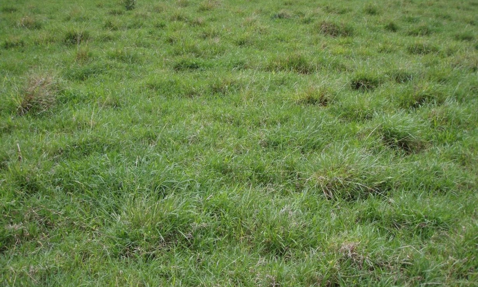
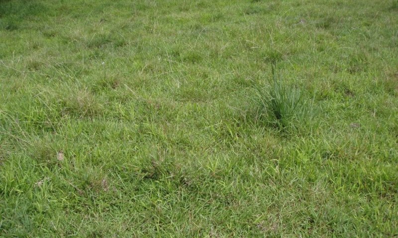
The central concept of the Isohyperthermic Perudic Naturalized Grassland is well drained, moderately deep to very deep soils formed in deposits of volcanic ash over aa or pahoehoe lava. Annual air temperatures and rainfall are associated with very warm (isohyperthermic), usually to constantly moist (udic to perudic) soil conditions.
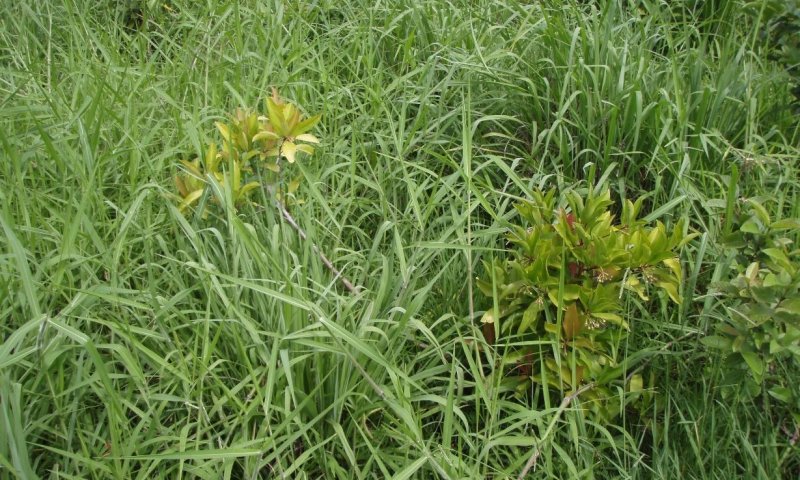
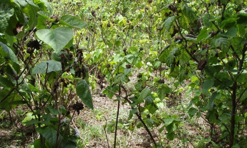
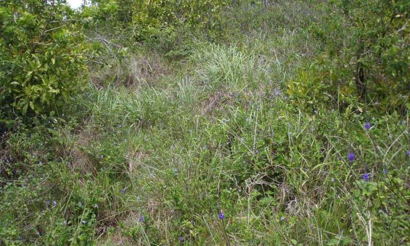
Significant alterations by humans over the past 150+ years have occurred in this ecological site including land clearing, intensive agricultural practices, and urbanization. The original vegetation was a tall statured ohia lehua forest. Because very little of the original native vegetation remains, the reference state of this ecological site consists of the dominant, naturalized grassland vegetation. Common introduced grasses are guineagrass (Urochloa maxima), Californiagrass (Urochloa mutica), pangolagrass (Digitaria eriantha), narrowleaf carpetgrass (Axonopus fissifolius), and hilograss (Paspalum conjugatum). In the absence of disturbance (grazing is most typical), these naturalized grasslands convert to invasive forest.
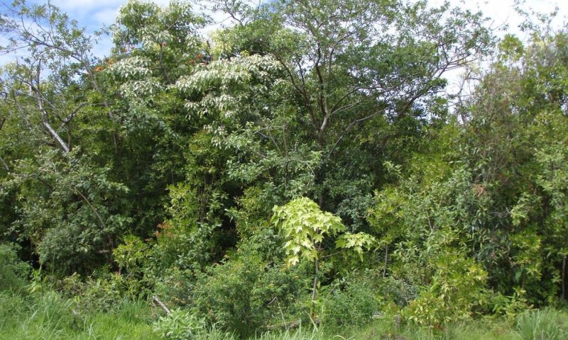
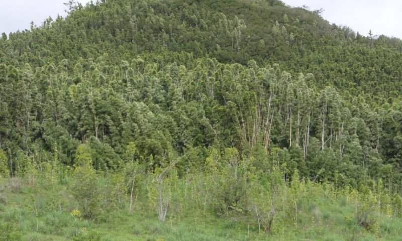
Forested areas contain many introduced species, with inkberry (Ardisia elliptica), strawberry guava (Psidium cattleianum), black bamboo (Phyllostachys nigra), and African tulip tree (Spathodea campanulata) among the more common species.
Among the native plant species are ohia lehua (Metrosideros polymorpha), kopiko (Psychotria spp.), olapa (Cheirodendron trigynum), hapuu (Cibotium spp.), and bird’s nest fern (Asplenium nidus). Pandanus or Tahitian screw pine (Pandanus tectorius) trees are common at lower elevations.
Associated sites
| VX159A01X501 |
Pahoehoe Histosol Woodland Ohia lehua - pandanus/uluhe (Old World forkedfern) The Pahoehoe Histosol Woodland is surrounded by this ecological site. It has the same climate but much shallower soils than this ecological site, resulting in vegetation dominated by uluhe fern with scattered ohia lehua trees rather than medium statured, closed canopy forest. |
|---|---|
| VX159A01X403 |
Isohyperthermic Udic Naturalized Grassland (Guineagrass / Desmodium) The Isohyperthermic Udic Naturalized Grassland Zone borders the drier parts of this ecological site. It has different dominant introduced grass species and supports a mix of typical dryland and moist forest species rather than the moist habitat species found in this ecological site. |
| VX159A01X500 |
Well Drained Udic and Perudic Forest The Well Drained Udic and Perudic Forest borders the highest elevations of this ecological site on the island of Hawaii. It has cooler temperatures, equal or greater rainfal, resulting in a forest of similar tall stature but having koa trees and not having pandanus and lama trees. Dominant introduced grass species overlap where the two ecological sites border each other. |
| VX164X01X002 |
Organic Surface Forest The Acidic Volcanic Ash Forest borders the highest elevations of this ecological site on the island of Maui. It has cooler temperatures equal or greater rainfall, resulting in a forest of similar medium stature but having more koa trees and not having pandanus and lama trees. |
Table 1. Dominant plant species
| Tree |
Not specified |
|---|---|
| Shrub |
Not specified |
| Herbaceous |
(1) Urochloa maxima |
Legacy ID
R159AY003HI


Click on box and path labels to scroll to the respective text.
Ecosystem states
States 1 and 5 (additional transitions)
| T1A | - | State 1 Reference transitions to State 5 Weed Invaded Grassland by long-term continuous grazing and lack of weed control measures. Remnant desirable forages have been grazed out and replaced entirely by weedy grasses, forbs, shrubs, and small trees. |
|---|---|---|
| R2B | - | State 2 Invaded Understory can be restored to State 1 Reference by clearing the forest with heavy machinery and planting desirable forage species. Native forest may be cleared gradually by allowing cattle access to the forest. Cattle eventually eat or destroy understory ferns, forbs, shrubs, and saplings, opening up the forest so that introduced forage species will thrive. |
| T2a | - | State 2 Invaded Understory State transitions to State 3 Invaded Over and Understory through the process of fast-growing weeds inhibiting reproduction of native plants and gradually replacing them. This process is accelerated by feral pigs and cattle directly damaging native plants and promoting the spread of weeds by disturbing the soil and spreading weed seeds. |
| R2A | - | State 2 Invade Understory may be restored to a facsimile of State 4 Native Forest. Pig-proof and deer-proof fence and removal of all ungulates are necessary. Intensive weed control must then be initiated and maintained in the long term. In some cases, large amounts of dead weed biomass must be dealt with by removal or decomposition. Reintroduction of missing native species will be necessary. |
| R3A | - | State 3 Invaded Over and Understory can be converted to State 1 Reference by clearing vegetation using heavy machinery, applying aggressive weed control measures, and planting desirable forage species. |
| T4B | - | State 4 Native Forest can transition to State 1 Reference by clearing the forest with heavy machinery and planting desirable pasture species. Native forest may be cleared gradually by allowing cattle access to the forest. Cattle eventually eat or destroy understory ferns, forbs, shrubs, and saplings, opening up the forest so that introduced grasses will thrive. |
| T4A | - | State 4 Native Forest transitions to State 2 Invaded Understory by the very aggressive, introduced weed species present in this ecological site invading intact native forest and gradually replacing native species in the understory. This invasion is facilitated by feral pigs and cattle that damage and consume native plants, disturb the soil, and spread weed seeds. |
| R5A | - | State 5 Weed Invaded Grassland can be restored to State 1 Reference by brush management, re-establishment of desirable forage species, persistent weed control, and prescribed grazing. |
State 1 submodel, plant communities
| P1.1A | - | Phase 1.1 changes to phase 1.2 by long-term continuous grazing. Remnant high-quality forages have been greatly reduced in abundance and largely replaced by lower-value species. Weedy forbs and shrubs are increasing. |
|---|---|---|
| P1.2A | - | A grazing plan is needed that provides for intensive but temporary grazing of pastures to ensure that cattle consume some low-value forage species along with preferred forages and to allow preferred forages time to recover from defoliation. Desirable grass species are competitive and able to recover with proper management. The grazing plan may require splitting the herd, creating additional water sources, and creating multiple pastures by cross-fencing. Weed control may be necessary to eliminate some species such as inedible shrubs. |