Natural Resources
Conservation Service
Ecological site R246XY005AK
Arctic Ice-Wedge Polygon Complex
Last updated: 5/22/2025
Accessed: 10/19/2025
General information
Provisional. A provisional ecological site description has undergone quality control and quality assurance review. It contains a working state and transition model and enough information to identify the ecological site.
MLRA notes
Major Land Resource Area (MLRA): 246X–Arctic Coastal Plain
The Arctic Coastal Plain MLRA (MLRA 246X) consists of level to gently rolling plains along the coast of the Arctic Ocean. This area makes up 22,235 square miles. It is mostly remote, sparsely populated wildland. Numerous rivers, mostly originating in the Brooks Range, drain to the Arctic Ocean. The largest being the Canning, Colville, Jago, Kongakut, Kuk, Utukok, and Sagavanirktok Rivers. Narrow, nearly level flood plains and stream terraces parallel the many rivers. The area is dotted by thousands of small and medium-size lakes and interconnecting wetlands. Many of the lakes are elongated thaw lakes, which are consistently oriented from north to northwest. Small sand dunes occur along the coastline, rivers, and plains. Elevation ranges from sea level to about 655 feet.
Permanent settlements include Point Lay, Wainwright, Utqiagvik, Nuigsut, and Kaktovik. The Prudhoe Bay oil fields and the northern terminus of the Trans-Alaska Pipeline are in the central part of the MLRA. The Dalton Highway and the Trans-Alaska Pipeline bisect the area west of the Sagavanirktok River, terminating at Deadhorse. The community of Deadhorse provides much of the industrial infrastructure and many of the residential facilities associated with the oil fields and pipeline. Parts of the National Petroleum Reserve and Arctic National Wildlife Refuge are in this MLRA.
Geology and Soils
This area was never glaciated (NRCS 2022). The bedrock geology consists of Cretaceous and Tertiary stratified sedimentary rocks and uplifted continental deposits. The modern landscape is mantled with Quaternary deposits of alluvial, eolian, or glaciofluvial origin.
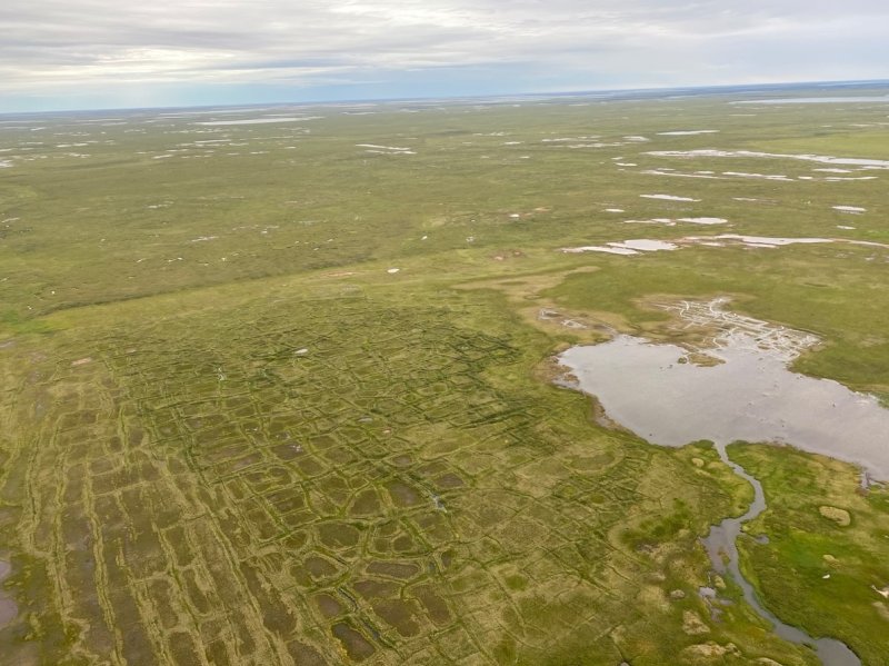
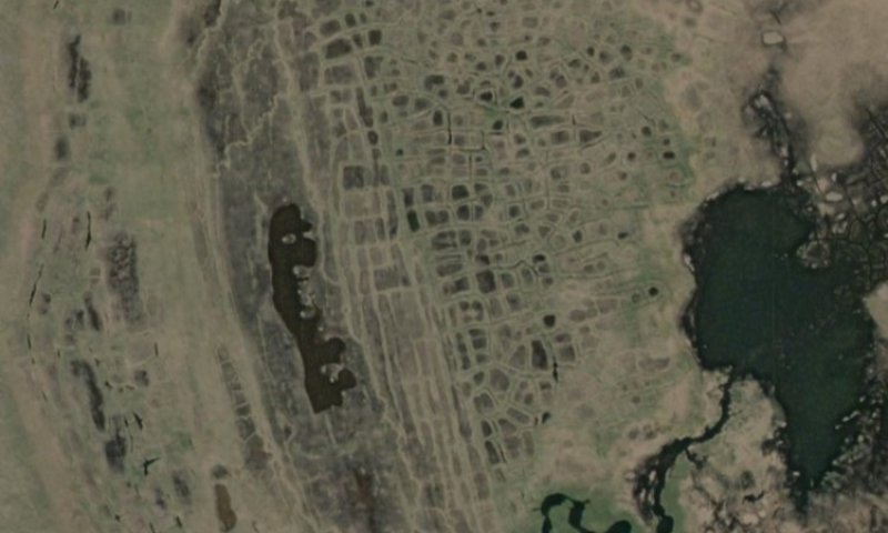
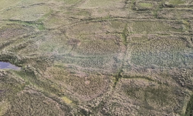
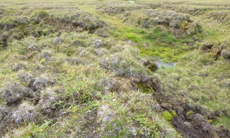
This MLRA is in the zone of continuous permafrost. Areas without permafrost in the soil profile are limited to tidal flats, large sand dunes, and soils directly adjacent to large rivers. Thick layers of permafrost occur in both fine textured and coarse textured deposits across the area. Depth to the base of the permafrost layer ranges between 500 and 2000 feet. Periglacial features, such as beaded drainages, patterned ground (ice-wedge polygons, thaw gullies, pingos, and frost boils) occur throughout the MLRA.
The dominant soil order in this MLRA is Gelisols. Most have an aquic soil moisture regime. The Gelisols are shallow or moderately deep to permafrost, occur on fine and coarse textured sediments, and are generally poorly drained or very poorly drained. Common Gelisol suborders are Histels, Orthels, and Turbels. The Histels have a glacic layer and/or thick accumulations of surface organic material and are associated with ice-wedge troughs of polygons, vegetated lake basins, swales, and low-gradient drainageways. The Orthels and Turbels have comparably thinner surface organic material and occur on flood plains, stream terraces, plains, and the centers of low- and high-center polygons. Miscellaneous (non-soil) areas make up about 20 percent of this MLRA. The most common are water, riverwash, and beaches.
Climate
The average annual precipitation in this area is 4 to 8 inches. Brief, cool summers and long, very cold winters characterize the arctic climate. The average annual snowfall is about 20 to 40 inches. The average annual temperature ranges from 11 to 14 degrees Fahrenheit. The average freeze-free period is between 43 and 76 days but freezing temperatures can occur in any month.
Vegetation
The wet soils prevalent across this MLRA support extensive swaths of tussock tundra and wet sedge meadow tundra (Viereck et al. 1992). The drier sites and low uplands support dwarf scrub dominated by various ericaceous shrubs and dwarf willow. On shallow, rocky soils and exposed sites, lichens and scattered herbs dominate the ground layer. Flood plains support a mixture of low willow scrub and scattered herbs. Fire is not common in this MLRA (AICC 2022).
LRU notes
The bulk of the MLRA is associated with the Circumpolar Arctic Vegetation Mapping (CAVM) subzone D with a small portion of the Northern most lands falling into subzone C (CAVM 2022). Arctic subzone D is associated with vegetation that have herbaceous and dwarf shrub communities that are commonly 4 to 15 inches tall, while subzone C has an herbaceous and dwarf shrub layer that are typically less than 6 inches tall (CAVM 2022). At this time, these differences in community structure are recognized with large differences in annual production expected; but unique ecological sites for each CAVM bioclimate subzone were not developed.
Classification relationships
Landfire BPS – 17060 - Alaska Arctic Polygonal Ground Wet Sedge Tundra (Landfire 2009)
Landfire BPS – 17080 – Alaska Arctic Polygonal Ground Shrub-Tussock Tundra
(Landfire 2009)
Ecological site concept
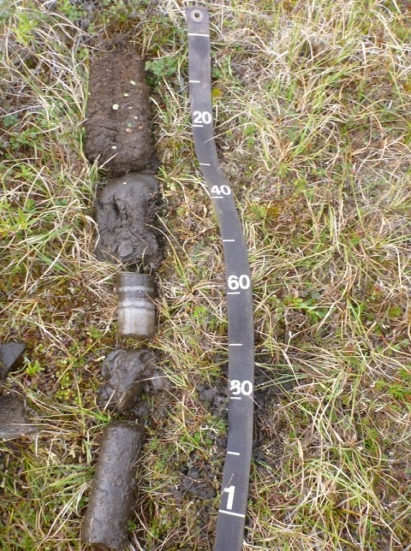
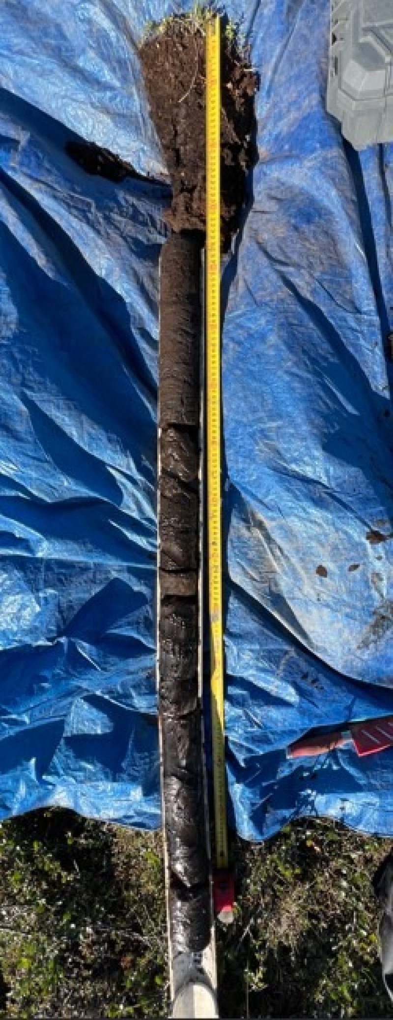
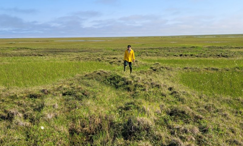
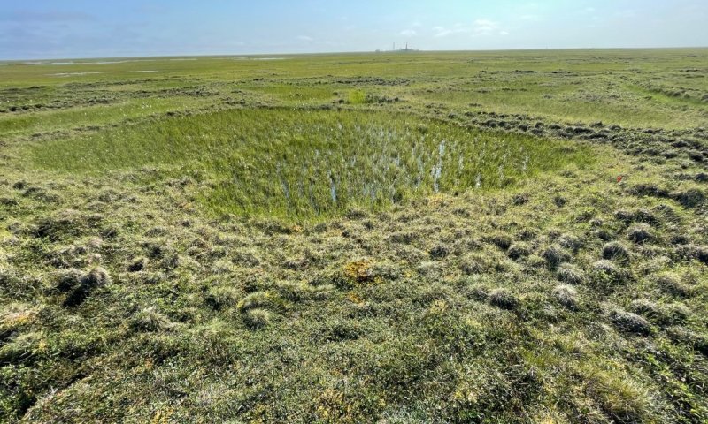
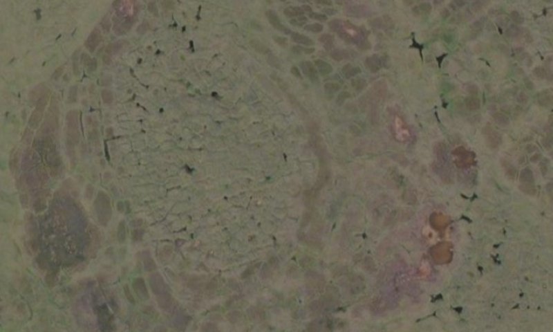
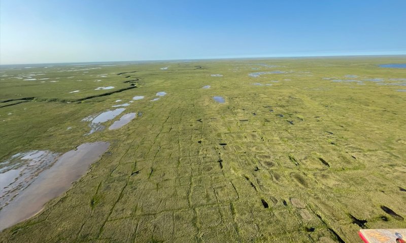
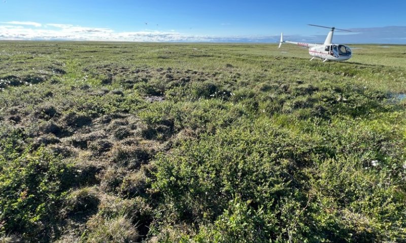
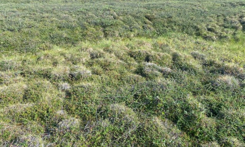
-Associated with low- and high-center ice-wedge polygons on stream terraces, drainageways, and relict lakebeds. The reference state is a complex of three ecological sites related to microtopography in low-center polygons: low-center, rim, and trough. An alternate thermokarst state indicates how this complex changes with ice-wedge degradation.
-Soils formed in organic material over eolian deposits and/or alluvium that are often cryoturbated.
-The low-center and trough of low-center polygons pond, while the rims do not. A water table occurs at very shallow to shallow depths and these soils are considered very poorly to poorly drained.
-Soils are considered very deep but have permafrost at shallow to moderate depths.
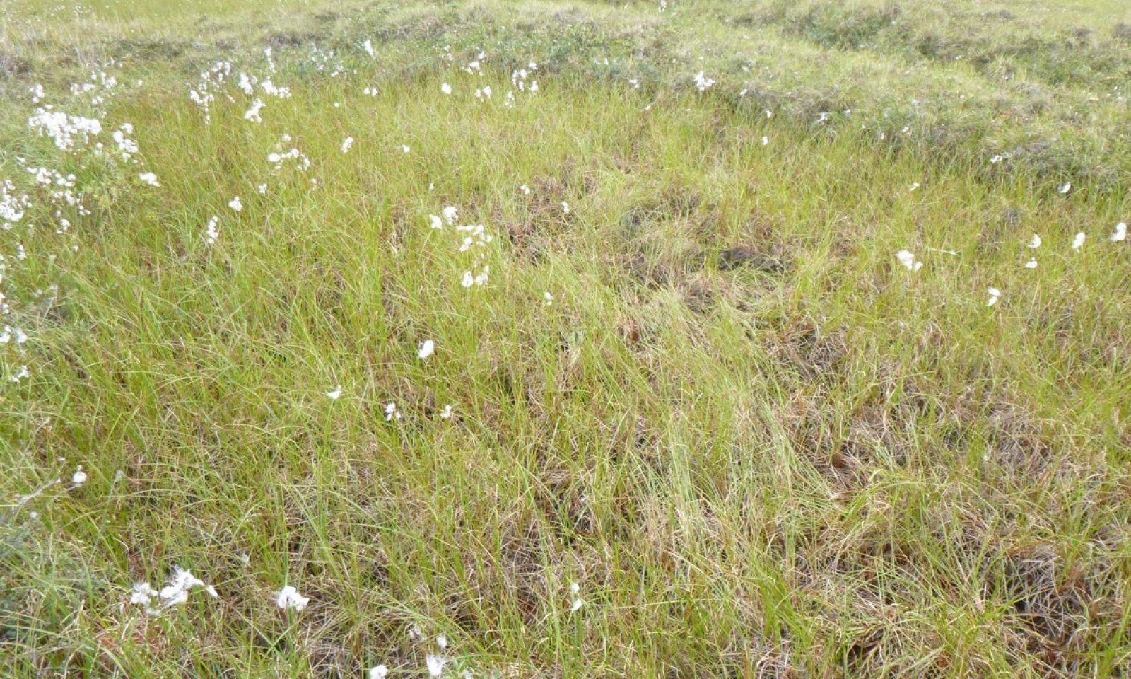
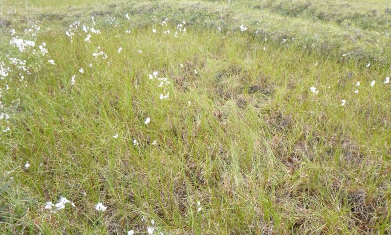
- The reference plant community for troughs and the low-centers is wet sedge meadow tundra (Viereck et al. 1992) with tall cottongrass, various sedges, and various moss as dominant plants. The reference plant community for rims is mixed shrub-sedge tussock tundra (Viereck et al. 1992) with dwarf birch, lingonberry, Bigelow's sedge, tussock cottongrass, splendid feathermoss, and turgid Aulacomnium moss as dominant plants.
Associated sites
| R246XY002AK |
Arctic Sedge Loamy Frozen Terraces Occurs on stream terraces without ice-wedge polygons with sedge-willow tundra. |
|---|---|
| R246XY004AK |
Arctic Shrub Sandy Flood Plains Occurs on flood plains that support willow thickets. |
| R246XY009AK |
Arctic High-Center Polygon Complex Occurs on plains with tussock tundra and high-center polygons. |
| R246XY012AK |
Arctic Dwarf Scrub Sandy Coastal Plain Occurs upslope on inland dunes with dwarf scrub vegetation. |
| R246XY014AK |
Arctic Sedge Peat Frozen Depressions Occurs on depressions without prominent ice-wedge polygons. This ecological site also represents younger drained lakebeds. |
Similar sites
| R246XY050AK |
Arctic Sedge Loamy Tidal Marsh Occurs in tidal marsh and estuaries with halophytic wet sedge communities. |
|---|---|
| R246XY009AK |
Arctic High-Center Polygon Complex Ecological site complex 005 and 009 model soils and vegetation associated with ice-wedge polygons. Ecological site complex 009 describes landforms with only high-center polygons, which differs from this ecological site complex. |
| R246XY014AK |
Arctic Sedge Peat Frozen Depressions Ecological site complex 14 models the soil and vegetation in freshwater depressions without ice-wedge polygons. While both ecological sites share similar plant communities, degradation of ice-wedges cause unique state transitions and disturbance pathways. |
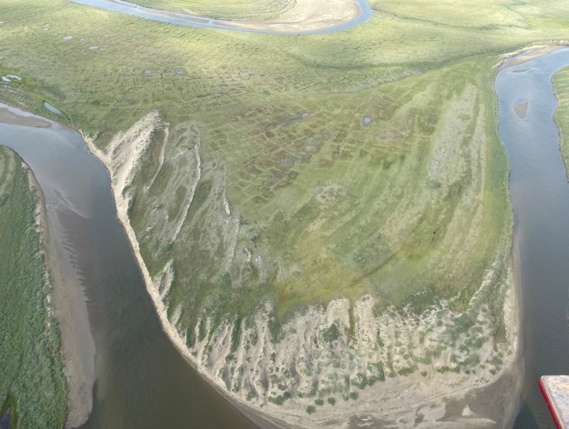
Figure 1. The flood plain, dunes, and younger surfaces of stream terraces are not associated with this Arctic Ice-Wedge Polygon Complex.
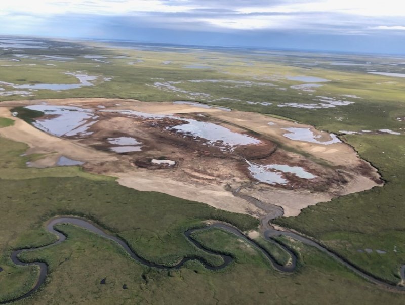
Figure 2. More recently drained lakes without ice-wedge polygons are associated with ecological site 014.
Table 1. Dominant plant species
| Tree |
Not specified |
|---|---|
| Shrub |
(1) Betula nana |
| Herbaceous |
(1) Carex aquatilis |


Click on box and path labels to scroll to the respective text.
Ecosystem states
| T1 | - | thermal erosion of ice wedges |
|---|