Natural Resources
Conservation Service
Ecological site R028AY022UT
Wet Fresh Streambank
Last updated: 5/02/2025
Accessed: 10/23/2025
General information
Provisional. A provisional ecological site description has undergone quality control and quality assurance review. It contains a working state and transition model and enough information to identify the ecological site.
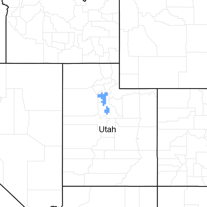
Figure 1. Mapped extent
Areas shown in blue indicate the maximum mapped extent of this ecological site. Other ecological sites likely occur within the highlighted areas. It is also possible for this ecological site to occur outside of highlighted areas if detailed soil survey has not been completed or recently updated.
MLRA notes
Major Land Resource Area (MLRA): 028A–Ancient Lake Bonneville
MLRA 28A occurs in Utah (82 percent), Nevada (16 percent), and Idaho (2 percent). It encompasses approximately 36,775 square miles (95,246 square kilometers). A large area west and southwest of Great Salt Lake is a salty playa. This area is the farthest eastern extent of the Great Basin Section of the Basin and Range Province of the Intermontane Plateaus. It is an area of nearly level basins between widely separated mountain ranges trending north to south. The basins are bordered by long, gently sloping alluvial fans. The mountains are uplifted fault blocks with steep side slopes. Most of the valleys are closed basins containing sinks or playa lakes. Elevation ranges from 3,950 to 6,560 feet (1,204 to 2000 meters) in the basins and from 6,560 to 11,150 feet (1996 to 3398 meters) in the mountains. Much of the MLRA has alluvial valley fill and playa lakebed deposits at the surface from pluvial Lake Bonneville, which dominated this MLRA 13,000 years ago. A level line of remnant lake terraces on some mountain slopes indicates the former extent of this glacial lake. The Great Salt Lake is what remains of the pluvial lake.
Mountains in the interior of this MLRA consist of tilted blocks of marine sediments from Cambrian to Mississippian age with scattered outcrops of Tertiary continental sediments and volcanic rocks. The average annual precipitation is 5 to 12 inches (13 to 30 cm) in the valleys and ranges up to 49 inches (124 cm) in the mountains. Most of the rainfall in the southern LRU occurs as high-intensity, convective thunderstorms during the growing season (April through September). The driest period is from midsummer to early autumn in the northern LRU. Precipitation in winter typically occurs as snow. The average annual temperature is 39 to 53 °F (4 to 12 °C). The freeze-free period averages 165 days and ranges from 110 to 215 days, decreasing in length with increasing elevation. The dominant soil orders in this MLRA are Aridisols, Entisols, and Mollisols. Soils are dominantly in the mesic or frigid soil temperature regime, aridic or xeric soil moisture regime, and mixed mineralogy. The soils are generally well drained, loamy or loamy-skeletal, and very deep.
LRU notes
The Salt Desert/Wetland LRU consists of all the run-in ecological sites. Run-in sites occur in landform positions that receive additional moisture either through overland flow or subsurface water flow. Typical landforms are basin floors, lake plains, low lake terraces, depressional areas, drainageways, and flood plains. Sites within this LRU typically have water table depths of less than 60 inches (152 cm). Wetland plants, pickleweed (Salicornia sp.) and/or greasewood (Sarcorbatus vermiculatus) are dominant in the plant communities.
Ecological site concept
The Wet Fresh Streambank site occurs on the flood plains of perennial streams that receive regular overbank flow during periods of high runoff. The soil on this site are formed from alluvial deposits from the adjacent stream channel. The close proximity to the stream channel creates a variable soil profile that is often stratified because of frequent overbank flows that deposit sediment on the flood plain. The water table is often close to the soil surface for much of the year. The water table can fluctuate with the stream flow and during periods of high runoff, the flood plain may experience erosion and deposition in different places. The plant community in this site can be variable, but it typically contains trees, shrubs, and herbaceous species. Common trees are cottonwood and boxelder. Coyote willow (Salix exigua) is common, but the shrub community can be highly variable. Nebraska sedge (Carex nebracensis) is the most common graminoid found on this site. This site may be found in a valley bottom with the Semiwet Fresh Streambank site (R028AY014UT). The Semiwet Fresh Streambank site will be found on floodplain-steps and will have a deeper water table.
Associated sites
| R028AY012UT |
Semiwet Fresh Meadow This site may occur in depressional areas in the flood plain adjacent to the Wet Fresh Streambank site. |
|---|---|
| R028AY020UT |
Wet Fresh Meadow This site may occur in depressional areas in the flood plain adjacent to the Wet Fresh Streambank site. |
| R028AY014UT |
Semiwet Fresh Streambank This site occurs adjacent to the Wet Fresh Streambank site and will have a deeper water table. |
| R028AY010UT |
Semiwet Saline Meadow This is a site that is found in more alkaline or saline water. |
Similar sites
| R028AY014UT |
Semiwet Fresh Streambank This site is also found on flood plains, but it will have a lower water table and will occur further away from the stream channel. |
|---|
Table 1. Dominant plant species
| Tree |
Not specified |
|---|---|
| Shrub |
(1) Salix exigua |
| Herbaceous |
Not specified |
Click on box and path labels to scroll to the respective text.