Natural Resources
Conservation Service
Ecological site R028AY010UT
Semiwet Saline Meadow
Last updated: 5/02/2025
Accessed: 10/19/2025
General information
Provisional. A provisional ecological site description has undergone quality control and quality assurance review. It contains a working state and transition model and enough information to identify the ecological site.
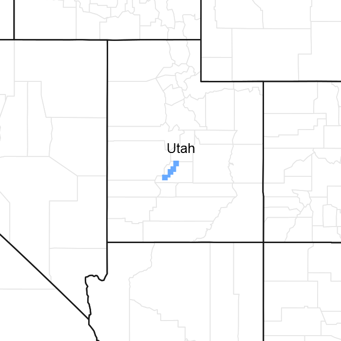
Figure 1. Mapped extent
Areas shown in blue indicate the maximum mapped extent of this ecological site. Other ecological sites likely occur within the highlighted areas. It is also possible for this ecological site to occur outside of highlighted areas if detailed soil survey has not been completed or recently updated.
MLRA notes
Major Land Resource Area (MLRA): 028A–Ancient Lake Bonneville
MLRA 28A occurs in Utah (82 percent), Nevada (16 percent), and Idaho (2 percent). It encompasses approximately 36,775 square miles (95,246 square kilometers). A large area west and southwest of Great Salt Lake is a salty playa. This area is the farthest eastern extent of the Great Basin Section of the Basin and Range Province of the Intermontane Plateaus. It is an area of nearly level basins between widely separated mountain ranges trending north to south. The basins are bordered by long, gently sloping alluvial fans. The mountains are uplifted fault blocks with steep side slopes. Most of the valleys are closed basins containing sinks or playa lakes. Elevation ranges from 3,950 to 6,560 feet (1,204 to 2000 meters) in the basins and from 6,560 to 11,150 feet (1996 to 3398 meters) in the mountains. Much of the MLRA has alluvial valley fill and playa lakebed deposits at the surface from pluvial Lake Bonneville, which dominated this MLRA 13,000 years ago. A level line of remnant lake terraces on some mountain slopes indicates the former extent of this glacial lake. The Great Salt Lake is what remains of the pluvial lake.
Mountains in the interior of this MLRA consist of tilted blocks of marine sediments from Cambrian to Mississippian age with scattered outcrops of Tertiary continental sediments and volcanic rocks. The average annual precipitation is 5 to 12 inches (13 to 30 cm) in the valleys and ranges up to 49 inches (124 cm) in the mountains. Most of the rainfall in the southern LRU occurs as high-intensity, convective thunderstorms during the growing season (April through September). The driest period is from midsummer to early autumn in the northern LRU. Precipitation in winter typically occurs as snow. The average annual temperature is 39 to 53 °F (4 to 12 °C). The freeze-free period averages 165 days and ranges from 110 to 215 days, decreasing in length with increasing elevation. The dominant soil orders in this MLRA are Aridisols, Entisols, and Mollisols. Soils are dominantly in the mesic or frigid soil temperature regime, aridic or xeric soil moisture regime, and mixed mineralogy. The soils are generally well drained, loamy or loamy-skeletal, and very deep.
LRU notes
The Salt Desert/Wetland LRU consists of all the run-in ecological sites. Run-in sites occur in landform positions that receive additional moisture either through overland flow or subsurface water flow. Typical landforms are basin floors, lake plains, low lake terraces, depressional areas, drainageways, and flood plains. Sites within this LRU typically have water table depths of less than 60 inches (152 cm). Wetland plants, pickleweed (Salicornia sp.) and/or greasewood (Sarcorbatus vermiculatus) are dominant in the plant communities.
Classification relationships
General Legal Description: SWA-C290 Photo 1B-5-014
Modal Soils: Airport – fine-silty, mixed, mesic Typic Natraquolls
Ecological site concept
The Semiwet Saline Meadow ecological site occurs on flood plains and relic levees where the water table is lower, between 20 and 40 inches from the soil surface. It occurs on low slopes of less than 2 percent. The Semiwet Saline Meadow site is flooded rarely (1 to 100 times every 100 years) and floods for less than 7 days. The site is influenced by salts and the surface soil is strongly to very saline. The plant community is comprised of mainly of inland saltgrass (Distichlis spicata), sedges (Carex sp.), and black greasewood (Sarcobatus vermiculatus).
The Semiwet Saline Meadow site was developed from soils that are no longer correlated to the current site. The soils that were used were Airport which is now correlated to Alkali Bottom and Wet Saline Meadow, Arave which is now correlated to Wet Saline Meadow and Alkali Bottom, and Benjamin which is now correlated to Semiwet Fresh Meadow and Alkali Bottom. The current correlated soils are in the Sevier River valley and are correlated to only flood plain soils. This site is similar to R028AY001ID, Semiwet Saline Meadow. These two sites should be further evaluated for combining. There are other locations that should or could be correlated to the Semiwet Saline Meadow, and should be considered when update projects are planned. The Semiwet Saline Meadow site also has overlap of concepts with the Alkali Bottom site. There is no supporting data for this site. The State and Transition model used for this site was developed by Idaho (R028AY001ID).
Associated sites
| R028AY012UT |
Semiwet Fresh Meadow The Semiwet Fresh Meadow site may occur in less saline soils. |
|---|---|
| R028AY022UT |
Wet Fresh Streambank The Wet Fresh Streambank site may occur along water courses in wetter soils, adjacent to the Semiwet Saline Meadow site. |
| R028AY020UT |
Wet Fresh Meadow The Wet Fresh Meadow site may occur in wetter, less saline soils. |
Similar sites
| R028AY001ID |
SEMIWET SALINE MEADOW This is a similar site developed in Idaho's portion of MLRA 28A. |
|---|---|
| R028AY001UT |
Alkali Bottom (Alkali Sacaton) The Alkali Bottom site has a similar plant community and is difficult to distinguish. Additional field work is needed to address this issue. |
Table 1. Dominant plant species
| Tree |
Not specified |
|---|---|
| Shrub |
(1) Sarcobatus vermiculatus |
| Herbaceous |
(1) Distichlis spicata |
Click on box and path labels to scroll to the respective text.