Major Land Resource Area 240X
Nulato Hills-Southern Seward Peninsula Highlands
Accessed: 05/19/2025
Description
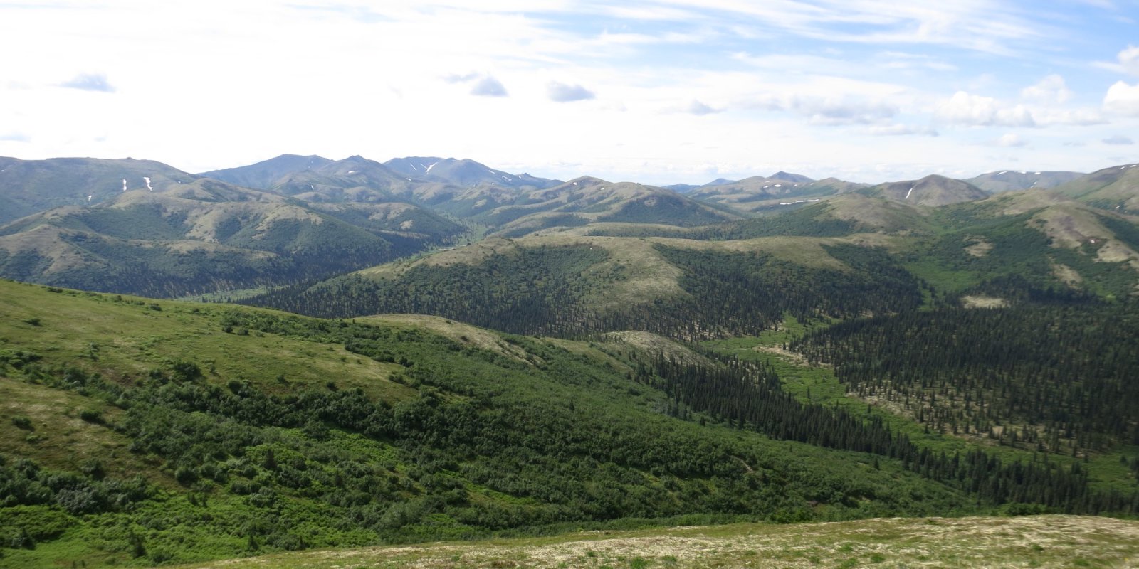
The Nulato Hills-Southern Seward Peninsula Highlands (MLRA 240X) is in Western Alaska, which describes the mostly treeless zone of discontinuous permafrost in the arctic. This MLRA is approximately 18,500 square miles in size. The terrain is defined by rolling hills, low mountains and river valleys. Flood plains systems are common but generally narrow. This watershed drains into Norton Sound and Bering Sea. Major rivers include the Unalakleet, Koyuk, and Fish Rivers. The area is mostly undeveloped wild land that is sparsely populated. Residents use this remote area primarily for subsistence hunting, fishing, and gathering. Villages are primarily located along the coast and include the two larger municipalities of Nome and Unalakleet, and various other villages such as Koyuk and Saint Michael. • • Geology and Soils • • This MLRA was mostly unglaciated during the late Pleistocene. Glaciers were limited to upper elevations on the Seward Peninsula. Coastal lowlands are filled with Holocene deposits. Silty eolian deposits mantle coastal areas and the slopes of lower elevation hills and mountains. Flood plains and terraces are built on fluvial deposits. Modified glacial moraines are evident in areas of past glacial activity. Bedrock material is primarily a mix of sedimentary and volcanic rock (USDA, 2022). This MLRA is in the zone of discontinuous permafrost. Shallow permafrost is most common on coastal plains, gentle footslopes, and organic swales. Permafrost constitutes a root- restrictive layer that perches water and creates poorly drained or poorly drained soils. Common soil orders include Gelisols that support permafrost and Entisols and Inceptisols which are marked by little to no development. The Gelisols are typically shallow or moderately deep to permafrost, occur on finer to gravelly textured sediments, and are poorly or very poorly drained. Common Gelisol suborders are Histels, Orthels, and Turbels. The Histels have thick accumulations of surface organic material and commonly occur on mounds of plains. The Orthels and Turbels have comparably thinner surface organic material. Turbels show signs of cryoturbation while Orthels do not. Entisols and Inceptisols are common on shallow rocky soils of the alpine and subalpine, as well as scoured flood plain soils. Non-soil areas (rock outcrop, rubble land and beaches) make up approximately five percent of the MLRA surface. • • Climate • • The climate is a mix of maritime in the summer and continental in the winter, which is a result of sea ice in Norton Sound. Summers are brief and cool summers and winters are long and cold. Mean annual precipitation is 15 to 20 inches at lower elevations, increasing to 20 to 40 inches at higher elevations (USDA, 2022). Mean annual temperatures ranges from 23 to 31 degrees F (SNAP, 2014a). • • Vegetation • • Vegetation is mainly influenced by site and soil characteristics such as temperature-degree days, exposure to wind, soil depth, and soil hydrology. Dwarf scrublands are present across much of the uplands. Lower elevations generally support more developed soils. Well drained soils support tall shrubs. Organic soils support mosses, graminoids and low shrubs. Forests occur on some low mountain slopes and river valleys but are associated with the Yukon-Kuskokwim Highlands (MLRA 230X). Tussock tundra is ubiquitous across much of the poorly drained, low gradient slopes and coastal plains (USDA, 2022).
Key publications
Next steps
-
1
Select an ecological site
Select an ecological site using the list, keys, photos, briefcase, or quick search option located on this page. -
2
Explore the ecological site description
Next, learn more about the selected ecological site and its characteristic dynamics by browsing the ecological site description and exploring alternative state and transition model formats.
Ecological site list
Ecological site map
Basemap
Find me
Find point
Full screen
Zoom in to display soil survey map units for an area of interest, and zoom out to display MLRAs. Select a map unit polygon to view ecological sites correlated to that map unit. View a brief description of an ecological site by clicking on its name in the map popup. Soil survey correlations may not be accurate, and ecological site classification of a location should always be verified in the field. Each selection may require the transfer of several hundred KB of data.
Ecological site keys
Ecological site photos
Print Options
Sections
Font
Other
Briefcase
Add ecological sites and Major Land Resource Areas to your briefcase by clicking on the briefcase (![]() ) icon wherever it occurs. Drag and drop items to reorder. Cookies are used to store briefcase items between browsing sessions. Because of this, the number of items that can be added to your briefcase is limited, and briefcase items added on one device and browser cannot be accessed from another device or browser. Users who do not wish to place cookies on their devices should not use the briefcase tool. Briefcase cookies serve no other purpose than described here and are deleted whenever browsing history is cleared.
) icon wherever it occurs. Drag and drop items to reorder. Cookies are used to store briefcase items between browsing sessions. Because of this, the number of items that can be added to your briefcase is limited, and briefcase items added on one device and browser cannot be accessed from another device or browser. Users who do not wish to place cookies on their devices should not use the briefcase tool. Briefcase cookies serve no other purpose than described here and are deleted whenever browsing history is cleared.
Ecological sites
Major Land Resource Areas
The Ecosystem Dynamics Interpretive Tool is an information system framework developed by the USDA-ARS Jornada Experimental Range, USDA Natural Resources Conservation Service, and New Mexico State University.