Supporting information
Inventory data references
Definitions
These definitions have been greatly simplified for brevity and do not cover every aspect of each topic.
Aa lava: A type of basaltic lava having a rough, jagged, clinkery surface and a vesicular interior.
Alluvial: Materials or processes associated with transportation and/or deposition by running water.
Aquic soil moisture regime: A regime in which the soil is free of dissolved oxygen because it is saturated by water. This regime typically exists in bogs or swamps.
Aquisalids: These are salty soils in wet areas. Although wet, the dissolved salts make the soils physiologically dry (the chemical activity, or effective concentration, of water is low). Aquisalids typically support plant species that are adapted to these conditions.
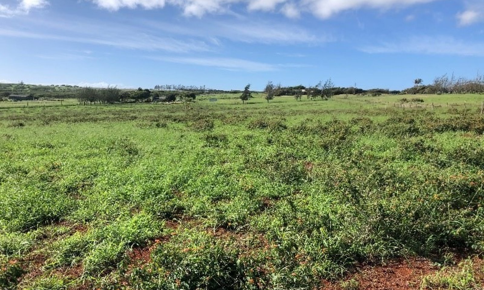
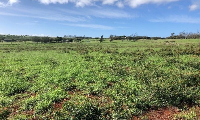
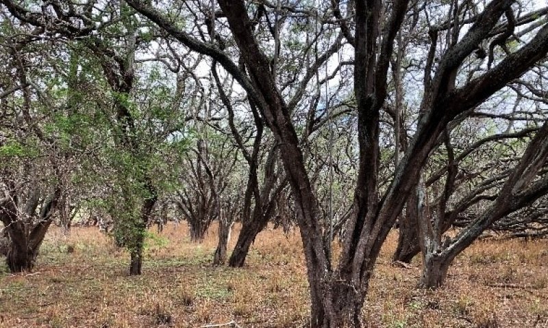
Aridic soil moisture regime: A regime in which defined parts of the soil are, in normal years, dry for more than half of the growing season and moist for less than 90 consecutive days during the growing season. In Hawaii it is associated with hot, dry areas with plants such as kiawe, wiliwili, and buffelgrass. The terms aridic and torric are basically the same.
Ash field: a land area covered by a thick or distinctive deposit of volcanic ash that can be traced to a specific source and has well defined boundaries. The term “ash flow” is erroneously used in the Physiographic section of this ESD due to a flaw in the national database.
Ashy: A “soil texture modifier” for volcanic ash soils having a water content at the crop wilting point of less than 30 percent; a soil that holds relatively less water than “medial” and “hydrous” soils.
Available water capacity: The amount of soil water available to plants to the depth of the first root-restricting layer.
Basal area or basal cover: The cross sectional area of the stem or stems of a plant or of all plants in a stand.
Blue rock: The dense, hard, massive lava that forms the inner core of an aa lava flow.
Bulk density: the weight of dry soil per unit of volume. Lower bulk density indicates a greater amount of pore space that can hold water and air in a soil.
CaCO3 equivalent: The amount of free lime in a soil. Free lime exists as solid material and typically occurs in regions with a dry climate.
Canopy cover: The percentage of ground covered by the vertical projection downward of the outermost perimeter of the spread of plant foliage. Small openings within the canopy are included.
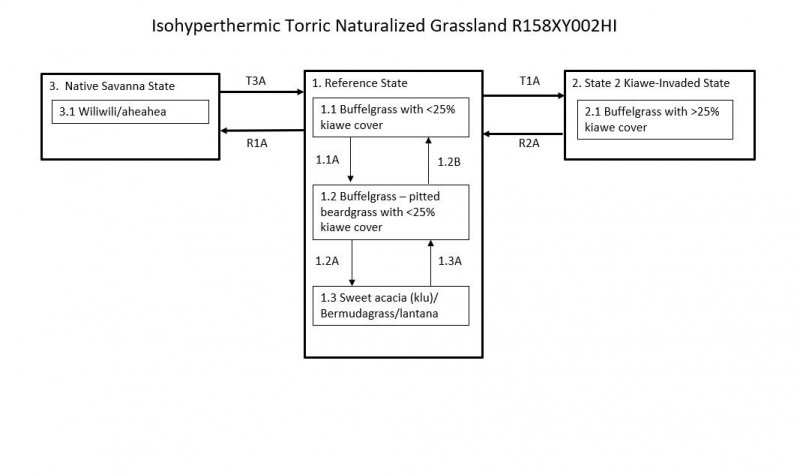
Community pathway: A description of the causes of shifts between community phases. A community pathway is reversible and is attributable to succession, natural disturbances, short-term climatic variation, and facilitating practices, such as grazing management.
Community phase: A unique assemblage of plants and associated dynamic soil properties within a state.
Dominant species: Plant species or species groups that exert considerable influence upon a community due to size, abundance, or cover.
Drainage class: The frequency, duration, and depth of a water table in a soil. There are seven drainage classes, ranging from “excessively drained” (soils with very rare or very deep water tables) to “well drained” (soils that provide ample water for plant growth but are not so wet as to inhibit root growth) to “very poorly drained” (soils with a water table at or near the surface during much of the growing season that inhibits growth of most plants).
Electrical conductivity (EC): A measure of the salinity of a soil. The standard unit is deciSiemens per meter (dS/m), which is numerically equivalent to millimhos per centimeter (mmhos/cm). An EC greater than about 4 dS/m indicates a salinity level that is unfavorable to growth of most plants.
Friability: A soil consistency term pertaining to the ease of crumbling of soils.
Gleyed: A condition of soil from which iron has been reduced (in the redox chemistry sense) and removed during soil formation or that saturation with stagnant water has preserved a reduced state. If iron has been removed, the soil is the color of uncoated sand and silt particles. If iron is present in a reduced state, the soil is the color of reduced iron (typically bluish-gray). Redox concentrations (spots of oxidized iron, formerly called mottles are often present.
Hydrous: A “soil texture modifier” for volcanic ash soils having a water content at the crop wilting point of 100 percent or more; a soil that holds more water than “medial” or “ashy” soils.
Ion exchange capacity: The ability of soil materials such as clay or organic matter to retain ions (which may be plant nutrients) and to release those ions for uptake by roots.
Isohyperthermic soil temperature regime: A regime in which mean annual soil temperature is 72 degrees F (22 degrees C) or higher and mean summer and mean winter soil temperatures differ by less than 11 degrees F (6 degrees C) at a specified depth.
Isomesic soil temperature regime: A regime in which mean annual soil temperature is 47 degrees F (8 degrees C) or higher but lower than 59 degrees F (15 degrees C) and mean summer and mean winter soil temperatures differ by less than 11 degrees F (6 degrees C) at a specified depth.
Isothermic soil temperature regime: A regime in which mean annual soil temperature is 59 degrees F (15 degrees C) or higher but lower than 72 degrees F (22 degrees C) and mean summer and mean winter soil temperatures differ by less than 11 degrees F (6 degrees C) at a specified depth.
Kipuka: An area of land surrounded by younger (more recent) lava. Soils and plant communities within a kipuka are older than, and often quite different from, those on the surrounding surfaces.
Major Land Resource Area (MLRA): A geographic area defined by NRCS that is characterized by a particular pattern of soils, climate, water resources, and land uses. The island of Hawaii contains nine MLRAs, some of which also occur on other islands in the state.
Makai: a Hawaiian word meaning “toward the sea.”
Mauka: a Hawaiian word meaning “toward the mountain” or “inland.”
Medial: A “soil texture modifier” for volcanic ash soils having a water content at the crop wilting point of 30 to 100 percent; a soil that holds an amount of water intermediate to “hydrous” or “ashy” soils.
Mollisols: Soils with relatively thick, dark surface horizons, high cation-exchange capacity, high calcium content, that do not become hard or very hard when dry. Mollisols are conducive to plant growth. They characteristically form under grass in climates that are seasonally dry, but can form under forests.
Naturalized plant community: A community dominated by adapted, introduced species. It is a relatively stable community resulting from secondary succession after disturbance. Most grasslands in Hawaii are in this category.
Oxisols: Soils characteristic of humid, tropical or subtropical regions that formed on land surfaces that have been stable for a long time. In Hawaii, they typically occur on islands or parts of islands that have been volcanically inactive for a long time. Oxisols are highly weathered, consist largely of quartz, kaolin clays, and aluminum oxides, and have low ion exchange capacity and loamy or clayey texture.
Pahoehoe lava: A type of basaltic lava with a smooth, billowy, or rope-like surface and vesicular interior.
Parent material: Unconsolidated and chemically weathered material from which a soil is developed.
Perudic soil moisture regime: A very wet regime found where precipitation exceeds evapotranspiration in all months of normal years. On the island of Hawaii, this regime is found on top of Kohala and on parts of the windward side of Mauna Kea.
pH: The numerical expression of the relative acidity or alkalinity of a soil sample. A pH of 7 is neutral; a pH below 7 is acidic and a pH above 7 is basic.
Phosphorus adsorption: The ability of soil materials to tightly retain phosphorous ions, which are a plant nutrient. Some volcanic ash soils retain phosphorus so strongly that it is partly unavailable to plants.
Psamments: Sandy soils that have low water-holding capacity, are susceptible to wind erosion, and typically have ground water deeper than 20 inches (50 centimeters).
Reference community phase: The phase exhibiting the characteristics of the reference state and containing the full complement of plant species that historically occupied the site. It is the community phase used to classify an ecological site.
Reference state: A state that describes the ecological potential and natural or historical range of variability of an ecological site.
Residuum: Unconsolidated mineral material that has chemically and physically weathered from rock and has not moved from its place of origin.
Restoration pathway: A term describing the environmental conditions and practices that are required to recover a state that has undergone a transition.
Sodium adsorption ratio (SAR): A measure of the amount of dissolved sodium relative to calcium and magnesium in the soil water. SAR values higher than 13 create soil conditions unfavorable to most plants.
Soil moisture regime: A term referring to the presence or absence either of ground water or of water held at a tension of less than 1500 kPa (the crop wilting point) in the soil or in specific horizons during periods of the year.
Soil temperature regime: A defined class based on mean annual soil temperature and on differences between summer and winter temperatures at a specified depth.
Soil reaction: Numerical expression in pH units of the relative acidity or alkalinity or a soil.
Spodosols: Soils with a spodic B horizon that has an accumulation of black or reddish amorphous materials that have a high pH-dependent ion exchange capacity, coarse texture, and few base cations. Above the spodic horizon there often is a light-colored albic horizon that was the source of the amorphous materials in the spodic horizon.
State: One or more community phases and their soil properties that interact with the abiotic and biotic environment to produce persistent functional and structural attributes associated with a characteristic range of variability.
State-and-transition model: A method used to display information about relationships between vegetation, soil, animals, hydrology, disturbances, and management actions on an ecological site.
Torric soil moisture regime: See Aridic soil moisture regime.
Transition: A term describing the biotic or abiotic variables or events that contribute to loss of state resilience and result in shifts between states.
Udic soil moisture regime: A regime in which the soil is not dry in any part for as long as 90 cumulative days in normal years, and so provides ample moisture for plants. In Hawaii it is associated with forests in which hapuu (tree ferns) are usually moderately to highly abundant.
Ultisols: Soils that have been intensively leached and weathered. They have a B horizon that has accumulated clay that has translocated there from higher horizons. They have moderate to low cation exchange capacity and low base saturation. The highest base saturation normally is in the few centimeters directly beneath the surface due to cycling of bases by plants.
Ustic soil moisture regime: A regime in which moisture is limited but present at a time when conditions are suitable for plant growth. In Hawaii it usually is associated with dry forests and subalpine shrublands.
Other References
Abrahamson I. 2013. Fire regimes in Hawaiian plant communities. In: Fire Effects Information System, US Dept. of Agriculture, Forest Service, Rocky Mountain Research Station, Fire Sciences Laboratory. Available" www.fs.fed.us/database/feis/fire_regimes/Hawaii/all.html
Allen, M.S., 2014. Marquesan colonization chronologies and post-colonization interaction: implications for Hawaiian origins and the ‘Marquesan Homeland’ hypothesis. Journal of Pacific Archaeology, 5(2), pp.1-17.
Armstrong RW. 1973. Atlas of Hawaii. University of Hawaii Press, Honolulu.
Athens JS. Ch. 12 Hawaiian Native Lowland Vegetation in Prehistory in Historical Ecology in the Pacific Islands – Prehistoric Environmental and Landscape Change. Kirch, PV and TL Hunt, eds. 1997. Yale U. Press, New Haven.
Burney DA, HF James, LP Burney, SL Olson, W Kikuchi, WL Wagner, M Burney, D McCloskey, D Kikuchi, FV Grady, R Gage II, and R Nishek. 2001. Fossil evidence for a diverse biota from Kauai and tis transformation since human arrival. Ecological Monographs 71:615-641.
Christensen CC. 1983. Report 17: Analysis of land snails. In: Archaeological investigations of the Mudlane-Waimea-Kawaihae Road Corridor, Island of Hawaii: An Interdisciplinary Study of an Environmental Transect. Clark JT. and Kirch PV, eds. Dept. of Anthropology, Bernice Pauahi Bishop Museum, Report 83-1, Honolulu, HI.
Clark JT. 1983. Report 3: The Waimea-Kawaihae Region: Historical Background. In: Archaeological investigations of the Mudlane-Waimea-Kawaihae Road Corridor, Island of Hawaii: An Interdisciplinary Study of an Environmental Transect. Clark JT and Kirch PV, eds. Dept. of Anthropology, Bernice Pauahi Bishop Museum, Report 83-1, Honolulu, HI.
Clark JT. 1983. Report 7: Archaeological investigations in Section 4. In: Archaeological investigations of the Mudlane-Waimea-Kawaihae Road Corridor, Island of Hawaii: An Interdisciplinary Study of an Environmental Transect. Clark JT and Kirch PV, eds. Dept. of Anthropology, Bernice Pauahi Bishop Museum, Report 83-1, Honolulu, HI.
Clark JT. 1983. Report 8: Archaeological investigations of agricultural sites in the Waimea area. In: Archaeological investigations of the Mudlane-Waimea-Kawaihae Road Corridor, Island of Hawaii: An Interdisciplinary Study of an Environmental Transect. Clark JT and Kirch PV, eds. Dept. of Anthropology, Bernice Pauahi Bishop Museum, Report 83-1, Honolulu, HI.
Craighill ES and EG Handy. 1991. Native Planters in Old Hawaii – Their Life, Lore, and Environment. Bernice P. Bishop Museum Bulletin 233, Bishop Museum Press, Honolulu, HI
Cuddihy LW and CP Stone. 1990. Alteration of Native Hawaiian Vegetation: Effects of Humans, Their Activities and Introductions. Honolulu: University of Hawaii Cooperative National Park Resources Study Unit.
Deenik J and AT McClellan. 2007. Soils of Hawaii. Soil and Crop Management, Sept. 2007, SCM-20. Cooperative Extension Service, College of Tropical Agriculture and Human Resources. University of Hawaii at Manoa. Available online at: https://www.ctahr.hawaii.edu/oc/freepubs/pdf/SCM-20.pdf
Dixon JB and Schulze DG, eds. 2002. Soil Mineralogy with Environmental Applications. Volume 7. Soil Science Society of America. Available online at: https://acsess.onlinelibrary.wiley.com/doi/book/10.2136/sssabookser7
Giambelluca TW and TA Schroeder. 1998. Climate. In: Atlas of Hawaii, 3rd edition. SP Juvik, JO Juvik, and RR Paradise, eds. pp. 49-59. Honolulu: University of Hawaii Press.
Gil CR. 2016-2017. Ananas comosus. Colegio Bolivar Agricultural Science. Available online at: https://www.colegiobolivar.edu.co/garden/wp-content/uploads/2017/06/Crosas-Ananas-comosus-2017.pdf
Hazlett RW and DW Hyndman. 1996. Roadside Geology of Hawaii. Mountain Press Publishing Company, Missoula MT.
Henke LA. 1929. A Survey of Livestock in Hawaii. Research Publication No. 5. University of Hawaii, Honolulu.
Horrocks M. 2009. Sweet potato (Ipomoea batatas) and banana (Musa sp.) microfossils in deposits from the Kona Field System, Island of Hawaii. Journal of Archaeological Science, May 2009.
Imada, C. 2012. Hawaiian Native and Naturalized Vascular Plants Checklist (December 2012 update). Bishop Museum Technical Report 60. Bishop Museum Press, Honolulu.
Jacobi JD. 1989. Vegetation Maps of the Upland Plant Communities on the Islands of Hawaii, Maui, Molokai, and Lanai. Technical Report 68. Cooperative National Park Resources Studies Unit, University of Hawaii at Manoa and National Park Service.
Juvik JO and D Nullet. 1993. Relationships between rainfall, cloud-water interception, and canopy throughfall in a Hawaiian montane forest. IN: Tropical Montane Cloud Forests. Proc. Int. Sym., San Juan, PR. Hamilton LS, JO Juvik, and FN Scatena, eds. East-West Center.
Kirch PV. 1982. The impact of the prehistoric Polynesians in the Hawaiian ecosystem. Pacific Science 36(1):1-14.
Kirch PV. 1983. Introduction. In: Archaeological investigations of the Mudlane-Waimea-Kawaihae Road Corridor, Island of Hawaii: An Interdisciplinary Study of an Environmental Transect. Clark JT and Kirch PV, eds. Dept. of Anthropology, Bernice Pauahi Bishop Museum, Report 83-1, Honolulu, HI.
Kirch PV. 1985. Feathered Gods and Fishhooks: An Introduction to Hawaiian Archaeology and Prehistory. Honolulu: University of Hawaii Press.
Kirch PV. 2000. On the Road of the Winds: An Archaeological History of the Pacific Islands Before European Contact. Berkeley: University of California Press.
Kirch, P.V., 2011. When did the Polynesians settle Hawaii? A review of 150 years of scholarly inquiry and a tentative answer. Hawaiian Archaeology, 12(2011), pp.3-26.
Leopold LB. 1949. The interaction of trade wind and sea breeze, Hawaii. Journal of Meteorology 6: 312-320.
Little EL Jr. and RG Skolmen. 1989. Common Forest Trees of Hawaii (Native and Introduced). US Department of Agriculture-US Forest Service Agriculture Handbook No. 679. (out of print). Available at www.fs.fed.us/psw/publications/documents/misc/ah679.pdf
Maly K and O Maly. 2004. He Moolelo Aina: A Cultural Study of the Puu O Umi Natural Area Reserve and Kohala-Hamakua Mountain Lands, Districts of Kohala and Hamakua, Island of Hawaii. Kumu Pono Associates, Hilo HI.
McEldowney H. 1983. Report 16: A description of major vegetation patterns in the Waimea-Kawaihae region during the early historic period. In: Archaeological investigations of the Mudlane-Waimea-Kawaihae Road Corridor, Island of Hawaii: An Interdisciplinary Study of an Environmental Transect. Clark JT and Kirch PV, eds. Dept. of Anthropology, Bernice Pauahi Bishop Museum, Report 83-1, Honolulu, HI.
Mubyana T. 1997/98. Effects of continuous sugarcane and pineapple cropping on organic matter and soil microbial biomass. Journal of African Research and Development 27&28:258-269.
Mueller-Dombois D and FR Fosberg. 1998. Vegetation of the Tropical Pacific Islands. Springer-Verlag New York, Inc.
Palmer DD. 2003. Hawaii’s Ferns and Fern Allies. University of Hawaii Press, Honolulu.
Pratt HD. 1998. A Pocket Guide to Hawaii’s Trees and Shrubs. Mutual Publishing, Honolulu.
Reppun F, Silva JHS, Wong K, and Deenik JL. 2017. A Soil Phosphorus Primer for Hawaiian Soils. Soil and Crop Management, August 2017, SCM-33. College of Tropical Agriculture and Human Resources, University of Hawaii at Manoa. Available online at: https://www.ctahr.hawaii.edu/oc/freepubs/pdf/SCM-33.pdf
Ripperton JC and EY Hosaka. 1942. Vegetation zones of Hawaii. Hawaii Agricultural Experiment Station Bulletin 89:1-60.
Rock JF. The Indigenous Trees of the Hawaiian Islands. 1st edition 1913, reprinted 1974, Charles E. Tuttle Company, Rutland, VT and Tokyo, Japan.
Schroeder TA. 1981. Characteristics of local winds in northwest Hawaii. Journal of Applied Meteorology 20: 874-881.
Shoji SD, M Nanzyo, and R Dahlgren. 1993. Volcanic Ash Soils: Genesis, Properties and Utilization. Elsevier, New York.
Silva JA and R Uchida, eds. 2000. Plant Nutrient Management in Hawaii’s Soils, Approaches for Tropical and Subtropical Agriculture. College of Tropical Agriculture and Human Resources, University of Hawaii at Manoa. Available online at: https://www.ctahr.hawaii.edu/oc/freepubs/pdf/pnm0.pdf
Sohmer SH and R Gustafson. 2000. Plants and Flowers of Hawaii. University of Hawaii Press, Honolulu.
Soil Survey Staff. 2014. Soil Taxonomy, Twelfth Edition. USDA – NRCS.
Steadman DW. 1995. Prehistoric extinctions of Pacific island birds: biodiversity meets zooarchaeology. Science 267:1123-1131.
USDA-NRCS-PIA T&E Species GIS files. Not publicly available.
USDA-NRCS. 2011. Soil Survey Laboratory Information Manual. Soil Survey Investigations Report No. 45, Version 2.0. National Soil Survey Center, Lincoln, Nebraska.
USDA-NRCS. 2006. Major Land Resource Regions. USDA Agriculture Handbook 296. http://soils.usda.gov/MLRAExplorer
USDA-NRCS. Island of Hawaii Soil Surveys 801 and 701. Available online at https://websoilsurvey.sc.egov.usda.gov/App/HomePage.htm
USDA-SCS. 1972. Soil Survey of Islands of Kauai, Oahu, Maui, Molokai, and Lanai, State of Hawaii. Foote DE, Hill EL, Nakamura S, and F Stephens, in cooperation with The University of Hawaii Agricultural Experiment Station.
USDI-USGS. 2006. A GAP Analysis of Hawaii. Final Report and Data.
Vitousek P. 2004. Nutrient Cycling and Limitation: Hawaii as a Model Ecosystem. Princeton University Press, Princeton and Oxford.
Wagner WL, DR Herbst, and SH Sohmer. 1999. Manual of the Flowering Plants of Hawaii, Revised Edition. Bishop Museum Press, Honolulu.
Welch DJ 1983. Report 5: Archaeological investigations in Section 2. In: Archaeological investigations of the Mudlane-Waimea-Kawaihae Road Corridor, Island of Hawaii: An Interdisciplinary Study of an Environmental Transect. Clark JT and Kirch PV, eds. Dept. of Anthropology, Bernice Pauahi Bishop Museum, Report 83-1, Honolulu, HI.
Western Regional Climate Center, cited 2020. Climate of Hawaii. Available: https://wrcc.dri.edu/Climate/narrative_hi.php
Whistler WA. 1995. Wayside Plants of the Islands: A Guide to the Lowland Flora of the Pacific Islands. Isle Botanica, Honolulu.
Wilmshurst, J.M., Hunt, T.L., Lipo, C.P. & Anderson, A.J. 2011. High-precision radiocarbon dating shows recent and rapid initial human colonization of East Polynesia. Proceedings of the National Academy of Sciences, USA, 108:1815–1820.
Other references
Definitions
These definitions have been greatly simplified for brevity and do not cover every aspect of each topic.
Aa lava: A type of basaltic lava having a rough, jagged, clinkery surface and a vesicular interior.
Alluvial: Materials or processes associated with transportation and/or deposition by running water.
Aquic soil moisture regime: A regime in which the soil is free of dissolved oxygen because it is saturated by water. This regime typically exists in bogs or swamps.
Aquisalids: These are salty soils in wet areas. Although wet, the dissolved salts make the soils physiologically dry (the chemical activity, or effective concentration, of water is low). Aquisalids typically support plant species that are adapted to these conditions.
Aridic soil moisture regime: A regime in which defined parts of the soil are, in normal years, dry for more than half of the growing season and moist for less than 90 consecutive days during the growing season. In Hawaii it is associated with hot, dry areas with plants such as kiawe, wiliwili, and buffelgrass. The terms aridic and torric are basically the same.
Ash field: a land area covered by a thick or distinctive deposit of volcanic ash that can be traced to a specific source and has well defined boundaries. The term “ash flow” is erroneously used in the Physiographic section of this ESD due to a flaw in the national database.
Ashy: A “soil texture modifier” for volcanic ash soils having a water content at the crop wilting point of less than 30 percent; a soil that holds relatively less water than “medial” and “hydrous” soils.
Available water capacity: The amount of soil water available to plants to the depth of the first root-restricting layer.
Basal area or basal cover: The cross sectional area of the stem or stems of a plant or of all plants in a stand.
Blue rock: The dense, hard, massive lava that forms the inner core of an aa lava flow.
Bulk density: the weight of dry soil per unit of volume. Lower bulk density indicates a greater amount of pore space that can hold water and air in a soil.
CaCO3 equivalent: The amount of free lime in a soil. Free lime exists as solid material and typically occurs in regions with a dry climate.
Canopy cover: The percentage of ground covered by the vertical projection downward of the outermost perimeter of the spread of plant foliage. Small openings within the canopy are included.
Community pathway: A description of the causes of shifts between community phases. A community pathway is reversible and is attributable to succession, natural disturbances, short-term climatic variation, and facilitating practices, such as grazing management.
Community phase: A unique assemblage of plants and associated dynamic soil properties within a state.
Dominant species: Plant species or species groups that exert considerable influence upon a community due to size, abundance, or cover.
Drainage class: The frequency, duration, and depth of a water table in a soil. There are seven drainage classes, ranging from “excessively drained” (soils with very rare or very deep water tables) to “well drained” (soils that provide ample water for plant growth but are not so wet as to inhibit root growth) to “very poorly drained” (soils with a water table at or near the surface during much of the growing season that inhibits growth of most plants).
Electrical conductivity (EC): A measure of the salinity of a soil. The standard unit is deciSiemens per meter (dS/m), which is numerically equivalent to millimhos per centimeter (mmhos/cm). An EC greater than about 4 dS/m indicates a salinity level that is unfavorable to growth of most plants.
Friability: A soil consistency term pertaining to the ease of crumbling of soils.
Gleyed: A condition of soil from which iron has been reduced (in the redox chemistry sense) and removed during soil formation or that saturation with stagnant water has preserved a reduced state. If iron has been removed, the soil is the color of uncoated sand and silt particles. If iron is present in a reduced state, the soil is the color of reduced iron (typically bluish-gray). Redox concentrations (spots of oxidized iron, formerly called mottles are often present.
Hydrous: A “soil texture modifier” for volcanic ash soils having a water content at the crop wilting point of 100 percent or more; a soil that holds more water than “medial” or “ashy” soils.
Ion exchange capacity: The ability of soil materials such as clay or organic matter to retain ions (which may be plant nutrients) and to release those ions for uptake by roots.
Isohyperthermic soil temperature regime: A regime in which mean annual soil temperature is 72 degrees F (22 degrees C) or higher and mean summer and mean winter soil temperatures differ by less than 11 degrees F (6 degrees C) at a specified depth.
Isomesic soil temperature regime: A regime in which mean annual soil temperature is 47 degrees F (8 degrees C) or higher but lower than 59 degrees F (15 degrees C) and mean summer and mean winter soil temperatures differ by less than 11 degrees F (6 degrees C) at a specified depth.
Isothermic soil temperature regime: A regime in which mean annual soil temperature is 59 degrees F (15 degrees C) or higher but lower than 72 degrees F (22 degrees C) and mean summer and mean winter soil temperatures differ by less than 11 degrees F (6 degrees C) at a specified depth.
Kipuka: An area of land surrounded by younger (more recent) lava. Soils and plant communities within a kipuka are older than, and often quite different from, those on the surrounding surfaces.
Major Land Resource Area (MLRA): A geographic area defined by NRCS that is characterized by a particular pattern of soils, climate, water resources, and land uses. The island of Hawaii contains nine MLRAs, some of which also occur on other islands in the state.
Makai: a Hawaiian word meaning “toward the sea.”
Mauka: a Hawaiian word meaning “toward the mountain” or “inland.”
Medial: A “soil texture modifier” for volcanic ash soils having a water content at the crop wilting point of 30 to 100 percent; a soil that holds an amount of water intermediate to “hydrous” or “ashy” soils.
Mollisols: Soils with relatively thick, dark surface horizons, high cation-exchange capacity, high calcium content, that do not become hard or very hard when dry. Mollisols are conducive to plant growth. They characteristically form under grass in climates that are seasonally dry, but can form under forests.
Naturalized plant community: A community dominated by adapted, introduced species. It is a relatively stable community resulting from secondary succession after disturbance. Most grasslands in Hawaii are in this category.
Oxisols: Soils characteristic of humid, tropical or subtropical regions that formed on land surfaces that have been stable for a long time. In Hawaii, they typically occur on islands or parts of islands that have been volcanically inactive for a long time. Oxisols are highly weathered, consist largely of quartz, kaolin clays, and aluminum oxides, and have low ion exchange capacity and loamy or clayey texture.
Pahoehoe lava: A type of basaltic lava with a smooth, billowy, or rope-like surface and vesicular interior.
Parent material: Unconsolidated and chemically weathered material from which a soil is developed.
Perudic soil moisture regime: A very wet regime found where precipitation exceeds evapotranspiration in all months of normal years. On the island of Hawaii, this regime is found on top of Kohala and on parts of the windward side of Mauna Kea.
pH: The numerical expression of the relative acidity or alkalinity of a soil sample. A pH of 7 is neutral; a pH below 7 is acidic and a pH above 7 is basic.
Phosphorus adsorption: The ability of soil materials to tightly retain phosphorous ions, which are a plant nutrient. Some volcanic ash soils retain phosphorus so strongly that it is partly unavailable to plants.
Psamments: Sandy soils that have low water-holding capacity, are susceptible to wind erosion, and typically have ground water deeper than 20 inches (50 centimeters).
Reference community phase: The phase exhibiting the characteristics of the reference state and containing the full complement of plant species that historically occupied the site. It is the community phase used to classify an ecological site.
Reference state: A state that describes the ecological potential and natural or historical range of variability of an ecological site.
Residuum: Unconsolidated mineral material that has chemically and physically weathered from rock and has not moved from its place of origin.
Restoration pathway: A term describing the environmental conditions and practices that are required to recover a state that has undergone a transition.
Sodium adsorption ratio (SAR): A measure of the amount of dissolved sodium relative to calcium and magnesium in the soil water. SAR values higher than 13 create soil conditions unfavorable to most plants.
Soil moisture regime: A term referring to the presence or absence either of ground water or of water held at a tension of less than 1500 kPa (the crop wilting point) in the soil or in specific horizons during periods of the year.
Soil temperature regime: A defined class based on mean annual soil temperature and on differences between summer and winter temperatures at a specified depth.
Soil reaction: Numerical expression in pH units of the relative acidity or alkalinity or a soil.
Spodosols: Soils with a spodic B horizon that has an accumulation of black or reddish amorphous materials that have a high pH-dependent ion exchange capacity, coarse texture, and few base cations. Above the spodic horizon there often is a light-colored albic horizon that was the source of the amorphous materials in the spodic horizon.
State: One or more community phases and their soil properties that interact with the abiotic and biotic environment to produce persistent functional and structural attributes associated with a characteristic range of variability.
State-and-transition model: A method used to display information about relationships between vegetation, soil, animals, hydrology, disturbances, and management actions on an ecological site.
Torric soil moisture regime: See Aridic soil moisture regime.
Transition: A term describing the biotic or abiotic variables or events that contribute to loss of state resilience and result in shifts between states.
Udic soil moisture regime: A regime in which the soil is not dry in any part for as long as 90 cumulative days in normal years, and so provides ample moisture for plants. In Hawaii it is associated with forests in which hapuu (tree ferns) are usually moderately to highly abundant.
Ultisols: Soils that have been intensively leached and weathered. They have a B horizon that has accumulated clay that has translocated there from higher horizons. They have moderate to low cation exchange capacity and low base saturation. The highest base saturation normally is in the few centimeters directly beneath the surface due to cycling of bases by plants.
Ustic soil moisture regime: A regime in which moisture is limited but present at a time when conditions are suitable for plant growth. In Hawaii it usually is associated with dry forests and subalpine shrublands.
Other References
Abrahamson I. 2013. Fire regimes in Hawaiian plant communities. In: Fire Effects Information System, US Dept. of Agriculture, Forest Service, Rocky Mountain Research Station, Fire Sciences Laboratory. Available" www.fs.fed.us/database/feis/fire_regimes/Hawaii/all.html
Armstrong RW. 1973. Atlas of Hawaii. University of Hawaii Press, Honolulu.
Athens JS. Ch. 12 Hawaiian Native Lowland Vegetation in Prehistory in Historical Ecology in the Pacific Islands – Prehistoric Environmental and Landscape Change. Kirch, PV and TL Hunt, eds. 1997. Yale U. Press, New Haven.
Burney DA, HF James, LP Burney, SL Olson, W Kikuchi, WL Wagner, M Burney, D McCloskey, D Kikuchi, FV Grady, R Gage II, and R Nishek. 2001. Fossil evidence for a diverse biota from Kauai and tis transformation since human arrival. Ecological Monographs 71:615-641.
Christensen CC. 1983. Report 17: Analysis of land snails. In: Archaeological investigations of the Mudlane-Waimea-Kawaihae Road Corridor, Island of Hawaii: An Interdisciplinary Study of an Environmental Transect. Clark JT. and Kirch PV, eds. Dept. of Anthropology, Bernice Pauahi Bishop Museum, Report 83-1, Honolulu, HI.
Clark JT. 1983. Report 3: The Waimea-Kawaihae Region: Historical Background. In: Archaeological investigations of the Mudlane-Waimea-Kawaihae Road Corridor, Island of Hawaii: An Interdisciplinary Study of an Environmental Transect. Clark JT and Kirch PV, eds. Dept. of Anthropology, Bernice Pauahi Bishop Museum, Report 83-1, Honolulu, HI.
Clark JT. 1983. Report 7: Archaeological investigations in Section 4. In: Archaeological investigations of the Mudlane-Waimea-Kawaihae Road Corridor, Island of Hawaii: An Interdisciplinary Study of an Environmental Transect. Clark JT and Kirch PV, eds. Dept. of Anthropology, Bernice Pauahi Bishop Museum, Report 83-1, Honolulu, HI.
Clark JT. 1983. Report 8: Archaeological investigations of agricultural sites in the Waimea area. In: Archaeological investigations of the Mudlane-Waimea-Kawaihae Road Corridor, Island of Hawaii: An Interdisciplinary Study of an Environmental Transect. Clark JT and Kirch PV, eds. Dept. of Anthropology, Bernice Pauahi Bishop Museum, Report 83-1, Honolulu, HI.
Craighill ES and EG Handy. 1991. Native Planters in Old Hawaii – Their Life, Lore, and Environment. Bernice P. Bishop Museum Bulletin 233, Bishop Museum Press, Honolulu, HI
Cuddihy LW and CP Stone. 1990. Alteration of Native Hawaiian Vegetation: Effects of Humans, Their Activities and Introductions. Honolulu: University of Hawaii Cooperative National Park Resources Study Unit.
Deenik J and AT McClellan. 2007. Soils of Hawaii. Soil and Crop Management, Sept. 2007, SCM-20. Cooperative Extension Service, College of Tropical Agriculture and Human Resources. University of Hawaii at Manoa. Available online at: https://www.ctahr.hawaii.edu/oc/freepubs/pdf/SCM-20.pdf
Dixon JB and Schulze DG, eds. 2002. Soil Mineralogy with Environmental Applications. Volume 7. Soil Science Society of America. Available online at: https://acsess.onlinelibrary.wiley.com/doi/book/10.2136/sssabookser7
Giambelluca TW and TA Schroeder. 1998. Climate. In: Atlas of Hawaii, 3rd edition. SP Juvik, JO Juvik, and RR Paradise, eds. pp. 49-59. Honolulu: University of Hawaii Press.
Gil CR. 2016-2017. Ananas comosus. Colegio Bolivar Agricultural Science. Available online at: https://www.colegiobolivar.edu.co/garden/wp-content/uploads/2017/06/Crosas-Ananas-comosus-2017.pdf
Hazlett RW and DW Hyndman. 1996. Roadside Geology of Hawaii. Mountain Press Publishing Company, Missoula MT.
Henke LA. 1929. A Survey of Livestock in Hawaii. Research Publication No. 5. University of Hawaii, Honolulu.
Horrocks M. 2009. Sweet potato (Ipomoea batatas) and banana (Musa sp.) microfossils in deposits from the Kona Field System, Island of Hawaii. Journal of Archaeological Science, May 2009.
Imada, C. 2012. Hawaiian Native and Naturalized Vascular Plants Checklist (December 2012 update). Bishop Museum Technical Report 60. Bishop Museum Press, Honolulu.
Jacobi JD. 1989. Vegetation Maps of the Upland Plant Communities on the Islands of Hawaii, Maui, Molokai, and Lanai. Technical Report 68. Cooperative National Park Resources Studies Unit, University of Hawaii at Manoa and National Park Service.
Juvik JO and D Nullet. 1993. Relationships between rainfall, cloud-water interception, and canopy throughfall in a Hawaiian montane forest. IN: Tropical Montane Cloud Forests. Proc. Int. Sym., San Juan, PR. Hamilton LS, JO Juvik, and FN Scatena, eds. East-West Center.
Kirch PV. 1982. The impact of the prehistoric Polynesians in the Hawaiian ecosystem. Pacific Science 36(1):1-14.
Kirch PV. 1983. Introduction. In: Archaeological investigations of the Mudlane-Waimea-Kawaihae Road Corridor, Island of Hawaii: An Interdisciplinary Study of an Environmental Transect. Clark JT and Kirch PV, eds. Dept. of Anthropology, Bernice Pauahi Bishop Museum, Report 83-1, Honolulu, HI.
Kirch PV. 1985. Feathered Gods and Fishhooks: An Introduction to Hawaiian Archaeology and Prehistory. Honolulu: University of Hawaii Press.
Kirch PV. 2000. On the Road of the Winds: An Archaeological History of the Pacific Islands Before European Contact. Berkeley: University of California Press.
Leopold LB. 1949. The interaction of trade wind and sea breeze, Hawaii. Journal of Meteorology 6: 312-320.
Little EL Jr. and RG Skolmen. 1989. Common Forest Trees of Hawaii (Native and Introduced). US Department of Agriculture-US Forest Service Agriculture Handbook No. 679. (out of print). Available at www.fs.fed.us/psw/publications/documents/misc/ah679.pdf
Maly K and O Maly. 2004. He Moolelo Aina: A Cultural Study of the Puu O Umi Natural Area Reserve and Kohala-Hamakua Mountain Lands, Districts of Kohala and Hamakua, Island of Hawaii. Kumu Pono Associates, Hilo HI.
McEldowney H. 1983. Report 16: A description of major vegetation patterns in the Waimea-Kawaihae region during the early historic period. In: Archaeological investigations of the Mudlane-Waimea-Kawaihae Road Corridor, Island of Hawaii: An Interdisciplinary Study of an Environmental Transect. Clark JT and Kirch PV, eds. Dept. of Anthropology, Bernice Pauahi Bishop Museum, Report 83-1, Honolulu, HI.
Mubyana T. 1997/98. Effects of continuous sugarcane and pineapple cropping on organic matter and soil microbial biomass. Journal of African Research and Development 27&28:258-269.
Mueller-Dombois D and FR Fosberg. 1998. Vegetation of the Tropical Pacific Islands. Springer-Verlag New York, Inc.
Palmer DD. 2003. Hawaii’s Ferns and Fern Allies. University of Hawaii Press, Honolulu.
Pratt HD. 1998. A Pocket Guide to Hawaii’s Trees and Shrubs. Mutual Publishing, Honolulu.
Reppun F, Silva JHS, Wong K, and Deenik JL. 2017. A Soil Phosphorus Primer for Hawaiian Soils. Soil and Crop Management, August 2017, SCM-33. College of Tropical Agriculture and Human Resources, University of Hawaii at Manoa. Available online at: https://www.ctahr.hawaii.edu/oc/freepubs/pdf/SCM-33.pdf
Ripperton JC and EY Hosaka. 1942. Vegetation zones of Hawaii. Hawaii Agricultural Experiment Station Bulletin 89:1-60.
Rock JF. The Indigenous Trees of the Hawaiian Islands. 1st edition 1913, reprinted 1974, Charles E. Tuttle Company, Rutland, VT and Tokyo, Japan.
Schroeder TA. 1981. Characteristics of local winds in northwest Hawaii. Journal of Applied Meteorology 20: 874-881.
Shoji SD, M Nanzyo, and R Dahlgren. 1993. Volcanic Ash Soils: Genesis, Properties and Utilization. Elsevier, New York.
Silva JA and R Uchida, eds. 2000. Plant Nutrient Management in Hawaii’s Soils, Approaches for Tropical and Subtropical Agriculture. College of Tropical Agriculture and Human Resources, University of Hawaii at Manoa. Available online at: https://www.ctahr.hawaii.edu/oc/freepubs/pdf/pnm0.pdf
Sohmer SH and R Gustafson. 2000. Plants and Flowers of Hawaii. University of Hawaii Press, Honolulu.
Soil Survey Staff. 2014. Soil Taxonomy, Twelfth Edition. USDA – NRCS.
Steadman DW. 1995. Prehistoric extinctions of Pacific island birds: biodiversity meets zooarchaeology. Science 267:1123-1131.
USDA-NRCS-PIA T&E Species GIS files. Not publicly available.
USDA-NRCS. 2011. Soil Survey Laboratory Information Manual. Soil Survey Investigations Report No. 45, Version 2.0. National Soil Survey Center, Lincoln, Nebraska.
USDA-NRCS. 2006. Major Land Resource Regions. USDA Agriculture Handbook 296. http://soils.usda.gov/MLRAExplorer
USDA-NRCS. Island of Hawaii Soil Surveys 801 and 701. Available online at https://websoilsurvey.sc.egov.usda.gov/App/HomePage.htm
USDA-SCS. 1972. Soil Survey of Islands of Kauai, Oahu, Maui, Molokai, and Lanai, State of Hawaii. Foote DE, Hill EL, Nakamura S, and F Stephens, in cooperation with The University of Hawaii Agricultural Experiment Station.
USDI-USGS. 2006. A GAP Analysis of Hawaii. Final Report and Data.
Vitousek P. 2004. Nutrient Cycling and Limitation: Hawaii as a Model Ecosystem. Princeton University Press, Princeton and Oxford.
Wagner WL, DR Herbst, and SH Sohmer. 1999. Manual of the Flowering Plants of Hawaii, Revised Edition. Bishop Museum Press, Honolulu.
Welch DJ 1983. Report 5: Archaeological investigations in Section 2. In: Archaeological investigations of the Mudlane-Waimea-Kawaihae Road Corridor, Island of Hawaii: An Interdisciplinary Study of an Environmental Transect. Clark JT and Kirch PV, eds. Dept. of Anthropology, Bernice Pauahi Bishop Museum, Report 83-1, Honolulu, HI.
Western Regional Climate Center, cited 2020. Climate of Hawaii. Available: https://wrcc.dri.edu/Climate/narrative_hi.php
Whistler WA. 1995. Wayside Plants of the Islands: A Guide to the Lowland Flora of the Pacific Islands. Isle Botanica, Honolulu.
Contributors
David Clausnitzer
John Proctor
Carolyn Wong
Mathew Cocking
Amy Koch
Mike Kolman
Kendra Moseley
Michael Constantinides
Jennifer Higashino
Approval
Kendra Moseley, 4/17/2025
Acknowledgments
Assistance, advice, review, and/or insights:
Elena Dosamantes, NRCS
David Duvauchelle, NRCS
David Kormomorowski, NRCS
John Colon, NRCS
Richard Ogoshi, NRCS
Lexus Kalawe, SWCD
Dohna Bicoy, NRCS
Randy Bartlett, Puu Kukui Watershed Preserve
Alison Cohan, The Nature Conservancy
Michael Constantinides, NRCS-PIA
Gordon Cran, Kapapala Ranch
Diana Crow, Ulupalakua Ranch
Lance DeSilva, Hawaii DLNR
Kerri Fay, Waikamoi Preserve, The Nature Conservancy
Alex Franco, Kaupo Ranch
Ranae Ganske-Cerizo, NRCS
Carl Hashimoto, NRCS
Jennifer Higashino, USFWS and NRCS
Bob Hobdy, consultant
Wallace Jennings, NRCS
Mel Johansen, The Nature Conservancy
Jordan Jokiel, Haleakala Ranch
Mike Kolman, NRCS
David Leonard, volunteer
Penny Levin
Reese Libby, GIS - NRCS
Hannah Lutgen, Maui SWCD
Joseph May, NRCS
Scott Meidel, Haleakala Ranch
Anna Palomino, Hoolawa Farms Inc.
Jon Price, USGS
Tamara Sherrill, USFWS, Maui Nui Botanical Garden
Amber Starr, Hana Ranch
Kahana Stone, NRCS
Mark Vaught, Water Resources, Alexander & Baldwin
Jacqueline Vega, NRCS
Rich von Wellsheim, Whispering Bamboos, Kipahulu