Major Land Resource Area 121X
Kentucky Bluegrass
Accessed: 05/19/2025
Next steps
-
1
Select an ecological site
Select an ecological site using the list, keys, photos, briefcase, or quick search option located on this page. -
2
Explore the ecological site description
Next, learn more about the selected ecological site and its characteristic dynamics by browsing the ecological site description and exploring alternative state and transition model formats.
Ecological site list
-
i
Key Characteristics
- Limestone Uplands
- Shallow
- Residuum, Colluvium
- Residuum
- Limestone Uplands
- Shallow to Moderately Deep
- Shallow
-
i
Key Characteristics
- Limestone Uplands
- Moderately Deep
- Residuum, Colluvium
- Residuum
- Limestone Uplands
- Shallow to Moderately Deep
- Mod Deep
-
i
Key Characteristics
- Knobs Shale-Siltstone Uplands
- Weathered Shale Uplands
- Residuum, Colluvium
- Residuum
- Parent Material otherwise
- Knob Shale Siltstone Uplands
- Parent Material Otherwise
- Otherwise and Weathered
-
i
Key Characteristics
- Knobs Shale-Siltstone Uplands
- Black Shale Uplands
- Residuum, Colluvium
- Residuum
- Parent Material otherwise
- Knob Shale Siltstone Uplands
- Black Shale
-
i
Key Characteristics
- Limestone Uplands
- Deep
- Ordovician Limestone Uplands
- Residuum, Colluvium
- Residuum
- Limestone Uplands
- Deep - Parent Material – Ordovician Limestone or Phosphatic Limestone
- Ordovician Limestone
-
i
Key Characteristics
- Knobs Shale-Siltstone Uplands
- Moderately Deep Shale-Siltstone Backslope
- Residuum, Colluvium
- Residuum
- Parent Material otherwise
- Knob Shale Siltstone Uplands
- Parent Material Otherwise
- Moderately deep
-
i
Key Characteristics
- Limestone Uplands
- Deep
- Phosphatic Limestone Uplands
- Residuum, Colluvium
- Residuum
- Limestone Uplands
- Deep - Parent Material – Ordovician Limestone or Phosphatic Limestone
- Phosphatic Limestone
-
i
Key Characteristics
- Lakebeds
- Poorly Drained and Very Poorly Drained Terrace Lakebeds
- Alluvium – Terraces, Lakebeds, Floodplains
- Lakebeds and Terraces
- Lakebeds
- Poorly Drained and VPD
-
i
Key Characteristics
- Lakebeds
- Somewhat Poorly Drained Terrace Lakebeds
- Alluvium – Terraces, Lakebeds, Floodplains
- Lakebeds and Terraces
- Lakebeds
- Somewhat Poorly Drained
-
i
Key Characteristics
- Terraces
- No Fragipan
- Alluvium – Terraces, Lakebeds, Floodplains
- Lakebeds and Terraces
- Terraces
- No Fragipan
-
i
Key Characteristics
- Terraces
- Fragipan
- Somewhat Poorly Drained Fragipan Terrace
- Alluvium – Terraces, Lakebeds, Floodplains
- Lakebeds and Terraces
- Terraces
- Fragipan
- Somewhat Poorly Drained
-
i
Key Characteristics
- Terraces
- Fragipan
- Moderately Well Drained Fragipan Terrace
- Alluvium – Terraces, Lakebeds, Floodplains
- Lakebeds and Terraces
- Terraces
- Fragipan
- Moderately Well Drained
-
i
Key Characteristics
- Loess Uplands
- Residuum, Colluvium
- Residuum
- Parent Material otherwise
- Parent Material otherwise - Fragipan or Loess Cap present
- Loess Cap present
-
i
Key Characteristics
- Fragipan Uplands
- SWPD and PD Fragipan Uplands
- Residuum, Colluvium
- Residuum
- Parent Material otherwise
- Parent Material otherwise - Fragipan or Loess Cap present
- Fragipan Uplands
- Somewhat Poorly Drained and PD
-
i
Key Characteristics
- Fragipan Uplands
- Well Drained and MWD Fragipan Upland
- Residuum, Colluvium
- Residuum
- Parent Material otherwise
- Parent Material otherwise - Fragipan or Loess Cap present
- Fragipan Uplands
- Well Drained and MWD
-
i
Key Characteristics
- Footslopes
- Colluvial Footslopes
- Residuum, Colluvium
- Colluvium – Footslopes
-
i
Key Characteristics
- Floodplains
- Poorly drained and Very Poorly Drained Floodplains
- Alluvium – Terraces, Lakebeds, Floodplains
- Floodplains
- Somewhat Poorly Drained to VPD
- Poorly Drained to VPD
-
i
Key Characteristics
- Floodplains
- SWPD Floodplains
- Alluvium – Terraces, Lakebeds, Floodplains
- Floodplains
- Somewhat Poorly Drained to VPD
- Somewhat Poorly Drained
-
i
Key Characteristics
- Floodplains
- Well Drained and Moderately Well Drained Floodplain
- Alluvium – Terraces, Lakebeds, Floodplains
- Floodplains
- Well Drained to MWD
Ecological site map
Basemap
Find me
Find point
Full screen
Zoom in to display soil survey map units for an area of interest, and zoom out to display MLRAs. Select a map unit polygon to view ecological sites correlated to that map unit. View a brief description of an ecological site by clicking on its name in the map popup. Soil survey correlations may not be accurate, and ecological site classification of a location should always be verified in the field. Each selection may require the transfer of several hundred KB of data.
Ecological site keys
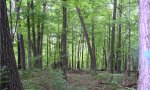
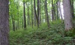
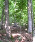
Ecological site photos
Print Options
Sections
Font
Other
Briefcase
Add ecological sites and Major Land Resource Areas to your briefcase by clicking on the briefcase (![]() ) icon wherever it occurs. Drag and drop items to reorder. Cookies are used to store briefcase items between browsing sessions. Because of this, the number of items that can be added to your briefcase is limited, and briefcase items added on one device and browser cannot be accessed from another device or browser. Users who do not wish to place cookies on their devices should not use the briefcase tool. Briefcase cookies serve no other purpose than described here and are deleted whenever browsing history is cleared.
) icon wherever it occurs. Drag and drop items to reorder. Cookies are used to store briefcase items between browsing sessions. Because of this, the number of items that can be added to your briefcase is limited, and briefcase items added on one device and browser cannot be accessed from another device or browser. Users who do not wish to place cookies on their devices should not use the briefcase tool. Briefcase cookies serve no other purpose than described here and are deleted whenever browsing history is cleared.
Ecological sites
Major Land Resource Areas
The Ecosystem Dynamics Interpretive Tool is an information system framework developed by the USDA-ARS Jornada Experimental Range, USDA Natural Resources Conservation Service, and New Mexico State University.