
Natural Resources
Conservation Service
Ecological site F119XY015AR
Loamy Wet Bottomland
Last updated: 5/16/2025
Accessed: 05/19/2025
General information
Provisional. A provisional ecological site description has undergone quality control and quality assurance review. It contains a working state and transition model and enough information to identify the ecological site.
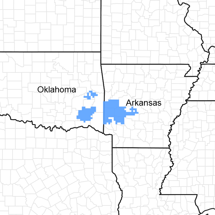
Figure 1. Mapped extent
Areas shown in blue indicate the maximum mapped extent of this ecological site. Other ecological sites likely occur within the highlighted areas. It is also possible for this ecological site to occur outside of highlighted areas if detailed soil survey has not been completed or recently updated.
MLRA notes
Major Land Resource Area (MLRA): 119X–Ouachita Mountains
MLRA 119- Ouachita Mountains, is in Arkansas (57 percent) and Oklahoma (43 percent). It makes up about 11,885 square miles (30,800 square kilometers). This area is in the Ouachita Mountains Section of the Ouachita Province of the Interior Highlands. The steep mountains are underlain by folded and faulted sedimentary and metamorphic rocks. Most of the stream valleys are narrow and have steep gradients, but wide terraces and flood plains border the Ouachita River in western Arkansas. Elevation ranges from 330 feet (100 meters) on the lowest valley floors to 2,625 feet (800 meters) on the highest mountain peaks. Local relief is generally 100 to 200 feet (30 to 60 meters), but it can exceed 980 feet (300 meters).
These steep mountains are underlain by folded and faulted formations, dominantly of shale and sandstone. Ordovician-age shale and sandstone are included in the Collier Shale, Crystal mountain Sandstone, and Womble Shale. Mississippian-age shale, sandstone, novaculite, and chert are included in the Arkansas Novaculite and the Stanley Shale. Pennsylvanian-age shale, slate, quartzite, and sandstone are included in the Jackfork Sandstone, Johns Valley Shale, and upper Atoka Formations. Alluvial deposits of silt, sand, and gravel are on the wide terraces and flood plains that border the Ouachita River in this area.
The average annual precipitation in most of this area is 50 to 66 inches (1,270 to 1,675 millimeters). It decreases to 41 to 49 inches (1,040 to 1,245 millimeters) along the western edge of the area. The precipitation is fairly evenly distributed throughout the year. The maximum occurs in spring and early in autumn. Most of the rainfall occurs as high-intensity, convective thunderstorms. Snowfall is not common in winter. The average annual temperature is 57 to 63 degrees F (14 to 17 degrees C). The freeze-free period averages 230 days and ranges from 205 to 255 days. The shorter freeze-free periods occur at the higher elevations on the major ridges.
The dominant soil orders in this MLRA are Ultisols and Inceptisols. The soils in the area dominantly have a thermic soil temperature regime, a udic soil moisture regime, and mixed or siliceous mineralogy. They are shallow to very deep, generally somewhat excessively drained to somewhat poorly drained, and loamy. Dystrudepts and Hapludalfs formed in residuum on hills and mountains. Hapludults formed in colluvium, colluvium over residuum, and residuum on hills, mountains, and plateaus. Udifluvents formed in alluvium on flood plains.
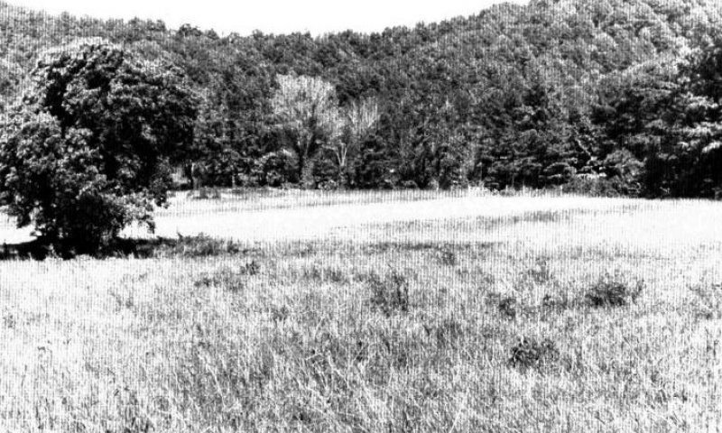
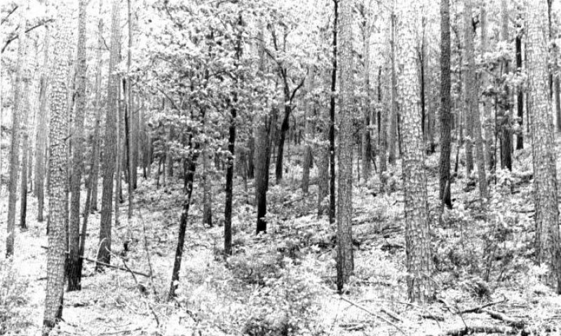
This area supports hardwood-pine forests. The primary overstory species are southern red oak, black oak, white oak, and hickories. Pine constitutes as much as 40 percent of the cover. It consists of shortleaf pine in the uplands and loblolly pine on the lower alluvial soils. Switchgrass, little bluestem, and Indiangrass are the primary grass species in the understory. Prairie cordgrass, plumegrass, low panicums, sedges, and rushes occur in smaller amounts. Some of the major wildlife species in this area are coyote, bobcat, beaver, raccoon, otter, skunk, opossum, muskrat, mink, cottontail, armadillo, gray squirrel, and turkey. The species of fish in the area include largemouth bass, bluegill, redear, sunfish, channel catfish, spotted bass, white bass, crappie, flathead catfish, sucker, bullhead, bowfin, and gar.
More than 70 percent of this MLRA is forested. About one fourth of the forested acreage, mainly in Arkansas, is federally owned. Some of the forestland is in large holdings, but much of it is in farm woodlots. Timber production, wood-using industries, and recreation are important throughout the area. Nearly one-fifth of the MRLA is grazing land. Most of the pastures support a mixture of tame grasses and legumes, but some small prairie outliers in the western part of the area support native grasses. Forage and small grains are the major crops on the small acreage of cropland in the area.
Classification relationships
South-Central Interior Large Floodplain
Summary: This floodplain system is found in the Interior Highlands as far west as eastern Oklahoma, as well as throughout the Interior Low Plateau, Cumberlands, Southern Ridge and Valley, and Western Allegheny Plateau, and lower elevations of the Southern Blue Ridge.
Ecological site concept
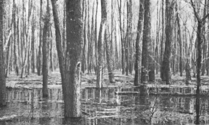
The loamy wet bottomland ecological site occurs on uplands and is found along flood plains. These sites have slopes between 3% and 35%. Elevations range from 300 to 1200 feet. Runoff class varies from very low to low with no ponding and occasional flooding. There are aquic moisture and thermic temperature regimes.
The soils associated with this ecological site are formed in alluvium derived from sandstone and shale. The surface texture is a fine sandy loam. These soils are somewhat poorly drained, with a moderate permeability class. Soil depth is 60 to 80 inches. The soil acid reaction is very acidic (4.5-6.5). Soils with a very acidic pH have low extractable calcium and magnesium along with a low availability of nitrogen and phosphorus, prohibiting the growth of certain plants. Important abiotic factors on this ecological site include the occasional flooding and seasonal water table.
Associated sites
| F119XY004AR |
Loamy Wet Depression |
|---|---|
| F119XY013AR |
Loamy Floodplain |
Similar sites
| F133BY002TX |
Seasonally Wet Upland |
|---|---|
| F133BY014TX |
Creek Bottomland |
Table 1. Dominant plant species
| Tree |
(1) Platanus occidentalis |
|---|---|
| Shrub |
Not specified |
| Herbaceous |
(1) Carex |
Click on box and path labels to scroll to the respective text.