
Natural Resources
Conservation Service
Ecological site F229XY033AK
Boreal Forest Loamy Slopes
Last updated: 6/12/2025
Accessed: 10/18/2025
General information
Provisional. A provisional ecological site description has undergone quality control and quality assurance review. It contains a working state and transition model and enough information to identify the ecological site.
MLRA notes
Major Land Resource Area (MLRA): 229X–Interior Alaska Lowlands
The Interior Alaska Lowlands MLRA includes the flood plains and terraces along the upper reaches of the Tanana and Kuskokwim Rivers and the middle reaches of the Yukon River. This area makes up 39,065 square miles. The northern portion of this area that contains the cities of Fairbanks and North Pole are the second most densely populated lands in Alaska. Other towns along the road system include Nenana, Delta Junction, and Tok; and parts of Fort Wainwright and Fort Greely, the two largest military reservations in Alaska. Elsewhere, the area is mostly undeveloped wild land and is sparsely populated. In the western part of the area, the communities of Tanana, Galena, and McGrath are accessible only by air or by river. Parts of the Denali National Park and Preserve and Tetlin National Wildlife Refuge are in this area. The Trans-Alaska Pipeline parallels the Alaska Highway from Delta Junction to Fairbanks.
This area is on broad, nearly level, braided to meandering flood plains, stream terraces, and outwash plains. In many places, shallow basins and undulating stream terraces are dotted with hundreds of small and medium size lakes and interconnecting wetlands. Sloughs, oxbow lakes, and escarpments along river channels are features associated with the flood plains, terraces, and basins. Isolated bedrock-controlled hills and low- to moderate-relief mountains are in scattered places throughout the area. Extended foot slopes are common at the base of hills and mountains and along the boundaries with adjoining mountainous MLRAs. Elevation ranges from about 100 feet in the southwestern part of the area, along the lower Yukon River, to about 1,900 feet in the upper Tanana Valley.
Geology and Soils
Although never glaciated, this area is filled with a deep layer of Pleistocene glaciofluvial deposits. Additional fluvial sediments from the Alaska Range and the northern Aleutian Range accumulated along the Tanana and Kuskokwim Rivers during the Holocene Epoch. The Koyukuk and lower Yukon River drainages have undergone several periods of deposition followed by erosion. In some places old terraces are 33 to 250 feet above the flood plain. Quaternary glaciofluvial and fluvial sediments are estimated to be as much as 330 to 660 feet thick throughout the area. Much of the MLRA, particularly along the Tanana and Kuskokwim Rivers, is mantled with a layer of silty micaceous loess originating from the unvegetated flood plains and outwash plains along the Alaska Range. Thick eolian deposits, including loess dunes, sand dunes, and sand sheets, make up about 12 percent of the area. Inclusions of glacial moraines and drift are near the mountains. Unconsolidated sediments bury the bedrock geology, except for structural hills in some places.
This area is in the zone of discontinuous permafrost. Permafrost is close to the surface in lands with finer textured silty sediments on stream terraces, plains, and the more gently sloping foot slopes and hills throughout the area. Isolated masses of ground ice occur on terraces and the lower side slopes of hills. Permafrost does not generally occur on floodplains, soils with sandy and gravelly parent material, and in areas near lakes and other water bodies.
The dominant soil orders in this area are Gelisols, Entisols, Inceptisols, and Spodosols. The Gelisols are shallow or moderately deep to permafrost, occur on finer textured sediments, and are poorly drained or very poorly drained. Common Gelisol suborders are Histels, Orthels, and Turbels. The Histels have thick accumulations of surface organic material and occur in depressions and peat plateau. The Orthels and Turbels have comparably thinner surface organic material and occur on drainageways, stream terraces, and outwash plains. The Inceptisols, Spodosols, and Entisols lack permafrost in the soil profile. Two important factors that prevent permafrost aggradation are groundwater connectivity and thick bands of sandy and/or gravelly soil horizons. Entisols most commonly occur on the floodplain with the most common suborder being Fluvents. Inceptisols and Spodosols occurs on streams terraces and slopes of hills and outwash plains. Dry soils on these landforms support soil suborders related to Cryods and Cryepts, while wet soils support Aquepts. Miscellaneous (non-soil) areas make up about 19 percent of this MLRA. The most common are riverwash and water.
For Gelisols, wildfires disturb the insulating organic material at the soil surface and can change the presence and/or depth of permafrost in the soil profile. These fire related changes to permafrost can also change the depth and presence of perched water tables. Gelisols that burn in this area can change soil taxonomic classification. For instance, depending on fire-severity, Histels may change to Orthels and Orthels may change to Inceptisols. Depending on the frequency and intensity of fires, landform position, and soil texture, the soils may or may not revert back to their original taxonomic classification.
Climate
Short, warm summers and long, very cold winters characterize the continental subarctic climate of the area. The average annual precipitation for this area ranges from 11 to 17 inches. The maximum precipitation occurs in late summer, mainly during thunderstorms. The average annual snowfall ranges from 30 to 80 inches. The average annual temperature for this area ranges from about 23 to 30 degrees Fahrenheit. The freeze-free period averages about 90 to 110 days. The temperature usually remains above freezing from June through early-September.
Vegetation
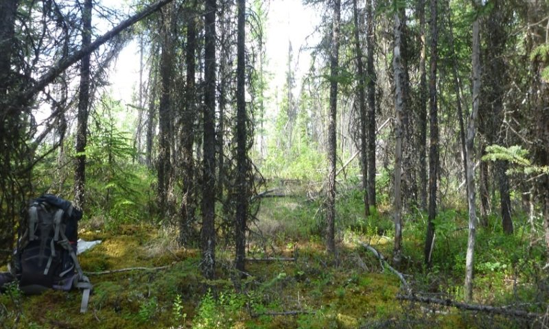
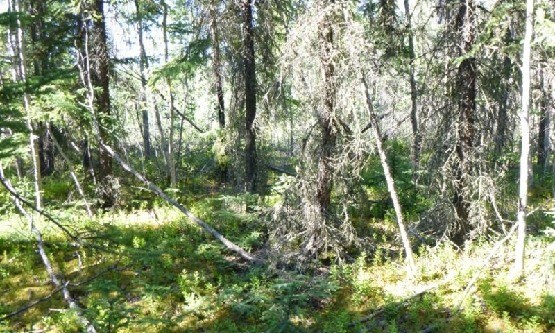
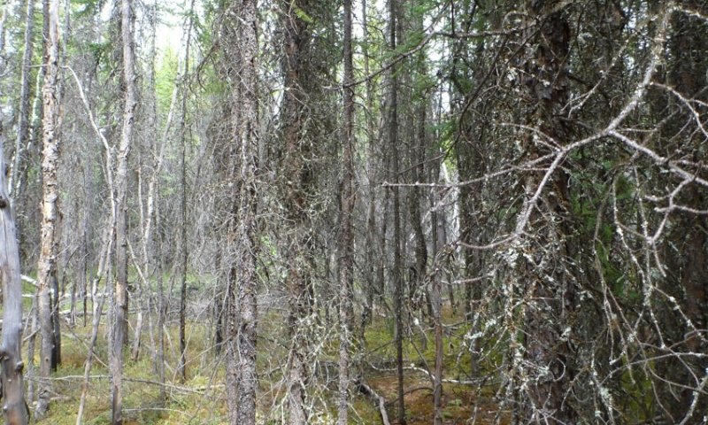
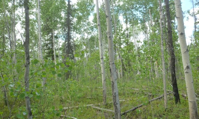
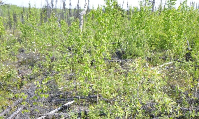
Much of the soil in this area supports forested communities in some stage of post-fire recovery. Mesic to dry soils in the uplands support mixed forests of black spruce, white spruce, paper birch, and quaking aspen. White spruce and white spruce-balsam poplar forests occur on occasionally to rarely flooded portions of the floodplain-step. Black spruce woodlands occur on stream terraces and other places with wet soils and/or shallow permafrost. On permafrost-affected alluvial flats, tamarack occurs in association with black spruce. Lightning-caused wildfires are common. Many thousands of acres are often burned during a single fire. Following wildfires, willow, shrub birch, and ericaceous shrub scrub invade most previously forested ecological sites until they eventually are replaced by forest vegetation. After fire, resin birch is common on wet and mesic soils and quaking aspen on dry soils. On all forest and woodland ecological sites, post-fire succession leads to a relatively rapid accumulation of organic matter and mosses on the surface. This accumulation results in decreases in soil temperature, biologic activity, and nutrient availability and a gradual decrease in site productivity.
Frequently flooded and continuously ponded soils lack forested communities. Non-forested soils include shrub birch, ericaceous shrub scrub, and tussock tundra in peat areas and in drainageways. Wet sedge meadows, sedge-moss bog meadows, and sedge-grass meadows are along the margins of lakes and on continuously ponded sites such as fens. Low to tall willow and alder scrub are on low flood plains.
Classification relationships
Landfire BPS – 16030 – Western North American Boreal White Spruce-Hardwood Forest (Landfire 2009)
Landfire BPS – 16050 – Western North American Boreal Mesic Birch-Aspen Forest (Landfire 2009)
Ecological site concept
- Associated with well drained soils on dunes, sand sheets, stream terraces, and slopes of hills and outwash plains.
- Soils formed in silty parent material such as loess over sandy or gravelly material such as sandy eolian deposits and alluvium. Mineral soils are capped with two to five inches of organic material.
- Soils do not pond or flood. A water table occurs at deep depths during the growing season.
- Soils are considered very deep and lack restrictions like permafrost.
- The reference plant community is open forest (Viereck et al. 1992) with black spruce and/or white spruce the dominant trees. Commonly observed understory species include russet buffaloberry, bog Labrador tea, lingonberry, false toadflax, splendid feathermoss, and Schreber’s big redstem moss. Five plant communities have been identified within the reference state related to fire.
Associated sites
| F229XY021AK |
Boreal Peat Terraces and Slopes Complex Occurs on the same terraces and slopes but in lower positions with wetter soils that pond frequently and have permafrost. Associated with black spruce stunted woodlands. |
|---|---|
| F229XY031AK |
Boreal Forest Loamy Slopes Moist Occurs on the same slopes but in lower positions with moister soils. Associated with black spruce forests. |
| R229XY010AK |
Boreal Scrub Loamy Frozen Drainageways Occurs in adjacent drainageways with closed low scrub vegetation and abundant obligate wetland species. |
| F229XY020AK |
Boreal Woodland Loamy Frozen Slopes Occurs on the same slopes but in lower positions with wetter soils that have permafrost. Associated with black spruce woodlands. |
| F229XY032AK |
Boreal Woodland Sandy Slopes Occurs on the same slopes but on drier soils. Associated with black spruce woodlands. |
Similar sites
| F229XY031AK |
Boreal Forest Loamy Slopes Moist Ecological site 31 occurs on the same slopes but in lower positions with moister soils. Ecological site 31 has less productive trees and more facultative wet plant species. |
|---|---|
| F231XY186AK |
Boreal Forest Silty Slopes Ecological site 186 occurs on hills with similar soils and vegetation but occurs to the North in the Interior Alaska Highlands MLRA. |
| XA232X02Y210 |
Boreal Forest Loamy Frozen Plains Warm Ecological site 210 occurs on hills and plains with similar soils and vegetation but occurs to the North in the Yukon Flats Lowlands MLRA. |
Table 1. Dominant plant species
| Tree |
(1) Picea glauca |
|---|---|
| Shrub |
(1) Shepherdia canadensis |
| Herbaceous |
(1) Hylocomium splendens |
Click on box and path labels to scroll to the respective text.
Ecosystem states
State 1 submodel, plant communities
Communities 1, 5 and 2 (additional pathways)
| 1.1a | - | A high-severity fire sweeps through and incinerates much of the above ground vegetation |
|---|---|---|
| 1.2b | - | 130 to 150 years without wildfire |
| 1.2a | - | A high-severity fire sweeps through and incinerates much of the above ground vegetation |
| 1.3b | - | 80 to 100 years without fire. |
| 1.3a | - | A high-severity fire sweeps through and incinerates much of the above ground vegetation |
| 1.4b | - | 30 to 50 years without fire |
| 1.4a | - | A high-severity fire sweeps through and incinerates much of the above ground vegetation |
| 1.5a | - | 4 to 6 years without wildfire |