
Natural Resources
Conservation Service
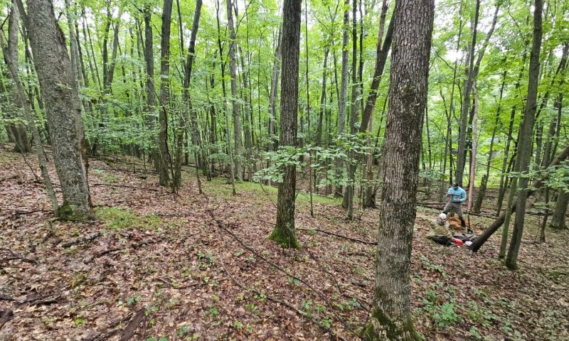
Ecological site F094AB028MI
Dry Sandy Slopes
Last updated: 5/13/2025
Accessed: 10/18/2025
General information
Provisional. A provisional ecological site description has undergone quality control and quality assurance review. It contains a working state and transition model and enough information to identify the ecological site.
MLRA notes
Major Land Resource Area (MLRA): 094A–Northern Michigan Sandy Highlands
"This area is dominated by outwash plains and moraines. The terrain can be steep on the moraines and flat in the areas of outwash. Elevation ranges from 177 to 520 m (580 to 1705 ft). Local topographic relief averages 14 m and ranges up to 188 m (45 to 615 ft). This area is covered entirely by drift. Bedrock consisting of Devonian limestone and dolomite with interbedded shale, chert, and anhydrite stringers is at various depths below the surface because of the curvature of the Michigan basin. However, bedrock exposures completely absent, as the depth of glacial drift ranges from 60 to 300 m (200-1000 ft). The Au Sable, Manistee, Au Gres, and Pine Rivers are the major streams draining this MLRA, in both the Lake Michigan and Lake Huron watersheds. The Muskegon River has its headwaters in this area.
About 70 percent of this area is forested, and about 15 percent is cropland or hayland. About one-third of the area is in small, privately owned holdings, and another one-third consists of national and State forests. The forests are used mainly for timber production and recreation. Dairy and beef operations are very important enterprises in the area. Forage and feed grains for dairy cattle and other livestock are the principal crops. Wheat, oats, corn, potatoes, and hay also are grown in the area. The Huron and Manistee National Forests, Hartwick Pines State Park, Camp Grayling (Department of Defense), Pigeon River Country State Forest are among the most notable conservation lands in the area. Reaches of the Au Sable and Pine Rivers are National Wild and Scenic Rivers.
Summary of existing land use:
Upland Forest (58%)
Hardwood (41%)
Conifer (15%)
Swamps and Marshes (14%)
Developed (11%)
Agricultural (10%)
Grassland (5%)
"
Classification relationships
According to the USFS (Bailey) system of ecoregions, the site is located mostly within 212Hg (Kirtland's Warbler High Sand Plains) and 212Hh (Gladwin Silty Lake Plain) subsections. According to the EPA (Omernik) system of ecoregions, the site is located in 50ae (Mio Plateau), 50ah (Tawas Lake Plain) and eastern 50ad (Vanderbilt Moraines) level IV ecoregions. This site roughly corresponds to PVCd, in the Kotar system. This site corresponds to the Ice Contact ecological land type 20 in the USFS Ecological Land Type system.
Ecological site concept
The central concept of Dry Sandy Slopes is uplands lacking a seasonal water table (excessively drained to well drained), lacking significant B horizon development in the soil profile, and on hilly landscapes greater than 15% slopes. Site occurs on sandy drift (outwash, ice contact, or lake plains) where soil textures are sand or loamy sand (upper 50 cm >70% sand). Site is outside the heavy snowfall belt, mostly east of Houghton Lake where fire was frequent. Vegetation trending towards xerophytic forests with a moderately high fire frequency.
Associated sites
| F094AB018MI |
Rich Sandy Drift Rich Sandy Drift has a greater amount of spodic development, which indirectly indicates higher productivity, or has higher pH, which drives higher productivity. Vegetation is similar. |
|---|---|
| F094AB019MI |
Dry Sandy Plains Dry Sandy Plains has a lower topographic relief which tends to increase the size of wildfires. Consequently, there is more jack pine and less white pine and oak. |
| F094AB020MI |
Acidic Sandy Depression Acidic Sandy Depression has a seasonally high water table, either moderately well drained or somewhat poorly drained. Consequently, there can be a transition to wetland species or higher cover of wintergreen. |
Similar sites
| F094AA006MI |
Snowy Sandy Drift Snowy Sandy Drift has a greater amount of annual snowfall, which leads to longer fire interval. Consequently, there is more white pine and northern hardwoods and less jack pine. |
|---|---|
| F094AB019MI |
Dry Sandy Plains Dry Sandy Plains has a lower topographic relief which tends to increase the size of wildfires. Consequently, there is more jack pine and less white pine and oak. |
Table 1. Dominant plant species
| Tree |
(1) Pinus strobus |
|---|---|
| Shrub |
Not specified |
| Herbaceous |
(1) Pteridium aquilinum |
Click on box and path labels to scroll to the respective text.