
Natural Resources
Conservation Service
Ecological site R072XY117KS
Tableland Swale
Last updated: 6/06/2025
Accessed: 10/18/2025
General information
Approved. An approved ecological site description has undergone quality control and quality assurance review. It contains a working state and transition model, enough information to identify the ecological site, and full documentation for all ecosystem states contained in the state and transition model.

Figure 1. Mapped extent
Areas shown in blue indicate the maximum mapped extent of this ecological site. Other ecological sites likely occur within the highlighted areas. It is also possible for this ecological site to occur outside of highlighted areas if detailed soil survey has not been completed or recently updated.
MLRA notes
Major Land Resource Area (MLRA): 072X–Central High Tableland
Major Land Resource Area (MLRA) 72--Central High Tableland. This area is in Kansas (54 percent), Nebraska (25 percent), and Colorado (21 percent). A very small part of the area is in Wyoming. The area makes up about 34,550 square miles (89,535 square kilometers). It includes the towns of Garden City, Goodland, and Colby, Kansas; Imperial, North Platte, Ogallala, and Sidney, Nebraska; and Holyoke and Wray, Colorado. Interstate 70 bisects the area, and Interstates 76 and 80 follow the south side of the South and North Platte Rivers, respectively. The Cimarron National Grasslands occur in the southwest corner of the MLRA.
Classification relationships
Hierarchical Classification Relationships
MLRA 72 is in the Central Great Plains Winter Wheat and Range Land Resource Region. It is in the High Plains Section, of the Great Plains Province, of the Interior Plains (USDA, 2006). MLRAs can be defined by climate, landscapes, geology, and annual precipitation zones (PZ). Other features such as landforms, soil properties, and key vegetation further refine these concepts, and are described at the Ecological Site Description (ESD) level.
Relationship to Other Classifications:
Natural Resource Conservation Service (NRCS) Classification Hierarchy:
Physiographic Division Physiographic Province Physiographic Section Land Resource Region Major Land Resource Area Land Resource Unit (Fenneman, 1946)
United States Forest Service (USFS) Classification Hierarchy:
Domain Division Province Section Subsection Landtype Association Landtype Landtype Phase (Cleland et al, 1997)
Revision Notes:
The Tableland Swale site was developed by an earlier version of the Loamy Terrace (2001). The earlier version of the Loamy Terrace ESD was based upon input from NRCS (formerly Soil Conservation Service) and historical information obtained from the Loamy Terrace Range Site Description (1967, updated1983).
Ecological site concept
The Tableland Swale ecological site is located in swales and draws on tablelands. These sites are most often found adjacent to the Loamy Tableland sites and occur in water- gathering positions on the landscape.
Associated sites
| R072XY100KS |
Loamy Tableland The Loamy Tableland ESD occurs on Tablelands and can be found adjacent to the Tableland Swale ecological site. Loamy Tableland does not occur in water gathering positions on the landscape. |
|---|---|
| R072XY101KS |
Limy Slopes The Limy Slopes ecological site is located on shoulders and backslopes on hillslopes on tableland landscapes. Soils that are correlated to Limy Slopes have free carbonates occurring within 4 inches (10cm) of the surface. This site is dominated by loess parent material. Limy Slopes generally occurs above this site on the uplands. |
Similar sites
| R072XY108KS |
Loamy Lowland Alluvial soils make up the parent material of this ecological site. This site occurs on flood plains or low stream terraces, and is characterized by a seasonal or perennial high water table greater than 6 feet from the surface. The soils characteristic of this site are deep and well drained and formed in calcareous alluvial sediments. The vegetation and state and transition model are similar to that of Tableland Swale. |
|---|---|
| R072XY107KS |
Sandy Lowland This site occurs on nearly level to moderately sloping floodplains and low terraces. The Sandy Lowland site is characterized by soils with greater than 55 percent sand in the surface. The soils characteristic of this site formed in sandy alluvium from mixed sources. |
| R072XY115KS |
Closed Upland Depression The Closed Upland Depression ecological site occurs on broad upland divides (Tablelands). This site occurs in small to large depressions called playas that have very slow to slow permeability classes and a range of low to high available water capacity. This site receives water runoff from areas higher on the landscape. |
Table 1. Dominant plant species
| Tree |
Not specified |
|---|---|
| Shrub |
Not specified |
| Herbaceous |
(1) Andropogon gerardii |
Physiographic features
The Tableland Swale ecological site is derived from loess-affected slope alluvium. The sites are in a water gathering position on the landscape Tableland. They occur in swales and draws, and have slopes ranging from 0 to 6 percent.

Figure 2. MLRA 72 Tableland ESD diagram
Table 2. Representative physiographic features
| Landforms |
(1)
Swale
(2) Draw |
|---|---|
| Flooding frequency | None to rare |
| Ponding frequency | None |
| Elevation | 2,500 – 5,700 ft |
| Slope | 3% |
| Ponding depth |
Not specified |
| Water table depth | 60 in |
Climatic features
The average annual precipitation in this area is 14 to 25 inches (355 to 635 millimeters). It fluctuates widely from year to year. Most of the rainfall occurs as high-intensity, convective thunderstorms during the growing season. The maximum precipitation occurs from late spring through early autumn. Precipitation in winter occurs as snow. The annual snowfall ranges from about 16 inches (40 centimeters) in the southern part of the area to 35 inches (90 centimeters) in the northern part. The average annual temperature is 46 to 57 degrees F (8 to 14 degrees C). The freeze-free period averages 159 days and ranges from 135 to 210 days, increasing in length from northwest to southeast. Climate data comes from the Natural Resources Conservation Service (NRCS) National Water and Climate Center. The data-set is from 1981-2010.
Table 3. Representative climatic features
| Frost-free period (characteristic range) | 120-137 days |
|---|---|
| Freeze-free period (characteristic range) | 139-157 days |
| Precipitation total (characteristic range) | 17-19 in |
| Frost-free period (actual range) | 114-145 days |
| Freeze-free period (actual range) | 134-167 days |
| Precipitation total (actual range) | 17-22 in |
| Frost-free period (average) | 129 days |
| Freeze-free period (average) | 149 days |
| Precipitation total (average) | 19 in |
Figure 3. Monthly precipitation range
Figure 4. Monthly minimum temperature range
Figure 5. Monthly maximum temperature range
Figure 6. Monthly average minimum and maximum temperature
Figure 7. Annual precipitation pattern
Figure 8. Annual average temperature pattern
Climate stations used
-
(1) SAINT FRANCIS [USC00147093], Saint Francis, KS
-
(2) BONNY DAM 2NE [USC00050834], Idalia, CO
-
(3) LAKIN [USC00144464], Lakin, KS
-
(4) LODGEPOLE [USC00254900], Lodgepole, NE
-
(5) SIDNEY 6 NNW [USC00257830], Gurley, NE
-
(6) ATWOOD [USC00140439], Atwood, KS
-
(7) OAKLEY 4W [USC00145888], Oakley, KS
-
(8) SYRACUSE 1NE [USC00148038], Syracuse, KS
-
(9) BIG SPRINGS [USC00250865], Big Springs, NE
Influencing water features
This site receives water from adjacent upland sites. This influences the kinds and amounts of vegetation present and makes it distinct from other ecological sites.

Figure 9. Fig. 7-1 from National Range & Pasture Handbook
Soil features
The series that make up the Tableland Swale ecological site consist of very deep, well drained soils that formed in loamy and silty alluvium derived mainly from loess. These soils are in swales and draws of uplands and have slopes ranging from 0 to 3 percent. The surface textures are silt loam and loam. These soils are generally high in fertility, well drained, and have a moderate available water capacity.
Major soil series making up the Tableland Swale ecological site are Goshen and Duroc.

Figure 10. Goshen profile in Scott County 1965
Table 4. Representative soil features
| Surface texture |
(1) Silt loam (2) Loam |
|---|---|
| Family particle size |
(1) Loamy |
| Drainage class | Well drained |
| Permeability class | Moderate to moderately slow |
| Soil depth | 80 in |
| Surface fragment cover <=3" | Not specified |
| Surface fragment cover >3" | Not specified |
| Available water capacity (0-40in) |
7 – 8.6 in |
| Calcium carbonate equivalent (0-40in) |
10% |
| Electrical conductivity (0-40in) |
2 mmhos/cm |
| Sodium adsorption ratio (0-40in) |
2 |
| Soil reaction (1:1 water) (0-40in) |
6.3 – 8 |
| Subsurface fragment volume <=3" (Depth not specified) |
6% |
| Subsurface fragment volume >3" (Depth not specified) |
Not specified |
Ecological dynamics
The plant communities for the Tableland Swale ecological site are dynamic due to the complex interaction of many ecological processes. The interpretive plant community for this site is the Reference Plant Community. The Reference Community has been determined by the study of rangeland relic areas, areas protected from excessive disturbance, areas under long term rotational grazing strategies, literature of plant communities from the early 1900s, and local expertise. Trends in plant community dynamics ranging from heavily grazed to lightly grazed areas, seasonal use pastures, and historical accounts have also been used.
This ecological site is made up of a Grassland State, a Shortgrass State, and a Tillage State. The Grassland State is characterized by non-broken land (no tillage), both warm and cool-season, tall- and mid-bunchgrasses, sod-forming grasses, forbs, and shrubs. The Shortgrass State is dominated by shortgrass species that form a dense sod. The Tillage State has been mechanically disturbed (broken) by equipment and includes either a variety of reseeded warm season bunch and sod forming grasses or early successional plants to include the latter as well as annual grasses and forbs.
Vegetation changes are expected within this ecological site and will be dependent on the site's geographical location inside Major Land Resource Area (MLRA) 72, the Central High Tablelands. The northern part of MLRA 72 is characterized by cooler temperatures and shorter growing season in respect to the southern end. As a result, cool season bunchgrasses and sod-formers proliferate. Growth of native cool-season plants begins about April 15 and continues to about June 15. Native warm-season plants begin growth about May 15, and continue to about August 15. Green-up of cool-season plants may occur in September and October if adequate moisture is available (weather data from National Climate Data Center-1980-2010).
The Tableland Swale ecological site developed with occasional fires as part of the ecological processes. Historically, it is believed that the fires were infrequent, randomly distributed, and started by lightning at various times throughout the season when thunderstorms were likely to occur. It is also believed that pre-European inhabitants may have used fire as a management tool for attracting herds of large migratory herbivores (bison, elk, deer, and pronghorn). The impact of fire over the past 100 years has been relatively insignificant due to the human control of wildfires and the lack of acceptance of prescribed fire as a management tool in the semi-arid, High Plains area.
The degree of herbivory (feeding on herbaceous plants) has a significant impact on the dynamics of the site. Historically, periodic grazing by herds of large migratory herbivores was a primary influence. Secondary influences of herbivory by species such as, grasshoppers, gophers, and root-feeding organisms impacted the vegetation historically, and continue to this day.
The management of herbivory by humans through grazing of domestic livestock and/or manipulation of wildlife populations has been a major influence on the ecological dynamics of the site. This management, coupled with the High Plains climate, largely dictates the plant communities for the site.
Drought historically had a major impact upon the vegetation of the Great Plains. Drought cycles are part of the natural disturbance regime and contribute to the range of variability of the vegetation within the site. The species composition changes according to the duration and severity of the drought cycle (Albertson and Weaver, 1946).
This site occurs in swales and narrow drainageways of uplands, and receives runoff from adjacent sites. This site is preferred by livestock, which can lead to grazing distribution concerns. Landscape position is conducive to livestock over-utilization of the plant communities, and management of this site by itself can generate challenges.
Water locations, salt placement, and other aids help to distribute grazing. Other management techniques, such as concentrated grazing and/or rotational grazing systems also help to distribute grazing more evenly. The general response of this site to heavy, long term continuous grazing pressure without adequate rest and recovery is to gradually lose the vigor and reproductive potential of the Reference Plant Community of tall- and midgrass species, and shift to the plant community toward less palatable species, cool-season dominant species, and/or shortgrass species.
The following diagram illustrates pathways that the vegetation on this site may take from the Reference Plant Community as influencing ecological factors and/or management changes. There may be other states or plant communities not shown in the diagram, as well as noticeable variations within those illustrated and described in the following sections.
State and transition model
More interactive model formats are also available.
View Interactive Models
Click on state and transition labels to scroll to the respective text
Ecosystem states
State 1 submodel, plant communities
State 2 submodel, plant communities
State 3 submodel, plant communities
State 1
Grassland State
The Grassland State is supported by empirical data and is defined by three native plant communities that are a result of periodic fire and drought, and herbivore and ungulate grazers. These events are part of the natural disturbance regime and climatic process that contribute to the development of the site. The Reference Plant Community consists of tall-and midgrass, warm- and cool-season grasses, forbs, and shrubs. Plant Community 1.2 is dominated by western wheatgrass, sideoats grama, and blue grama, and combined with a minor component (2-10 percent composition by weight) of Reference Community species. The 1.3 At-Risk Plant Community is most vulnerable to exceeding the resilience limits of the Grassland State and transitioning to an alternative state. This plant community is dominated (40-100 percent composition by weight) by blue grama and buffalograss. Subdominant (10-40 percent composition by weight) species include western wheatgrass, sand dropseed, and threeawns. Heavy, continuous use throughout the year combined with inadequate rest and recovery of the dominant Reference Plant Community species will reduce the health and vigor of the dominant plant species, allowing western wheatgrass, sideoats grama, and blue grama to increase. To a small extent, some buffalograss will also increase. After the vegetation is reduced to western wheatgrass and heavy, continuous grazing of the dominant plant species continues, blue grama, buffalograss, sand dropseed, and threeawns will increase. There also could be an increase kochia, Russian thistle, and other undesirable annuals. The following are narratives for each of the described plant communities. These plant communities may not represent every possibility, but they are the most prevalent and repeatable plant communities that exist on this ecological site. The plant composition table following has been developed from the best available knowledge at the time of this revision. As more data is collected, some of these plant communities may be adjusted or removed, and new ones may be added. The main purpose for including any description of a plant community here is to capture the current knowledge and experience at the time of this revision.
Community 1.1
Reference Community
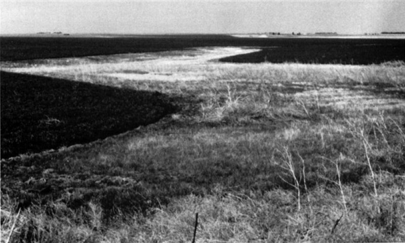
Figure 11. Tableland Swale--Kit Carson County, Colorado.
The Reference Plant Community serves as the basis for all other interpretations. The potential vegetation of this site is a mix of warm-season mid- and tallgrasses, cool-season midgrasses, and warm-season shortgrasses. This community is comprised of approximately 95 percent grasses and grass-like plants, 4 percent forbs, and 1 percent (trace amount) shrubs. Big bluestem, sideoats grama, little bluestem, and Indiangrass are the dominant species in this community, making up approximately 70 percent of the total annual production per acre per year (ac/yr). Subdominant species making up approximately 20 percent of the total annual production include western wheatgrass, blue grama, buffalograss, and vine mesquite. The Reference Community has a diverse forb population that makes up approximately 5 percent of the total annual production per ac/yr. Leadplant is the shrub species that makes up 1 percent of the total annual production per ac/yr. Prescription grazing that allows for adequate recovery periods after each grazing event, and a forage and animal balance will maintain the species composition and biotic integrity of this plant community. Multiple years of spring grazing followed by summer deferment will reduce the cool-season component (western wheatgrass) of this plant community and increase the warm-season component (big bluestem, sideoats grama, and Iittle bluestem). To the contrary, multiple years of spring deferment and summer grazing will increase the cool-season component and decrease the warm-season component of this plant community. This plant community is diverse and productive which allows for excellent capture and storage of precipitation and increased infiltration rates. The diversity in plant species allows for high drought tolerance. Plant litter, is uniformly distributed with very little movement offsite, and natural plant mortality is very low. its diversity and productivity will also promote the proper function of the water and mineral cycles. Decomposition of roots, high infiltration rates, and high litter cover allow for the proper function of the nutrient cycle. With proper management, this community will remain functioning at a peak ecological level. Total annual production ranges from 2,000 to 3,000 pounds of air-dried vegetation per acre per year, and will average 2,500 pounds.
Dominant plant species
-
big bluestem (Andropogon gerardii), grass
-
sideoats grama (Bouteloua curtipendula), grass
-
little bluestem (Schizachyrium scoparium), grass
-
Indiangrass (Sorghastrum nutans), grass
-
western wheatgrass (Pascopyrum smithii), grass
Figure 12. Annual production by plant type (representative values) or group (midpoint values)
Table 5. Annual production by plant type
| Plant type | Low (lb/acre) |
Representative value (lb/acre) |
High (lb/acre) |
|---|---|---|---|
| Grass/Grasslike | 1880 | 2350 | 2820 |
| Forb | 100 | 125 | 150 |
| Shrub/Vine | 20 | 25 | 30 |
| Total | 2000 | 2500 | 3000 |
Figure 13. Plant community growth curve (percent production by month). KS2472, Big Bluestem, Little Bluestem, Sideoats Grama.
| Jan | Feb | Mar | Apr | May | Jun | Jul | Aug | Sep | Oct | Nov | Dec |
|---|---|---|---|---|---|---|---|---|---|---|---|
| J | F | M | A | M | J | J | A | S | O | N | D |
| 0 | 0 | 0 | 5 | 20 | 35 | 25 | 10 | 5 | 0 | 0 | 0 |
Community 1.2
Cool-Season Dominant
This plant community developed under heavy, continuous season long grazing that did not allow for the rest and recovery of dominant Reference Plant Community species. There are no prescription fires implemented. Big bluestem, sideoats grama, little bluestem, and Indiangrass have decreased in abundance. Because of its rhizomatous nature and season of grazing use, western wheatgrass has increased. This community is dominated by western wheatgrass, blue grama, buffalograss, and vine mesquite. Big bluestem and other highly palatable species have decreased due to heavy, uninterrupted grazing pressure during the growing season and/or throughout the year. The total annual production of this site is approximately 2,000 pounds per acre (air-dry weight).
Dominant plant species
-
western wheatgrass (Pascopyrum smithii), grass
-
blue grama (Bouteloua gracilis), grass
-
buffalograss (Bouteloua dactyloides), grass
-
vine mesquite (Panicum obtusum), grass
Community 1.3
At-Risk Community
The At-Risk Community phase is most vulnerable to exceeding the resilience limits of the Grassland state and transitioning to the Shortgrass State. An At-Risk Community phase is that is reversible if management is changed. This plant community evolved with heavy, continuous grazing during the growing season and/or throughout the year without adequate recovery periods between each grazing event during the growing season. Prescription fire has been removed as a management tool. Recognition of this plant community will enable the land user to implement key management decisions before a significant ecological threshold is crossed. Remnant tallgrasses and palatable forbs and shrubs may still be present but have significantly decreased in abundance. Big bluestem, sideoats grama, little bluestem, Indiangrass, and western wheatgrass have been eliminated or reduced to trace amounts. The palatable forb component has also been reduced. Blue grama and buffalograss have increased in abundance, making up greater than 40 percent of the plant community, and are beginning to take on a dense sod appearance. Sand dropseed and red threeawn have also increased. This plant community is at risk of losing key species that were present in the 1.1 Reference Plant Community (warm-season mid-and tallgrasses), and the 1.2 Plant Community (cool-season midgrasses). Once these key species are removed and other plants have increased, it will take a long time, if ever, to bring them back by management alone. Total aboveground carbon has been reduced due to decreases in forage and litter production. Reduction of rhizomatous wheatgrass, nitrogen- fixing forbs, shrub component, and increased warm-season shortgrasses have started to alter the species composition and the biotic integrity of this community. Water and nutrient cycles are being impaired. This site is becoming increasingly arid, there is a reduction in interception and an increase in evaporation and runoff. This restoration needs further field investigations and documentation. Total annual production can vary from 650 to 1,750 pounds of air-dry vegetation per acre and will average 1,200 pounds during an average year.
Dominant plant species
-
blue grama (Bouteloua gracilis), grass
-
buffalograss (Bouteloua dactyloides), grass
-
western wheatgrass (Pascopyrum smithii), grass
Pathway 1.1 to 1.2
Community 1.1 to 1.2
This community pathway is driven by short-term management (<10 years) devoid of a forage and animal balance, lack of prescription fires, and heavy, continuous grazing without adequate recovery periods between grazing events. These drivers will convert the Reference Plant Community to increased western wheatgrass, sideoats grama, and blue grama. Drought, in combination with this type of management or spring deferment and summer grazing, will quicken the rate at which the Community Pathway 1.1 to 1.2 occurs.
Pathway 1.2 to 1.1
Community 1.2 to 1.1
This community pathway is driven by management incorporating long-term (>10-20 years) prescription grazing that includes a forage and animal balance, prescription fires at a frequency of one in 10 years, adequate rest and recovery periods of the dominant Reference Community species and incorporating spring grazing with early season rest. This type of management will shift the plant community dominated by western wheatgrass to those species found in the Reference Plant Community.
Pathway 1.2 to 1.3
Community 1.2 to 1.3
Community Pathway 1.2 to 1.3 is driven by long-term management (>20 years) without a forage and animal balance, an absence of prescription fires, and heavy, continuous grazing without adequate recovery periods between grazing events. These drivers will make blue grama and buffalograss dominant. Western wheatgrass, sand dropseed, and threeawns will make up the subdominant species (10-40%). Drought, in combination with this type of management, will quicken the rate at which Community Pathway 1.2 to 1.3 occurs.
Pathway 1.3 to 1.2
Community 1.3 to 1.2
This community pathway is driven by management that incorporates long-term prescription grazing (>40 years), a forage and animal balance, the use of prescribed fires, and adequate rest and recovery periods of the dominant Reference Plant Community species (if remnants remain) and/or the midgrasses in Plant Community 1.2. This type of management will favor Plant Communities 1.2 and 1.1 (dependent upon the remnant amounts).
State 2
Shortgrass State
The Reference Grassland State ecosystem has been driven beyond the limits of ecological resilience and has crossed a threshold into the Shortgrass State. The designation of the Shortgrass State denotes changes in infiltration, runoff, bulk density, and species composition. The changes in soil properties, water movement, and the plant community affects changes in the ecosystem. This affects the hydrologic functionality, biotic integrity, and soil and site stability of the site. With long-term, heavy, continuous grazing buffalograss and blue grama will become the dominant species and have a sod-bound appearance. Unable to withstand the grazing pressure, only a remnant population of western wheatgrass remains. Species diversity has been further reduced. Water infiltration is reduced due to the sod nature of the buffalograss and blue grama. There is a possible increase in bulk density due to concentrated animal impact over many years. Runoff is increased. (Generally) vegetation type affects the amount and structure associated cover, therefore the infiltration rate differs among vegetation types. The amount of cover, and hence the rate of infiltration, is usually greatest under trees and shrubs, followed in decreasing order by bunchgrass, shortgrass, and bare ground (Blackburn, 1975; Thurow et al., 1986). Specific dynamic soil property changes between the Grassland State and the Shortgrass State has been documented. As plant community cover decreases from bunchgrasses to more of the sod-forming grasses, there is a decrease in infiltration and interception and an increase in surface runoff (Thurow, 2003). There is no known timeframe or restoration pathway success from this state to the Grassland State. Experience suggests that long-term prescription grazing to include a forage and animal balance, and adequate recovery periods following each grazing event over long periods of time, will gradually move this plant community toward the Grassland State. This process is not well documented and may take greater than 40 years. This alternative state will be tested through long-term observation of ecosystem behavior and repeated application of conservation and restoration practices.
Community 2.1
Sod community
This plant community evolved with long-term, heavy, continuous grazing without adequate rest and recovery periods. Most, if not all, of the key grass, forb, and shrub species are absent. Western wheatgrass may persist in trace amounts, greatly reduced in vigor and not readily seen. Blue grama and buffalograss dominate the community with a tight “sodbound” structure. Red threeawn, sand dropseed, sixweeks fescue, and hairy fasle goldenaster may be present. This plant community is resistant to change due to grazing tolerance of buffalograss and blue grama. A significant amount of production and diversity has been lost when compared to the Reference Plant Community. Loss of warm-season mid- and tallgrasses and cool-season midgrasses, a shrub component, and nitrogen fixing forbs have negatively impacted energy flow and nutrient cycling. Water infiltration is reduced significantly. This is due to the massive shallow root system, called a “root pan," characteristic of blue grama and buffalograss. Soil loss may be obvious where flow paths are connected. Blue grama provides this site with a unique feature. The leaves remain semi-dormant during drought periods, but resume growing each time adequate moisture is available during the growing season. Reseeding of blue grama is unlikely because young seedlings seldom survive the extended drought periods that are common on this site. Blue grama maintains itself by tillering. This also provides blue grama with another unique feature of being able to withstand drought and heavy grazing use. Blue grama is typically a bunchgrass but quickly forms a sod-bound condition when heavily grazed. It will take a very long time (>40 years) to restore this plant community back to the Reference Plant Community with management.
Dominant plant species
-
blue grama (Bouteloua gracilis), grass
-
buffalograss (Bouteloua dactyloides), grass
State 3
Tillage State
The Reference Grassland State ecosystem has been driven beyond the limits of ecological resilience and has crossed a threshold into the Tillage State. The designation of the Tillage State denotes changes in infiltration, runoff, bulk density, aggregate stability, and species composition. The inherent changes in soil properties, water movement, and the plant community affect changes in hydrologic functionality, biotic integrity, and soil and site stability. This group includes two separate vegetation states that are highly variable. They are derived through two distinct management scenarios and are not successionally related. Infiltration, runoff, and soil erosion varies depending on the vegetation present. The Tillage State consists of abandoned cropland that has been naturally revegetated (go-back) or mechanically seeded to grassland. Many reseeded plant communities were planted with a local seeding mix under the Conservation Reserve Program (CRP) or were planted to a monoculture of sideoats grama. Go-back communities are difficult to define due to the variability of plant communities that exist. Many of these communities are represented by threeawn species. This is an alternative state because the ecological functions, i.e. dynamic soil properties and plant communities, are not fully restored to that of the Reference State. Tillage can destroy soil aggregation. Aggregate stability is critical for infiltration, root growth, and resistance to water and wind erosion (Brady and Weil, 2008) This alternative state should be tested through long-term observation of ecosystem behavior and repeated application of conservation and restoration practices.
Community 3.1
Go-Back Community
This plant community is created when the soil is tilled or farmed (sodbusted), and abandoned. The native plants are eliminated, soil organic matter/carbon reserves are reduced, soil structure is changed, and a plowpan or compacted layer can be formed, decreasing water infiltration. Synthetic chemicals may remain as a residual from farming operations. In early successional stages, this community is not stable. Soil erosion is a concern. An annual plant community such as Russian thistle, kochia, annual bromes, foxtail (bristlegrass), and other introduced annuals invade. These plants give some protection from erosion and start to rebuild organic matter. This plant community is gradually replaced by early perennial species such as threeawn and dropseed. Western wheatgrass, buffalograss, or blue grama can become established depending upon whether a remnant seed source is available. Eventually other perennial warm- and cool-season species can establish. This successional process takes many years as the soil is being developed.
Dominant plant species
-
Fendler threeawn (Aristida purpurea var. longiseta), grass
-
sand dropseed (Sporobolus cryptandrus), grass
Community 3.2
Reseed Community
This plant community can vary considerably depending upon the degree of soil loss, species selection, establishment and age of the stand, and management. There are several factors that make seeded rangeland a different grazing resource than native rangeland. Species selected, stand density, improved or selected varieties, and harvest efficiency all impact the production level and palatability. This results in uneven utilization when both seeded and native rangelands are in the same grazing unit. Therefore, the seeded rangeland should be managed as a separate grazing unit if possible. Species diversity on seeded rangeland is often lower and native forb species generally take longer to reestablish. Prescription grazing, to include a forage and animal balance and adequate recovery periods during grazing events, will be needed to maintain productivity and desirable species.
Transition 1 to 2
State 1 to 2
The triggers for this transition are overgrazing, long-term (>20 years) management without a forage and animal balance, heavy, continuous grazing in the growing season and/or throughout the year, and inadequate recovery periods between grazing events. This type of management will convert the Grassland State to the Shortgrass State. Blue grama and buffalograss are the dominant species, making up greater than 40 percent of the composition by weight. Drought, in combination with this type of management, will quicken the rate of state transition. The hydrologic cycle and soil function of the site are the ecological processes affected. Soil dynamic property changes include an increase in bulk density and a decrease in aggregate stability.
Transition 1 to 3
State 1 to 3
This transition is triggered by a management action as opposed to a natural event. Mechanical tillage is the event that contributes directly to the loss of resilience and results in a shift between the Grassland State and the Tillage State. Ecological structure and function have been compromised. Soil properties affected by tillage include plant cover, nutrient availability, structure and aggregate stability, hydrologic function, temperature, and bulk density. This alternative state should be tested through long-term observation of ecosystem behavior and repeated application of conservation and restoration practices.
Transition 2 to 3
State 2 to 3
This transition is triggered by a management action as opposed to a natural event. Mechanical tillage contributes directly to the loss of resilience and results in a shift from the Grassland State to the Tillage State. Ecological structure and function have been compromised. Soil properties affected by tillage include plant cover, nutrient availability, structure and aggregate stability, hydrologic function, temperature, and bulk density. This alternative state should be tested through long-term observation of ecosystem behavior and repeated application of conservation and restoration practices.
Additional community tables
Table 6. Community 1.1 plant community composition
| Group | Common name | Symbol | Scientific name | Annual production (lb/acre) | Foliar cover (%) | |
|---|---|---|---|---|---|---|
|
Grass/Grasslike
|
||||||
| 1 | Warm-season Tall and Midgrasses, Dominant 72% | 900–1800 | ||||
| big bluestem | ANGE | Andropogon gerardii | 400–800 | – | ||
| sideoats grama | BOCU | Bouteloua curtipendula | 300–600 | – | ||
| little bluestem | SCSC | Schizachyrium scoparium | 150–350 | – | ||
| Indiangrass | SONU2 | Sorghastrum nutans | 50–100 | – | ||
| switchgrass | PAVI2 | Panicum virgatum | 0–25 | – | ||
| Fendler threeawn | ARPUL | Aristida purpurea var. longiseta | 0–8 | – | ||
| sand dropseed | SPCR | Sporobolus cryptandrus | 0–8 | – | ||
| 2 | Cool-season Midgrass/grass-like, Subdominant 13% | 150–325 | ||||
| western wheatgrass | PASM | Pascopyrum smithii | 150–325 | – | ||
| switchgrass | PAVI2 | Panicum virgatum | 0–25 | – | ||
| Canada wildrye | ELCA4 | Elymus canadensis | 0–8 | – | ||
| sedge | CAREX | Carex | 0–8 | – | ||
| 3 | Warm-season Shortgrass, Subodminant 10% | 150–250 | ||||
| buffalograss | BODA2 | Bouteloua dactyloides | 75–115 | – | ||
| blue grama | BOGR2 | Bouteloua gracilis | 75–115 | – | ||
| vine mesquite | PAOB | Panicum obtusum | 0–115 | – | ||
|
Forb
|
||||||
| 4 | Forbs Minor component 5% | 50–125 | ||||
| Cuman ragweed | AMPS | Ambrosia psilostachya | 0–15 | – | ||
| white sagebrush | ARLUM2 | Artemisia ludoviciana ssp. mexicana | 0–15 | – | ||
| wavyleaf thistle | CIUN | Cirsium undulatum | 0–15 | – | ||
| purple prairie clover | DAPUP | Dalea purpurea var. purpurea | 0–15 | – | ||
| American licorice | GLLE3 | Glycyrrhiza lepidota | 0–15 | – | ||
| rush skeletonplant | LYJU | Lygodesmia juncea | 0–15 | – | ||
| scarlet beeblossom | OESU3 | Oenothera suffrutescens | 0–15 | – | ||
| beardtongue | PENST | Penstemon | 0–15 | – | ||
| slimflower scurfpea | PSTE5 | Psoralidium tenuiflorum | 0–15 | – | ||
| prairie coneflower | RATIB | Ratibida | 0–15 | – | ||
| Missouri goldenrod | SOMI2 | Solidago missouriensis | 0–15 | – | ||
| scarlet globemallow | SPCO | Sphaeralcea coccinea | 0–15 | – | ||
| white heath aster | SYERE | Symphyotrichum ericoides var. ericoides | 0–15 | – | ||
| aromatic aster | SYOB | Symphyotrichum oblongifolium | 0–15 | – | ||
|
Shrub/Vine
|
||||||
| 5 | Shrubs Trace component 1% | 0–25 | ||||
| leadplant | AMCA6 | Amorpha canescens | 0–25 | – | ||
Interpretations
Animal community
Wildlife Interpretations
When properly maintained, this site provides excellent habitat for wildlife. The gently sloping open landscape is a preferred area for upland game. Well-maintained sites generally have a more abundant and dependable supply of quality forbs, which wildlife prefer in their diet.
For quail or deer to use this site significantly, either natural or man-induced woody cover should be within a reasonable distance for easy escape from danger.
Small rodents prefer this site when it is near its potential. Generally, the better the condition, the more smaller rodents are present. It is also a preferred hunting area for many predators, including hawks, owls, and coyotes.
Animal Community
Grazing by domestic livestock is one of the major income-producing industries in the area. Rangelands in this area provide yearlong forage under prescribed grazing for cattle, sheep, horses, and other herbivores. During the dormant period, livestock may need supplementation based on reliable forage analysis.
Grazing Interpretations
Calculating Safe Stocking Rates: Proper stocking rates should be incorporated into a grazing management strategy that protects the resource, maintains or improves rangeland health, and is consistent with management objectives. In addition to usable forage, safe stocking rates should consider ecological condition, trend of the site, past grazing use history, season of use, stock density, kind and class of livestock, forage digestibility, forage nutritional value, variation of harvest efficiency based on desirability preference of plant species and/or grazing system, and site grazability factors (such as steep slopes, site inaccessibility, or distance to drinking water).
Often the current plant community does not entirely match any particular Community Phase as described in this Ecological Site Description. Because of this, a resource inventory is necessary to document plant composition and production. Proper interpretation of inventory data will permit the establishment of a safe initial stocking rate.
No two years have the same weather conditions. For this reason, year-to-year and season-to season fluctuations in forage production are to be expected on grazing lands. Livestock producers must make timely adjustments in the numbers of animals or in the length of grazing periods to avoid overuse of forage plants when production is unfavorable, and to make advantageous adjustments when forage supplies are above average.
Initial stocking rates should be improved using vegetation monitoring and actual use records that include number and type of livestock, the timing and duration of grazing, and utilization levels. Actual use records over time will assist in making stocking rate adjustments based on the variability factors.
Hydrological functions
Narrative in progress.
Recreational uses
Because of the deep fertile soils and gentle slopes of this site, it is continually in danger of development for cropland, home sites, roads, and urban uses.
The site exhibits little visual contrast but does present a panoramic view of the wide-open spaces cherished by many in the Great Plains States.
Wood products
No appreciable wood products are present on this site.
Other products
None noted.
Other information
Site Development and Testing Plan.
Future work (for approved ESD) includes field visits to verify ES site concepts with field staff. Field staff include but are not limited to the soil survey office project office leader, area soil scientist, state soil scientist, ecological site specialist, state rangeland conservationist, area rangeland management specialist, and local field personnel. Field visits are to be determined by spatial extent of the site as well as personal knowledge of the site. Activity during field visits will include, but not be limited to identifying the soil, landform, plant community, and verifying existing site concepts.
Supporting information
Inventory data references
Information presented here has been derived from NRCS clipping data, numerous ocular estimates, and other inventory data. Field observations from experienced range trained personnel were used extensively to develop this ecological site description. Specific data information is contained in individual landowner/user case files and other files located in county NRCS field offices.
Those NRCS individuals involved in developing the Loamy Terrace South ecological site in the early 2000s include: From Nebraska: Carol Eakins, Chuck Markley, Jeff Nichols, Mary Schrader; from Kansas: Joan Gienger, Ted Houser, Tim Watson, Amanda Shaw, Susan Francis, Jon Deege, Robert Schiffner; and from Colorado: Josh Saunders and Harvey Sprock.
Range Site Description for Kansas, Loamy Terrace, USDA-Soil Conservation Service, September 1983
Ecological Site Description for Kansas, Loamy Terrace South (R072XB014KS), located in Ecological Site Information System (ESIS), 2007
Other references
Albertson, F. W. and Weaver, J. E., "Reduction of Un-Grazed Mixed Prairie to Short Grass as a Result of Drought and Dust" (1946). Agronomy & Horticulture -- Faculty Publications. Paper 496.
Brady, N.C. and Weill, R.R., The Nature and Properties of Soils, 14th Edition, 2008, pp. 504–517.
Grazing Management, An ecological perspective, Heitschmidt, Rodney K., Stuth, Jerry W., 2003 ISBN: 1-878907-61-1.
High Plains Regional Climate Center(http://hpcc.unl.edu). Available online. Accessed 4/13/2017.
Thurow, T.L., W.H. Blackburn, and C.A. Taylor, Jr. 1986. Hydrologic characteristics of vegetation types as affected by livestock grazing systems, Edwards Plateau, Texas. J. Range Manage. 39:505-509.
USDA, NRCS. National Water and Climate Center, (http://wcc.nrcs.usda.gov). Available online. Accessed 4/13/2017.
USDA, NRCS. National Range and Pasture Handbook, September 1997.
USDA, NRCS. National Soil Information System, (http://nasis.nrcs.usda.gov). Available online. Accessed 04/13/2017.
USDA, NRCS. 2002. The PLANTS Database, Version 3.5 (http://plants.usda.gov). Available online. Accessed 4/13/2017.
MLRA 72 Workshop: Quality control review, comments and field verification of Ecological sites, Wray Colorado, April 26-27, 2016. Those individuals include Julie Elliot, Kimberly Diller, Clark Harshbarger, Kristi Gay, Josh Saunders, Tom Nadgwick, and Mike Moore from Colorado. Chuck Markley, Jeff Nichols, Kristin Dickinson, and Dan Shurtliff from Nebraska. David Kraft, Michelle Bush, Tom Cochran, Roger Tacha, Ted Houser, and Chris Tecklenburg (current ESI specialist MLRA72) from Kansas.
Quality assurance review: David Kraft (acting QA for region 5 and 9).
Contributors
Chris Tecklenburg
Approval
Suzanne Mayne-Kinney, 6/06/2025
Acknowledgments
The ecological site development process is a collaborative effort, conceptual in nature, dynamic, and is never considered complete. I thank all those who set the foundational work in the early 2000s regarding this ESD. I thank all those who contributed to the development of this site. In advance, I thank those who would provide insight, comments and questions about this ESD in the future.
Rangeland health reference sheet
Interpreting Indicators of Rangeland Health is a qualitative assessment protocol used to determine ecosystem condition based on benchmark characteristics described in the Reference Sheet. A suite of 17 (or more) indicators are typically considered in an assessment. The ecological site(s) representative of an assessment location must be known prior to applying the protocol and must be verified based on soils and climate. Current plant community cannot be used to identify the ecological site.
| Author(s)/participant(s) | Chris Tecklenburg |
|---|---|
| Contact for lead author | Chris Tecklenburg (chris.tecklenburg@ks.usda.gov) |
| Date | 01/05/2017 |
| Approved by | Suzanne Mayne-Kinney |
| Approval date | |
| Composition (Indicators 10 and 12) based on | Annual Production |
Indicators
-
Number and extent of rills:
None -
Presence of water flow patterns:
Typically, none. If present (steeper slopes following intense storms) short and not connected. -
Number and height of erosional pedestals or terracettes:
None, due to the slope percentage and amount of cover. Pedestals and terracettes are indicators of soil being moved by water and/or wind. -
Bare ground from Ecological Site Description or other studies (rock, litter, lichen, moss, plant canopy are not bare ground):
Less than 5% bare ground is found on this site, with bare patches generally less than 2-3 inches in diameter. Extended drought can cause bare ground to increase. Bare ground is the remaining ground cover after accounting for ground surface covered by vegetation (basal and foliar canopy), litter, standing dead vegetation, gravel/rock, and visible biological crust (e.g., lichen, mosses, algae). -
Number of gullies and erosion associated with gullies:
None. There are no channels that are being cut into the soil by moving water. Gullies are not a natural feature of this landscape and site. -
Extent of wind scoured, blowouts and/or depositional areas:
None. The vegetative cover in the reference state is sufficient to limit wind-scoured or blowout areas. This site is not a depositional area for offsite wind erosion. -
Amount of litter movement (describe size and distance expected to travel):
None. The inherent capacity for litter movement on a soil is a function of its slope and landscape position. -
Soil surface (top few mm) resistance to erosion (stability values are averages - most sites will show a range of values):
Plant canopy is large enough to intercept most raindrops. The soil characteristic of this site is resistant to erosion. No physical crusts apparent. Soil stability scores will range from 5-6. -
Soil surface structure and SOM content (include type of structure and A-horizon color and thickness):
(Goshen Official Soils Description) Ap--0 to 7 inches; very dark grayish brown (10YR 3/2) moist, loam; weak fine granular structure; soft, friable; few pebbles on surface; neutral; abrupt smooth boundary.
A--7 to 18 inches; very dark brown (10YR 3/2) moist, loam; weak coarse blocky structure parting to weak fine and medium granular; soft, friable; moderately alkaline; abrupt smooth boundary. -
Effect of community phase composition (relative proportion of different functional groups) and spatial distribution on infiltration and runoff:
Diverse grass, forb, shrub canopy and root structure reduces raindrop impact and slows overland flow providing increased time for infiltration to occur. -
Presence and thickness of compaction layer (usually none; describe soil profile features which may be mistaken for compaction on this site):
There is no evidence of compacted soil layers due to cultural practices. Soil structure is conducive to water movement and root penetration. -
Functional/Structural Groups (list in order of descending dominance by above-ground annual-production or live foliar cover using symbols: >>, >, = to indicate much greater than, greater than, and equal to):
Dominant:
Tall and Midgrasses 70%. big bluestem 400-800, sideoats grama 300-600, little bluestem 150-350, Indiangrass 50-100Sub-dominant:
Shortgrass and cool season 20%. western wheatgrass 125-300, blue grama 75-115, buffalograss 75-115, vine mesquite 75-115.Other:
Minor component other grasses 4%. sedge, Canada wildrye, arrowfeather, threeawn, switchgrass, sand dropseed.Additional:
Forbs minor component 5%. Shrubs minor component 1%. leadplant 0-25 -
Amount of plant mortality and decadence (include which functional groups are expected to show mortality or decadence):
The majority of plants are alive and vigorous. Some mortality and decadence is expected for the site. This in part is due to drought, unexpected wildfire or a combination of the two events. This would be expected for both dominant and sub-dominant groups. -
Average percent litter cover (%) and depth ( in):
Plant litter is distributed evenly throughout the site. -
Expected annual annual-production (this is TOTAL above-ground annual-production, not just forage annual-production):
2000-3000 lbs./acre. Representative value is 2500 lbs./forage/acre. Below normal precipitation during the growing season expects 2000 lbs./forage/acre and above normal precipitation during the growing season expect 3000 lbs./forage/acre. If utilization has occurred, estimate the annual production removed or expected and include this amount when making the total site production estimate. -
Potential invasive (including noxious) species (native and non-native). List species which BOTH characterize degraded states and have the potential to become a dominant or co-dominant species on the ecological site if their future establishment and growth is not actively controlled by management interventions. Species that become dominant for only one to several years (e.g., short-term response to drought or wildfire) are not invasive plants. Note that unlike other indicators, we are describing what is NOT expected in the reference state for the ecological site:
Invasive or noxious weeds should not occur in the reference community. However, cheatgrass, Russian thistle, kochia, and other non-native annuals can invade following extended drought assuming as seed source is available. -
Perennial plant reproductive capability:
The number and distribution of tillers or rhizomes is assessed relative to the expected production of the perennial warm and cool season mid and shortgrasses.
Print Options
Sections
Font
Other
The Ecosystem Dynamics Interpretive Tool is an information system framework developed by the USDA-ARS Jornada Experimental Range, USDA Natural Resources Conservation Service, and New Mexico State University.
Click on box and path labels to scroll to the respective text.