Natural Resources
Conservation Service
Ecological site R028AY205UT
Semidesert Alkali Sandy Loam (Alkali Sacaton)
Last updated: 5/02/2025
Accessed: 10/19/2025
General information
Provisional. A provisional ecological site description has undergone quality control and quality assurance review. It contains a working state and transition model and enough information to identify the ecological site.
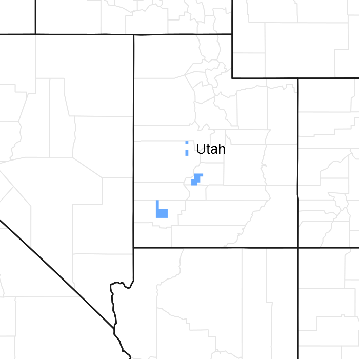
Figure 1. Mapped extent
Areas shown in blue indicate the maximum mapped extent of this ecological site. Other ecological sites likely occur within the highlighted areas. It is also possible for this ecological site to occur outside of highlighted areas if detailed soil survey has not been completed or recently updated.
MLRA notes
Major Land Resource Area (MLRA): 028A–Ancient Lake Bonneville
MLRA 28A occurs in Utah (82 percent), Nevada (16 percent), and Idaho (2 percent). It encompasses approximately 36,775 square miles (95,246 square kilometers). A large area west and southwest of Great Salt Lake is a salty playa. This area is the farthest eastern extent of the Great Basin Section of the Basin and Range Province of the Intermontane Plateaus. It is an area of nearly level basins between widely separated mountain ranges trending north to south. The basins are bordered by long, gently sloping alluvial fans. The mountains are uplifted fault blocks with steep side slopes. Most of the valleys are closed basins containing sinks or playa lakes. Elevation ranges from 3,950 to 6,560 feet (1,204 to 2000 meters) in the basins and from 6,560 to 11,150 feet (1996 to 3398 meters) in the mountains. Much of the MLRA has alluvial valley fill and playa lakebed deposits at the surface from pluvial Lake Bonneville, which dominated this MLRA 13,000 years ago. A level line of remnant lake terraces on some mountain slopes indicates the former extent of this glacial lake. The Great Salt Lake is what remains of the pluvial lake.
Mountains in the interior of this MLRA consist of tilted blocks of marine sediments from Cambrian to Mississippian age with scattered outcrops of Tertiary continental sediments and volcanic rocks. The average annual precipitation is 5 to 12 inches (13 to 30 cm) in the valleys and ranges up to 49 inches (124 cm) in the mountains. Most of the rainfall in the southern LRU occurs as high-intensity, convective thunderstorms during the growing season (April through September). The driest period is from midsummer to early autumn in the northern LRU. Precipitation in winter typically occurs as snow. The average annual temperature is 39 to 53 °F (4 to 12 °C). The freeze-free period averages 165 days and ranges from 110 to 215 days, decreasing in length with increasing elevation. The dominant soil orders in this MLRA are Aridisols, Entisols, and Mollisols. Soils are dominantly in the mesic or frigid soil temperature regime, aridic or xeric soil moisture regime, and mixed mineralogy. The soils are generally well drained, loamy or loamy-skeletal, and very deep.
LRU notes
The Semidesert Alkali Sandy Loam (Alkali Sacaton) site occurs between the two proposed LRUs, Basin and Range North and Basin and Range South. Field work is need to evaluate the soils and sites that have been correlated to this ecological site.
Ecological site concept
The Semidesert Alkali Sandy Loam (Alkali Sacaton) site is found on valley floodplains and low alluvial fans. The soils are deep and well drained formed in alluvium. The dominant plant is alkali sacaton (Sporobolus airoides). The Semidesert Alkali Sandy Loam (Alkali Sacaton) is similar to Alkali Flat, but is on a different landscape position. Alkali Flat is lower on the landscape. Semidesert Alkali Sandy Loam also has a coarser soil texture than Alkali Flat and it should have a higher pH than associated sagebrush sites. Semidesert Loam (basin big sagebrush) is an associated site and it found on an upslope landscape position.
Associated sites
| R028AA221UT |
Semidesert Loam (Basin Big Sagebrush) This site occurs on alluvial flats and fans and it is found upslope. It is not in a valley bottom position. The soils are deep and are silt loams to loams. The dominant shrubs is basin big sagebrush |
|---|---|
| R028AY004UT |
Alkali Flat (Black Greasewood) This site is lower in the landscape and is dominated by greasewood. |
| R028AY220UT |
Semidesert Loam (Wyoming Big Sagebrush) This site occurs upslope and is dominated by Wyoming big sagebrush. |
Table 1. Dominant plant species
| Tree |
Not specified |
|---|---|
| Shrub |
Not specified |
| Herbaceous |
(1) Sporobolus airoides |
Click on box and path labels to scroll to the respective text.